Hattfjelldal is a municipality in Nordland county, Norway. It is part of the Helgeland traditional region. The administrative centre of the municipality is the village of Hattfjelldal. Other villages include Grubben, Svenskvollen, and Varntresk. Hattfjelldal Airfield is located in the village of Hattfjelldal.

Røssvatnet (Norwegian) or Reevhtse (Southern Sami) is a lake and reservoir in the municipalities of Hattfjelldal and Hemnes in Nordland county, Norway. It has been the site of human occupation since the Stone Age. Its area of 219 square kilometres (85 sq mi) makes it the second largest lake in Norway by surface area. Without the dam which has regulated the lake since 1957, it would be 190 square kilometres (73 sq mi) and the third largest lake in Norway. Its depth is 240 metres (790 ft), its volume is estimated at about 15 cubic kilometres (3.6 cu mi), and its surface elevation is 374 metres (1,227 ft) above sea level.

The Korgfjell Tunnel is an 8,530-metre (5.30 mi) long road tunnel in Nordland county, Norway. The tunnel connects Knutli in Vefsn Municipality with the village of Korgen in Hemnes Municipality. Work on the tunnel started in September 2001 and it was opened on 16 September 2005.

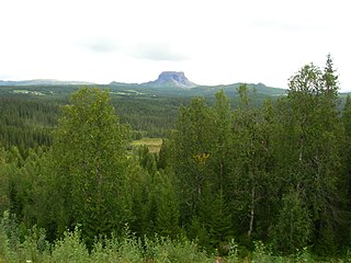
Korgen is the administrative centre of Hemnes Municipality in Nordland county, Norway. The village located along the river Røssåga, about 8 kilometres (5.0 mi) south of the village of Bjerka. Korgen is connected by the European route E06 highway to the nearby towns of Mo i Rana and Mosjøen. The eastern end of the Korgfjell Tunnel is located in Korgen. The village of Bleikvassli lies about 20 kilometres (12 mi) to the south along the Norwegian County Road 806. The 0.9-square-kilometre (220-acre) village has a population (2017) of 878 which gives the village a population density of 976 inhabitants per square kilometre (2,530/sq mi). This makes it the largest urban area in the municipality.

Finneidfjord is a small village in the municipality of Hemnes in Nordland county, Norway. It is located on a small isthmus, about halfway between the villages of Hemnesberget and Bjerka. The European route E06 highway and the Nordland Line pass through the village.
Bjerka is a village in the municipality of Hemnes in Nordland county, Norway. It is located along the European route E06 highway and the Nordland Line, about 20 kilometres (12 mi) southeast of Hemnesberget and about 7 kilometres (4.3 mi) north of the municipal center of Korgen.

Hemnesberget is a village in the municipality of Hemnes in Nordland county, Norway. It is located on the Hemnes peninsula which lies on the south side of the Ranfjorden. Hemnes Church is located in this village.

Bleikvatnet is a lake in the municipality of Hemnes in Nordland county, Norway. The lake lies about 5 kilometres (3.1 mi) northeast of the village of Bleikvasslia. The 12.59-square-kilometre (4.86 sq mi) lake is regulated by a dam. The water flows out to the south and then down a 64-metre (210 ft) tall waterfall on the river Bleikvasselva.

Gresvatnet (Norwegian) or Gräsvattnet (Swedish) or Graesiejaevrie (Southern Sami) is a lake on the border between Norway and Sweden. Most of the lake lies in Hemnes Municipality in Nordland county (Norway) and then a small portion crosses the border into Storuman Municipality in Västerbotten County (Sweden). The lake lies about 25 kilometres (16 mi) east of the village of Korgen, and just a few kilometres northeast of the mountain Oksskolten and the Okstindbreen glacier. The lake is one of the upper reservoirs for the Bjerka Hydroelectric Power Station.
Sokumvatnet is a lake that lies in the municipality of Gildeskål in Nordland county, Norway. Sokumvatnet is located about 15 kilometres (9.3 mi) southeast of the village of Inndyr. It lies just south of the lake Litle Sokumvatnet and northeast of the lake Langvatnet. The lake serves as a reservoir for the Sundsfjord Hydroelectric Power Station.
Stormyrbassenget, also known as Stormyraven or Avan, is a lake in the municipality of Hemnes in Nordland county, Norway. It lies about 12 kilometres (7.5 mi) south of the municipal center of Korgen and about 4 kilometres (2.5 mi) north of the village of Bleikvasslia. The lake lies along the river Røssåga as it flows north to the Ranfjord.
Stormålvatnet is a lake in the municipality of Hemnes in Nordland county, Norway. It is located about 12 kilometres (7.5 mi) east of the village of Korgen. The river Bjerkaelva flows through the lake on its way to the nearby Ranfjord.

Sør-Rana is a former municipality in Nordland county, Norway. The 777-square-kilometre (300 sq mi) municipality existed from 1929 until 1964. Sør-Rana encompassed an area on both sides of the middle section of the Ranfjorden around where the Sørfjorden and Elsfjorden branch off the main fjord.
Oksskolten is a mountain in the municipality of Hemnes in Nordland county, Norway. At 1,916-metre (6,286 ft) tall, it is the highest point in Nordland county, the highest in Northern Norway, and has Norway's eighth largest primary factor. The mountain lies just south of the lake Gresvatnet in the Okstindan mountain range east of the village of Korgen and north of the lake Røssvatnet.

Okstindan is a mountain range which lies in the inner Helgeland district in Nordland county, Norway. It is located within the municipality of Hemnes. The mountain Oksskolten is part of the Okstindan range, and it is the highest mountain in North Norway. Other mountains in the range include Okstinden, Okshornet, Vesttinden, and Bessedørtinden. Between these mountains lies the large glacier Okstindbreen. The Swedish border lies just to the east of the mountains.
Utskarpen is a village in the municipality of Rana in Nordland county, Norway, about 37 kilometres (23 mi) west of the town of Mo i Rana. The village is located at the end of the Utskarpen fjord, an arm of the main Ranfjorden. On the western side of Utskarpen is the intersection with Norwegian County Road 17 and Norwegian County Road 12. The neighboring villages are Mæla to the north and Myklebustad to the west.

Bleikvassli Church is a parish church of the Church of Norway in Hemnes Municipality in Nordland county, Norway. It is located in the village of Bleikvasslia. It is the church for the Bleikvassli parish which is part of the Indre Helgeland prosti (deanery) in the Diocese of Sør-Hålogaland. The red, wooden church was built in a long church style in 1955 by the architect Torgeir Alvsaker. The church seats about 190 people.
Korgen Church is a parish church of the Church of Norway in Hemnes Municipality in Nordland county, Norway. It is located in the village of Korgen. It is the church for the Korgen parish which is part of the Indre Helgeland prosti (deanery) in the Diocese of Sør-Hålogaland. The white, wooden church was built in a cruciform style in 1863 by the architect Nils Grenstad. The church seats about 450 people.
Korgen is a former municipality in Nordland county, Norway. The 625-square-kilometre (241 sq mi) municipality existed from 1918 until its dissolution in 1964. The municipality included the central part of what is now Hemnes Municipality, centered around the river Røssåga. The administrative centre was the village of Korgen where Korgen Church is located.


