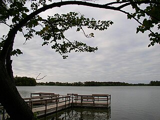
Waseca County is a county in the U.S. state of Minnesota. As of the 2020 census, the population was 18,968. Its county seat is Waseca.

Nobles County is a county in the U.S. state of Minnesota. As of the 2020 census, the population was 22,290. Its county seat is Worthington. Nobles County comprises the Worthington, MN Micropolitan Statistical Area.

Le Sueur County is a county located in the south central portion of the U.S. state of Minnesota. As of the 2020 census, the population was 28,674. Its county seat is Le Center.
Bloom Township is a township in Nobles County, Minnesota, United States. The population was 213 at the 2000 census.

Lake Winnipeg is a very large, relatively shallow 24,514-square-kilometre (9,465 sq mi) lake in North America, in the province of Manitoba, Canada. Its southern end is about 55 kilometres (34 mi) north of the city of Winnipeg. Lake Winnipeg is Canada's sixth-largest freshwater lake and the third-largest freshwater lake contained entirely within Canada, but it is relatively shallow excluding a narrow 36 m (118 ft) deep channel between the northern and southern basins. It is the eleventh-largest freshwater lake on Earth. The lake's east side has pristine boreal forests and rivers that were in 2018 inscribed as Pimachiowin Aki, a UNESCO World Heritage Site. The lake is 416 km (258 mi) from north to south, with remote sandy beaches, large limestone cliffs, and many bat caves in some areas. Manitoba Hydro uses the lake as one of the largest reservoirs in the world. There are many islands, most of them undeveloped.

The Pigeon River forms part of the Canada–United States border between the state of Minnesota and the province of Ontario, west of Lake Superior. In pre-industrial times the river was a waterway of great importance for transportation and the fur trade.
Bachelor Lake is a lake in Brown County, Minnesota in the northeastern part of Stark township. Covering 79.80 acres, it is an officially protected water of the State of Minnesota. The lake is within the Cottonwood River Major Watershed. The lake’s elevation is 1,004 feet (306 m), and it is zoned as a shoreland area which is regulated as a shoreland management water.
Burandt Lake is a lake in Carver County, Minnesota, bordering the city of Waconia. It is 97 acres in size and approximately 24 feet deep at its deepest point. It was named for Adolph Burandt, a local farmer.

The Chippewa River is a 153-mile-long (246 km) tributary of the Minnesota River in western and southwestern Minnesota in the United States. Via the Minnesota River, it is part of the watershed of the Mississippi River.

Temperance River State Park is a state park of Minnesota, USA, located between the communities of Schroeder and Tofte on Highway 61 on the North Shore of Lake Superior. It has campsites, picnic areas, and hiking trails on both sides of the Temperance River.

Lake Carlos State Park is a state park about 10 miles north of Alexandria, Minnesota, USA. The park was established in 1937 to provide a public recreational facility in one of Minnesota's summer resort centers, and attracts tourists from Minnesota and bordering states.
Markham is an unincorporated community in Colvin Township, Saint Louis County, Minnesota, United States.
Fairbanks is an unincorporated community in Fairbanks Township, Saint Louis County, Minnesota, United States; located within the Superior National Forest.
Central Lakes is an unincorporated community in Saint Louis County, Minnesota, United States.

Greenleaf Lake State Recreation Area is a state park unit of Minnesota, USA, currently in development. It includes undeveloped shoreline on both Greenleaf and Sioux Lakes, halfway between the cities of Hutchinson and Litchfield in Meeker County. Portions of the state recreation area (SRA) are open to the public for day-use recreation, but there are no facilities yet on site. The park boundaries were set by the Minnesota Legislature and the state is still acquiring land from willing sellers; two-thirds of the property remain privately owned.
Freedhem is an unincorporated community in Belle Prairie Township, Morrison County, Minnesota, United States. The community is located near the junction of 203rd Street and Morrison County Road 45, Jewel Road. Nearby places include Little Falls, Pierz, and Camp Ripley.
Wall Lake is an unincorporated community in Otter Tail County, in the U.S. state of Minnesota.


