White flight or white exodus is the sudden or gradual large-scale migration of white people from areas becoming more racially or ethnoculturally diverse. Starting in the 1950s and 1960s, the terms became popular in the United States. They referred to the large-scale migration of people of various European ancestries from racially mixed urban regions to more racially homogeneous suburban or exurban regions. The term has more recently been applied to other migrations by whites, from older, inner suburbs to rural areas, as well as from the American Northeast and Midwest to the milder climate in the Southeast and Southwest. The term 'white flight' has also been used for large-scale post-colonial emigration of whites from Africa, or parts of that continent, driven by levels of violent crime and anti-colonial or anti-white state policies.

Dorchester is a neighborhood comprising more than 6 square miles (16 km2) in the City of Boston, Massachusetts, United States. Originally, Dorchester was a separate town, founded by Puritans who emigrated in 1630 from Dorchester, Dorset, England, to the Massachusetts Bay Colony. This dissolved municipality, Boston's largest neighborhood by far, is often divided by city planners in order to create two planning areas roughly equivalent in size and population to other Boston neighborhoods.

Anacostia is a historic neighborhood in Southeast Washington, D.C. Its downtown is located at the intersection of Marion Barry Avenue SE and the neighborhood contains commercial and government buildings, mid-rise mixed development, city-sanctioned art murals and galleries ,a perfroming arts center, a playhouse theater, the local landmark, "The Big Chair," Fredrick Douglass's Home and is adjacent to the Fort Stanton Park neighborhood which hosts the Smithsonian Anacostia Community Museum. It is located directly east of and along the Anacostia River, after which the neighborhood is named.

Humboldt Park, one of 77 designated community areas, is on the West Side of Chicago, Illinois. The Humboldt Park neighborhood is known for its dynamic social and ethnic demographic change over the years. The Puerto Rican community has identified strongly with the area since the 1970s. Humboldt Park is also the name of the Chicago Park District's historic 207-acre (0.8 km2) park or public garden adjacent to the community area.

Shepherd Park is a neighborhood in the northwest quadrant of Washington, D.C. In the years following World War II, restrictive covenants which had prevented Jews and African Americans from purchasing homes in the neighborhood were no longer enforced, and the neighborhood became largely Jewish and African American. Over the past 40 years, the Jewish population of the neighborhood has declined but the neighborhood has continued to support a thriving upper and middle class African American community. The Shepherd Park Citizens Association and Neighbors Inc. led efforts to stem white flight from the neighborhood in the 1960s and 1970s, and it has remained a continuously integrated neighborhood, with very active and inclusive civic groups.

Mattapan is a neighborhood in Boston, Massachusetts, United States. Mattapan is the original Native American name for the Dorchester area, possibly meaning "a place to sit." At the 2010 census, it had a population of 36,480, with the majority of its population immigrants.
Blockbusting was a business practice in the United States in which real estate agents and building developers convinced residents in a particular area to sell their property at below-market prices. This was achieved by fearmongering the homeowners, telling them that racial minorities would soon be moving into their neighborhoods. The blockbusters would then sell those same houses at inflated prices to black families seeking upward mobility. Blockbusting became prominent after post-World War II bans on explicitly segregationist real estate practices. By the 1980s it had mostly disappeared in the United States after changes to the law and real estate market.

Kevin Hagan White was an American politician best known for serving as the mayor of Boston for four terms from 1968 to 1984. He was first elected to the office at the age of 38. He presided as mayor during racially turbulent years in the late 1960s and 1970s, and the start of desegregation of schools via court-ordered busing of school children in Boston. White won the mayoral office in the 1967 general election in a hard-fought campaign opposing the anti-busing and anti-desegregation Boston School Committee member Louise Day Hicks. Earlier he had been elected Massachusetts Secretary of the Commonwealth in 1960 at the age of 31, and he resigned from that office after his election as Mayor.

Buckeye–Shaker is a neighborhood on the East Side of Cleveland, Ohio. It encompasses two sub neighborhoods: in its south and west, the old Buckeye neighborhood; and in its northeast, the Shaker Square neighborhood, which is centered on a historic shopping district and an eponymous rapid transit station, located at the intersection of Shaker and Moreland Boulevards, on the light rail line that connects the city of Shaker Heights to downtown Cleveland. From the early to mid-20th century, the Buckeye Road neighborhood was known as "Little Hungary", serving as the historic heart of Cleveland's Hungarian community, which at one time was the largest in the world outside of Hungary and for years has been almost completely African-American. Shaker Square, continues to be known as one of Cleveland's most notable neighborhoods, in terms of shopping, dining, architecture, the education of its residents, participation in civic life, diversity, and quality of living.

Grays Ferry, also known as Gray's Ferry, is a neighborhood in South Philadelphia, Pennsylvania, United States, bounded (roughly) by 25th Street on the east, the Schuylkill River on the west, Vare Avenue on the south, and Grays Ferry Avenue on the north. The section of this neighborhood west of 34th Street is also known as Forgotten Bottom.
Potrero Hill is a residential neighborhood in San Francisco, California. A working-class neighborhood until gentrification in the late 1990s. It is now an affluent neighborhood home to some of the highest income residents in the city according to the United States Census Bureau.
Conant Gardens is a historically Black neighborhood in northeast Detroit, Michigan. The neighborhood was once the most exclusive Black neighborhood in that city, and residents of Conant Gardens comprised the most highly educated Black enclave in Detroit.

Castle Hill is a neighborhood located in the southeast section of the borough of the Bronx in New York City. Its boundaries are Waterbury Avenue and Westchester Avenue to the north, Westchester Creek to the east, the East River to the south, and White Plains Road to the west. Unionport is a subsection of Castle Hill, typically considered north of Lafayette Avenue.

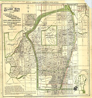
The Country Club District is a group of neighborhoods forming a historic upscale residential district in Kansas City, developed by noted urban planner and real estate developer J. C. Nichols.

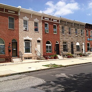
Middle East is a neighborhood in the heart of East Baltimore, Maryland.
Paseo Academy, also referred to as Paseo Academy of Fine and Performing Arts and sometimes Paseo High School, is a magnet performing arts high school located at 4747 Flora Avenue in Kansas City, Missouri. It is part of the Kansas City Public Schools.
Ruskin Heights is a neighborhood in southeast Kansas City, Missouri, Jackson County. This neighborhood was made in the early 1950s as a postwar suburb on former farmland. It had a total population of 23,874 people in 2020, making it one of the most densely populated neighborhoods of Kansas City. It has a total land area of approximately 0.794 square miles (2.06 km2). It is mostly flat, but slightly elevated at some points. The ZIP Code is 64134.
North Shoal Creek is a neighborhood in north central Austin, Texas established in the 1960s.

San Juan Hill was a community in what is now the Lincoln Square neighborhood of the Upper West Side in Manhattan, New York City. Its residents were mostly African-American, Afro-Caribbean, and Puerto Rican, and comprised one of the largest African-American communities in New York before World War I. San Juan Hill was bound by 59th Street to the south, West End Avenue to the west, 65th Street to the north, and Amsterdam Avenue to the east. The site is now occupied by Lincoln Center, a 16.3-acre (6.6 ha) complex dedicated to the performing arts.
Racism is a prevailing issue in the city of Columbus, Ohio, United States. Minority groups may face some societal, health, and legal challenges not experienced by non-minority residents.