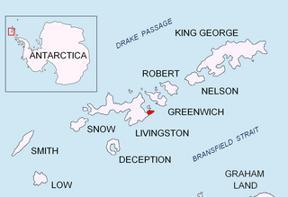
Kaloyan Nunatak is a conspicuous nunatak in the Tangra Mountains. It is named after Czar Kaloyan of Bulgaria, 1197-1207 AD.

Mesta Peak is a conspicuous, sharp and narrow rocky peak extending 500 m in east-west direction and rising to approximately 400 m in Delchev Ridge, Tangra Mountains, eastern Livingston Island in the South Shetland Islands, Antarctica. The peak has steep and ice-free slopes and surmounts the east extremity of Sopot Ice Piedmont to the north.

Musala Glacier on Greenwich Island in the South Shetland Islands, Antarctica is situated northeast of Targovishte Glacier, east-northeast of Zheravna Glacier and southeast of Fuerza Aérea Glacier. It is bounded by St. Kiprian Peak to the south, Vratsa Peak to the southwest, central Breznik Heights to the west, and Ilarion Ridge bordering Hardy Cove to the northeast, extends 2 nautical miles in east-west direction and 1.2 nautical miles in north-south direction, and drains eastwards into Bransfield Strait north of Fort Point.

Oborishte Ridge has an elevation of 340 m in the southwest extremity of Breznik Heights, Greenwich Island in the South Shetland Islands, Antarctica. Extending 1.7 km along the southeast coast of Yankee Harbour and 950 m wide. Ice-free surface area 138 hectares. Surmounting Solis Glacier to the east and Wulfila Glacier to the southeast.

Pautalia Glacier is a small glacier on Burgas Peninsula, Livingston Island in the South Shetland Islands, Antarctica situated northeast of Strandzha Glacier and south of Sopot Ice Piedmont. It is bounded by Petko Voyvoda Peak to the west, Sozopol Gap to the northwest, Kaloyan Nunatak to the north and Shabla Knoll to the east. The glacier extends 700 m in northwest-southeast direction and 1.1 km in southwest-northeast direction, and flows southeastward into Bransfield Strait.

Peshev Ridge is a crescent-shaped ridge in central Tangra Mountains extending 2 km (1.2 mi) along the northeast coast of Brunow Bay and southeast of Macy Glacier, Livingston Island in the South Shetland Islands, Antarctica. Its east extremity is formed by the summit St. Naum Peak, separated from Balchik Ridge to the east by Starosel Gate. The ridge was named in honour of Dimitar Peshev (1894–1973), who led the nationwide campaign that kept Bulgaria’s Jews safe during the Holocaust.

Shabla Knoll rises to over 400 m (1,312 ft) in Delchev Ridge, Tangra Mountains, Livingston Island in the South Shetland Islands, Antarctica surmounting Sopot Ice Piedmont to the north and Pautalia Glacier to the southwest.

Tryavna Peak is a peak rising to 300 m in the Delchev Ridge of the Tangra Mountains of eastern Livingston Island in the South Shetland Islands, Antarctica. The peak surmounts Sopot Ice Piedmont to the north and northwest. The feature is named after the Bulgarian town of Tryavna.

Vratsa Peak is a sharp rocky peak rising to 470 m in Breznik Heights, Greenwich Island in the South Shetland Islands, Antarctica surmounting Musala Glacier to the northeast and Targovishte Glacier to the southwest and south.

Wulfila Glacier is located on the southern slopes of Breznik Heights, Greenwich Island in the South Shetland Islands, Antarctica, south-southwest of Solis Glacier and west of Zheravna Glacier. It is bounded by Oborishte Ridge to the northwest, Nevlya Peak to the north, Terter Peak and Razgrad Peak to the northeast, and Ephraim Bluff to the southeast. The glacier extends 3 km in northwest-southeast direction and 2 km in northeast-southwest direction, draining southwestwards into McFarlane Strait between Ephraim Bluff and the base of Provadiya Hook.

Parchevich Ridge is a partly ice-free ridge of elevation 370 m situated in Breznik Heights north of Hardy Cove, 690 m south of Benkovski Nunatak, and 1.7 km southwest of Santa Cruz Point on Greenwich Island, Antarctica. Surmounting Hardy Cove to the southwest and Gruev Cove to the east-northeast. Bulgarian topographic survey Tangra 2004/05. Named after Petar Parchevich (1612–74), a Bulgarian Catholic bishop and diplomat who campaigned for Bulgarian independence in 1630–45.

Gruev Cove is the 300 m wide cove indenting for 650 m the east coast of Greenwich Island, in the South Shetland Islands south of Santa Cruz Point and north of Parchevich Ridge. It is surmounted by Bogdan Ridge to the north and Benkovski Nunatak to the west.

Salash Nunatak is a rocky peak of elevation 220 m in Breznik Heights projecting from the upper Wulfila Glacier on Greenwich Island in the South Shetland Islands, Antarctica. Situated 400 m southwest of the summit of Oborishte Ridge and 1.35 km west of Nevlya Peak.

Castillo Nunatak is a conspicuous rocky peak rising to 437 m on the glacial divide between Huntress Glacier and Balkan Snowfield on Hurd Peninsula in eastern Livingston Island in the South Shetland Islands, Antarctica. It is linked to Charrúa Ridge to the west Charrúa Gap and, via Willan Nunatak and Willan Saddle, to Burdick Ridge to the east-northeast. Castillo Nunatak is a prominent landmark in the Charrúa Gap area.

Santa Cruz Point, also Spencer Bluff, is a rocky point forming the east extremity of Greenwich Island in the South Shetland Islands, Antarctica and the southwest side of the entrance to English Strait. Surmounted by Bogdan Ridge on the west.

Lloyd Hill is an ice-covered hill rising to 335 m in the southwest of Dryanovo Heights, Greenwich Island in the South Shetland Islands, Antarctica. The hill surmounts Teteven Glacier to the north and Murgash Glacier to the southeast.

Bajo Nunatak is a conspicuous rocky peak rising to 210 m at the south edge of the ice cap of Robert Island in the South Shetland Islands, Antarctica. The nunatak surmounts Zahari Point to the southeast, Micalvi Cove to the east-southeast, and English Strait to the southwest.

Rousseau Peak is a peak rising to 272 m in the north of Breznik Heights, Greenwich Island in the South Shetland Islands, Antarctica and surmounting Sotos Point to the west-northwest and Fuerza Aérea Glacier to the north, west and south. Precipitous, rocky west slopes.


