
Murgash Glacier is the 3.4 km long and 3.2 km wide glacier on Greenwich Island in the South Shetland Islands, Antarctica situated southeast of Yakoruda Glacier, south of Teteven Glacier, southwest of Traub Glacier and west-northwest of Bravo Glacier. It is bounded by Lloyd Hill on the northwest, Tile Ridge on the east and Hebrizelm Hill on the southeast, and drains southwards into Kramolin Cove in McFarlane Strait between Yovkov Point and Kaspichan Point.

Rila Point is a low, ice-free point on the south coast of Moon Bay, projecting 330 m west-northwestwards from Burgas Peninsula on Livingston Island in the South Shetland Islands, Antarctica, and forming the east side of the entrance to Bruix Cove. The point is named after Rila Mountain, Bulgaria.
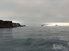
Wulfila Glacier is located on the southern slopes of Breznik Heights, Greenwich Island in the South Shetland Islands, Antarctica, south-southwest of Solis Glacier and west of Zheravna Glacier. It is bounded by Oborishte Ridge to the northwest, Nevlya Peak to the north, Terter Peak and Razgrad Peak to the northeast, and Ephraim Bluff to the southeast. The glacier extends 3 km in northwest-southeast direction and 2 km in northeast-southwest direction, draining southwestwards into McFarlane Strait between Ephraim Bluff and the base of Provadiya Hook.
Bogdan Ridge is a conspicuous rocky ridge of elevation 440 m forming the northeast extremity of Breznik Heights, Greenwich Island in the South Shetland Islands, Antarctica. The ridge extends 1.3 km westwards from Santa Cruz Point and surmounts Gruev Cove to the south.

Barrientos Island is an ice-free island in the Aitcho group on the west side of English Strait in the South Shetland Islands, Antarctica. Extending 1.71 by 0.54 km, surface area 65 hectares. The area was visited by early 19th century sealers. Barrientos Island is a popular tourist site frequented by Antarctic cruise ships.

Micalvi Cove is a 1.9 km wide cove indenting for 1.35 km the southwest coast of Robert Island in the South Shetland Islands, Antarctica next northwest of Kermen Peninsula, and entered between Edwards Point and Zahari Point. Avren Rocks are situated in the interior of the cove. The area was visited by early 19th century sealers.
Edwards Point is a rocky point in the south extremity of Kermen Peninsula and Robert Island in the South Shetland Islands, Antarctica. The point is a southeast entrance point of English Strait and forms the west side of the entrance to Devesil Bight and the southeast side of the entrance to Micalvi Cove. The area was visited by early 19th century sealers.
Spark Point, also Canto Point, is a rocky point forming the northwest side of the entrance to both Discovery Bay and Galápagos Cove, and the east side of the entrance to Jambelí Cove in the northeast of Greenwich Island in the South Shetland Islands, Antarctica. The point ends up in a conspicuous monolithic formation and has an adjacent ice-free area of 164 hectares. The area was visited by early 19th century sealers.
Bajo Nunatak is a conspicuous rocky peak rising to 210 m at the south edge of the ice cap of Robert Island in the South Shetland Islands, Antarctica. The nunatak surmounts Zahari Point to the southeast, Micalvi Cove to the east-southeast, and English Strait to the southwest.

Cecilia Island is the ice-free southernmost island of the Aitcho group on the west side of English Strait in the South Shetland Islands, Antarctica. Extending 910 by 450 m, surface area 36 hectares. The area, visited by American and English sealers in the early 19th century, nowadays has become a popular tourist site frequented by Antarctic cruise ships.

Ongley Island is a rugged rocky island lying off the north coast of Greenwich Island in the South Shetland Islands, Antarctica. Extending 1.35 km (0.84 mi) in west-northwest direction and 470 m (510 yd) wide, with a surface area of 44 hectares. The area was visited by early 19th century sealers.

Romeo Island is a rocky island lying off the north coast of Greenwich Island and west of Aitcho Islands in the South Shetland Islands, Antarctica. Extending 1.35 km (0.84 mi) in west-northwest direction and 470 m (510 yd) wide, with a surface area of 44 hectares. The area was visited by early 19th century sealers.

Polish Bluff is a point forming the southwest side of the entrance to Española Cove and the northeast side of the entrance to Argentina Cove in Hurd Peninsula, Livingston Island in the South Shetland Islands, Antarctica. The area was visited by early 19th century sealers operating from nearby Johnsons Dock.
Hardy Cove is the 950 m wide cove indenting for 1.37 km the east coast of Greenwich Island in the South Shetland Islands, Antarctica and surmounted by Parchevich Ridge to the north and Ilarion Ridge to the south. The cove was known to the early 19th century sealers.

La Morenita is a conspicuous rocky hill rising to 93 m in the southwest extremity of Half Moon Island in the South Shetland Islands, Antarctica. It surmounts the Argentine Antarctic base Cámara situated in its northern foothills, Menguante Cove to the northeast and Mugla Passage to the south. The area was visited by early 19th century sealers operating from nearby Yankee Harbour.
Gabriel Hill is the summit of Half Moon Island in the South Shetland Islands, Antarctica. It is a rocky hill rising to 101 m in the island’s northwest extremity and surmounting Moon Bay to the west and Menguante Cove to the southeast. The area was visited by early 19th century sealers operating from nearby Yankee Harbour.
Xenia Hill is the rocky hill rising to 96 m in the northeast extremity of Half Moon Island in the South Shetland Islands, Antarctica. It surmounts McFarlane Strait to the north and east, and Menguante Cove to the south-southeast. The area was visited by early 19th century sealers operating from nearby Yankee Harbour.
Guayaquil Bay is the 2.59 km wide bay indenting for 1.25 km the north coast of Greenwich Island in the South Shetland Islands, Antarctica and entered between Agüedo Point and Orión Point. The bay is used by ships servicing the Ecuadorian Antarctic base Pedro Vicente Maldonado situated 560 m south-southwest of Orión Point. The area was visited by 19th century sealers operating from nearby Clothier Harbour.


