
Sherbrooke is a city in southern Quebec, Canada. It is at the confluence of the Saint-François and Magog rivers in the heart of the Estrie administrative region. Sherbrooke is also the name of a territory equivalent to a regional county municipality (TE) and census division (CD) of Quebec, coextensive with the city of Sherbrooke. With 172,950 residents at the Canada 2021 Census, it is the sixth largest city in the province and the 30th largest in Canada. The Sherbrooke Census Metropolitan Area had 227,398 inhabitants, making it the fourth largest metropolitan area in Quebec and 19th in Canada.
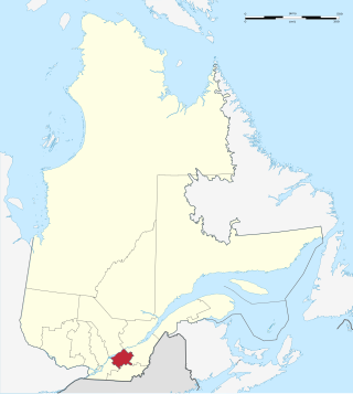
Centre-du-Québec is a region of Quebec, Canada. The main centres are Drummondville, Victoriaville, and Bécancour. It has a land area of 6,930.05 square kilometres (2,675.71 sq mi) and a 2016 Census population of 242,399 inhabitants.

Le Plateau-Mont-Royal is a borough (arrondissement) of the city of Montreal, Quebec, Canada.

Sillery, a former independent city founded in 1637, is one of 35 administrative sectors, which are unincorporated places, located in the post-expansion jurisdiction of the City of Quebec, Quebec, Canada. Sillery was one of multiple self-governing municipalities amalgamated into a vastly expanded Quebec City, that went into legal effect on January 1, 2002, as part of the province-wide 2000–06 municipal reorganization in Quebec. Located alongside in what pre-merger was the southwestern border of Quebec City, Sillery is a constituent district of the borough of Sainte-Foy–Sillery–Cap-Rouge. The territorially expanded City of Quebec consists of six boroughs.

Perche is a former province of France, known historically for its forests and, for the past two centuries, for the Percheron draft horse breed. Until the French Revolution, Perche was bounded by four ancient territories of northwestern France: the provinces of Maine, Normandy, and Orléanais, and the region of Beauce. Afterwards it was absorbed into the present-day departments of Orne and Eure-et-Loir, with small parts in the neighboring departments of Eure, Loir-et-Cher, and Sarthe.
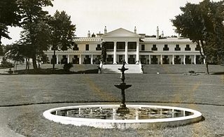
Quebec's Government House, known as Spencer Wood, was the viceregal residence of Quebec. It was built in 1854. Located at Bois-de-Coulonge Park in Sillery, it was purchased by the Quebec government in 1870, and served as the residence of Quebec lieutenant governors until 1966, when a major fire destroyed the main residence.

Route 335 is a north-south regional route located on the north shore of the St. Lawrence River. from Montreal It serves the administrative regions of Montreal, Laval, Laurentides, and Lanaudière. It is the only secondary road whose route crosses the Island of Montreal. Between Autoroute 440 in Laval and Côte-Saint-Louis Road in Terrebonne, Route 335 is located in the right-of-way of the future Autoroute 19.

Sherbrooke Street is a major east–west artery and at 31.3 kilometres (19.4 mi) in length, is the second longest street on the Island of Montreal, Canada. The street begins in the town of Montreal West and ends on the extreme tip of the island in Pointe-aux-Trembles, intersecting Gouin Boulevard and joining up with Notre-Dame Street. East of Cavendish Boulevard this road is part of Quebec Route 138.
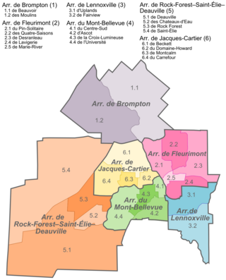
Jacques-Cartier is an arrondissement, or borough, of the city of Sherbrooke, Quebec. The borough comprises the portion of pre-amalgamation Sherbrooke located north of the Magog River. It contains the Carrefour de l'Estrie shopping centre and the Bois Beckett Park, one of few old-growth forests in the region.
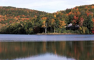
Mont-Saint-Bruno Provincial Park is a small national park of Quebec located near the municipality of Saint-Bruno-de-Montarville, 15 kilometres (9.3 mi) to the east of Montréal on the south shore of the Saint Lawrence River. The park, with an area of 8.84 square kilometres (3.41 sq mi), notably includes Mont Saint-Bruno, one of the Monteregian Hills which peaks at 218 metres (715 ft). The mountain is shared with the Ski Mont Saint-Bruno ski resort, a quarry and a small Canadian Forces training camp. Despite its relatively small size, the mountain is known for its rich fauna and flora. Situated at the heart of the old signory of Montarville, its many lakes have permitted the construction and exploitation of many water mills, contributing to the region's economical success. A building from one of those mills, the "Vieux Moulin", still stands to this day and is used as a rest area for skiers and hikers in different seasons.
André Bouchard was a Canadian ecologist and environmentalist who spent most of his career at Université de Montréal (UdeM) and the Montreal Botanical Garden. His specialties included landscape ecology and plant community ecology, and he received several awards during his lifetime.

Mont Bellevue is a peak standing 333 m (1,093 ft), situated in Mont-Bellevue Park located in the borough of Mont-Bellevue in Sherbrooke, Quebec. The park also covers Mont Bellevue's parent peak, Mont John-S.-Bourque(elevation: 365 m ), as well as 200 ha of land, 30 km (19 mi) of trails, and several different types of ecosystems. Claiming 20% of the total park land, it is the largest park in Sherbrooke.
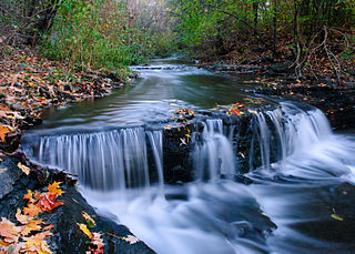
Ruisseau-De Montigny Nature Park is a large nature park in the Rivière-des-Prairies neighbourhood of the Rivière-des-Prairies–Pointe-aux-Trembles borough of Montreal, Quebec, Canada.

Pointe-aux-Prairies Nature Park is a large nature park in the Rivière-des-Prairies–Pointe-aux-Trembles borough of Montreal, Quebec, Canada.

Lac-Témiscouata National Park is a provincial park located in Quebec, Canada south of the Saint Lawrence River, near the border with New Brunswick. It contains Lake Témiscouata, which is "the second-largest lake south of the Saint Lawrence River" within some unspecified area, perhaps within Quebec, with a length of around 40 km (25 mi). Touladi River can also be found within the park's boundaries.

The Bois-de-Saraguay Nature Park is a large nature park in the Ahuntsic-Cartierville borough of Montreal, Quebec, Canada.

Rivière-du-Moulin Ecological Reserve is a strictly protected ecological reserve in the province of Quebec, Canada. It contains a stand of mature eastern hemlock trees, with some white pines, a combination that was once common in Quebec but has almost disappeared due to forestry and farming.
A regional park, in Quebec, is an area designated by a regional county municipality (MRC) or equivalent territory for the purposes of recreation and of nature conservation.

The Bois du Parc National Nature Reserve (RNN39) is a National Nature Reserve located in the department of Yonne. Established in 1979, it spreads over 45 ha, and its most interesting features are its steep-sided cliffs in an important coral reef dating from the Jurassic era.


