Bokungo | |
|---|---|
| Country | |
| Province | Tshuapa |
| Population (2005) | |
| • Languages | Lingala |
Bokungu is a territory of the Democratic Republic of the Congo. It is located in Tshuapa Province.
Bokungo | |
|---|---|
| Country | |
| Province | Tshuapa |
| Population (2005) | |
| • Languages | Lingala |
Bokungu is a territory of the Democratic Republic of the Congo. It is located in Tshuapa Province.

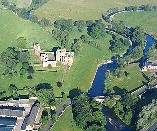
The River Eamont is a river in Cumbria, England and one of the major tributaries of the River Eden. The name of the river is from Old English (ēa-gemōt) and is a back formation from Eamont Bridge which means the junction of streams.
Mazovia encoding is used under DOS to represent Polish texts. Basically it is code page 437 with some positions filled with Polish letters. An important feature was that the block graphic characters of code page 437 remained unchanged. In contrast, IBM's later official Central European code page 852 did not preserve all block graphics, causing incorrect display in programs such as Norton Commander.

Benares Shoals, or Benares Shoal, is a submerged coral reef, an isolated patch located at 5°15′S071°40′E, just 6 kilometres (3.7 mi) west-northwest of Île Pierre, the closest island of Peros Banhos atoll in the northern Chagos Archipelago. It measures about 3 kilometres (2 mi) east–west, with a width of about 700 metres (2,300 ft) and an area of 2 square kilometres (0.77 sq mi). The least depth at the western end is 4.5 metres (15 ft).

Goggomobil was a series of microcars produced by Hans Glas GmbH in the Bavarian town Dingolfing between 1955 and 1969.

Gliese 667 is a triple-star system in the constellation Scorpius lying at a distance of about 6.8 parsecs from Earth. All three of the stars have masses smaller than the Sun. There is a 12th-magnitude star close to the other three, but it is not gravitationally bound to the system. To the naked eye, the system appears to be a single faint star of magnitude 5.89.

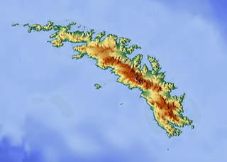
Novosilski Glacier is a glacier, 8 miles (13 km) long and 2 miles (3.2 km) wide, flowing in a westerly direction from the southwest slopes of the Salvesen Range to Novosilski Bay on the south coast of South Georgia. First surveyed and named by a German expedition 1928–29, under Kohl-Larsen. The name derives from nearby Novosilski Bay.

Arapoti is a city in Paraná, Brazil, served by Avelino Vieira Airport. As of 2020, the estimated population was 28,300.

Alar del Rey is a municipality located in the province of Palencia, Castile and León, Spain. According to the 2018 census (INE), the municipality has a population of 928 inhabitants.

Cardeñadijo is a municipality located in the province of Burgos, Castile and León, Spain. According to the 2004 census (INE), the municipality has a population of 668 inhabitants.

Quintanaélez is a municipality and town located in the province of Burgos, Castile and León, Spain. According to the 2004 census (INE), the municipality has a population of 85 inhabitants.

Castromembibre is a municipality located in the province of Valladolid, Castile and León, Spain. According to the 2004 census (INE), the municipality has a population of 80 inhabitants.

Ural Maru was a 6,377-ton Japanese merchant vessel, used as a transport ship and hospital ship during World War II. She was torpedoed and sunk with the loss of some 3,700 lives on 27 September 1944.

Itutinga is a Brazilian municipality located in the state of Minas Gerais. The city belongs to the mesoregion of Campo das Vertentes and to the microregion of Lavras. In 2020, the estimated population was 3,768.

Astapenko Glacier is a glacier, 11 miles (18 km) long, draining the north and northeast slopes of Stanwix Peak in the Bowers Mountains and flowing east-northeast to Ob' Bay, situated in Victoria Land, Antarctica. It was mapped by the United States Geological Survey from surveys and from U.S. Navy air photos, 1960–62, and named by the Advisory Committee on Antarctic Names for Pavel D. Astapenko, Soviet IGY observer, a Weather Central meteorologist at Little America V in 1958. The glacier lies on the Pennell Coast, a portion of Antarctica lying between Cape Williams and Cape Adare.
Wólka Łysowska is a village in the administrative district of Gmina Przesmyki, within Siedlce County, Masovian Voivodeship, in east-central Poland. It lies approximately 7 kilometres (4 mi) north-east of Przesmyki, 31 km (19 mi) north-east of Siedlce, and 114 km (71 mi) east of Warsaw.

The Poiana Ruscă Mountains are a Carpathian mountain range in western Romania. The mountains are situated roughly south of the Mureș River, northeast of the Timiș River, and west of the Strei River. The Bega River emerges from these mountains. The nearest large towns are Lugoj, Hunedoara, and Caransebeș.
Radošiće is a village in the municipality of Raška, Serbia. According to the 2002 census, the village has a population of 224 people.
Kalakeri LTis a village in Bijapur of Karnataka, India.

Gliese 667 Cc is an exoplanet orbiting within the habitable zone of the red dwarf star Gliese 667 C, which is a member of the Gliese 667 triple star system, approximately 23.62 light-years away in the constellation of Scorpius. The exoplanet was found by using the radial velocity method, from radial-velocity measurements via observation of Doppler shifts in the spectrum of the planet's parent star.