Related Research Articles

Hattieville is a village in the Belize District of the nation of Belize. It is located at 17N 88W, at an elevation of 196 feet above mean sea level, and has a population of about 1,300 people. Hattieville was established as a refugee camp after Hurricane Hattie made many people homeless in Belize City when it hit in 1961, but it became a permanent town.
Xaibe is small rural settlement in the country of Belize mainly consisting of people from the Yucatec Maya ethnicity. It is located in Corozal District. The name Xaibe literally means 'crossroads'. The people of the Maya civilization often traversed across the village to reach other Maya villages. The population of the village is very small. The last available data of the population of Xaibe in 2010 revealed that it had a modest population of approximately 1,575 people. There is, however, evidence of the fact that the people belonging to the Maya civilization resided in the Xaibe village. These people then gradually shifted to Mexico, just across the border at the time of the Caste War of Yucatán. The village is known for celebrating the Maya tradition Hanal Pixan which means "food for the souls" also known as Day of the Dead.
Little Belize is a colony of conservative Plautdietsch-speaking "Russian" Mennonites, known as "Old Colony Mennonites", in the Corozal District of Belize. It is part of the Corozal South East constituency. Little Belize is located east of Progresso at an elevation of 1 meter above sea level. Because the Mennonite colony is close to Progresso, it is sometimes called "Progresso".

Shipyard, also called Shipyard Colony, is a Mennonite settlement that is also an administrative village in the Orange Walk District of Belize.
Silver Creek is a village in the Toledo District of Belize. According to the 2000 census, Silver Creek had a population of 1,326 people. There is also a stream named Silver Creek at this same location. Near the village of Silver Creek is an ancient Maya civilization site. Nearby there is a larger Maya site from at least as early as 700 AD, Lubaantun.
Roaring Creek is a small village in the Cayo District of Belize, just north-west of Belmopan. Its name is derived from the creek waterfalls which flow into the Belize River next to the Guanacaste Park area.
San Vicente Centenario is a municipality in the Honduran department of Santa Bárbara.

Indian Church is a small remote village in the Orange Walk District of Belize. It is located on the west bank of New River, neighbouring the town of San Carlos to its south, and the Maya ruins of Lamanai to its north. According to the 2010 census, Indian Church has a population of 267 people in 66 households. The village is named for the historic Spanish churches recovered among the ancient Maya ruins. The residents lived among the ruins until 1991 when the Government of Belize established the 2-square-mile (5.2 km2) Lamanai Archaeological Reserve maintained by Belize's Institute of Archaeology.

Santa Elena de Jamuz is a municipality located in the province of León, Castile and León, Spain. According to the 2004 census (INE), the municipality has a population of 1,315 inhabitants.

Bretocino is a municipality located in the province of Zamora, Castile and León, Spain. According to the 2009 census (INE), the municipality has a population of 259 inhabitants.

Revellinos is a municipality located in the province of Zamora, Castile and León, Spain. According to the 2004 census (INE), the municipality has a population of 310 inhabitants.

Division No. 4 is a census division located within the Pembina Valley Region in the south-central region of the province of Manitoba, Canada. Unlike in some other provinces, census divisions do not reflect the organization of local government in Manitoba. These areas exist solely for the purposes of statistical analysis and presentation; they have no government of their own.
Gardenia is a village in Belize District, Belize located about 20 miles (32 km) north of Belize City.
Crooked Tree is a settlement located in the nation of Belize. It is a mainland village located in the Belize District.
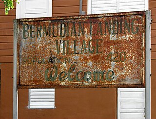
Bermudian Landing is a village in the nation of Belize, located near Scotland Halfmoon in Belize District. The name comes from the Bermuda grass planted by the early loggers to feed their oxen, who were used to drag the mahogany to the landing.
Double Head Cabbage is a village in Belize located in Belize District.
Freetown Sibun is a populated settlement located in the nation of Belize. It is a mainland village that is located in Belize District along the Sibun River.
La Democracia is a populated settlement located in the nation of Belize. It is a mainland village that is located in Belize District.
Seine Bight is a village on the Placencia Peninsula located in the Stann Creek District of Belize. It is located 2 and a half miles south of Maya Beach Village and North of the village of Placencia. This small village has roughly 1,000 inhabitants, mostly Garifuna people who subsist on fishing, hunting, and homegrown vegetables. The early settlers named their village for their favored fishing tackle, Seine fishing and a bight, a bend or curve in a coastline.

Unitedville is a village in the Cayo District of central interior Belize. The village is in an agricultural region with the most frequent crops being citrus and banana. It is one of 192 municipalities administered at the village level in the country for census taking purposes.
References
17°53′N88°16′W / 17.883°N 88.267°W
| | This article about the geography of Belize is a stub. You can help Wikipedia by expanding it. |