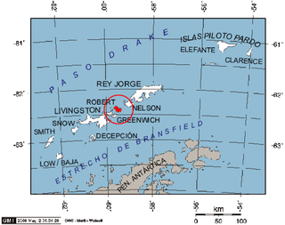
Robert Island or Mitchells Island or Polotsk Island or Roberts Island is an island 11 miles (18 km) long and 8 miles (13 km) wide, situated between Nelson Island and Greenwich Island in the South Shetland Islands, Antarctica. Robert Island is located at 62°24′S59°30′W. Its surface area is 132 km2 (51 sq mi). The name "Robert Island" dates back to around 1821 and is now established in international usage.

Rugged Island is an island 3 miles (4.8 km) long and 1 mile (1.6 km) wide, lying west of Livingston Island in the South Shetland Islands. Its surface area is 10.4 square kilometres (4.0 sq mi). The island's summit San Stefano Peak rises to 256 metres (840 ft) above sea level. Rugged Island is located at 62°38′S61°15′W. Rugged Island was known to both American and British sealers as early as 1820, and the name has been well established in international usage for over 100 years.

Etar Snowfield is a roughly crescent-shaped snowfield on western Livingston Island in the South Shetland Islands, Antarctica situated west of Urdoviza, Medven and Berkovitsa Glaciers, northwest of Verila Glacier, east of Ivanov Beach and south of Gerlovo Beach. It drains the west slopes of Oryahovo Heights and the north slopes of Rotch Dome, and flows into Barclay Bay between Mercury Bluff and Rowe Point. The feature extends 5 km (3 mi) inland, and 15 km (9 mi) in south-southwest to north-northeast direction.

Start Point is a point marking the northwest end of Byers Peninsula, Livingston Island in the South Shetland Islands, Antarctica and forming the southwest side of the entrance to Svishtov Cove and the northeast side of the entrance to the New Plymouth bay. Discovered by Edward Bransfield in January 1820, and so named by him because of its resemblance to a point on the south coast of England by the same name and because it was the place where his operations began.

Desolation Island is one of the minor islands in the South Shetlands archipelago, Antarctica situated at the entrance to Hero Bay, Livingston Island. The island is V-shaped with its northern coast indented by Kozma Cove. Surface area is 3.12 square kilometres (1.20 sq mi).

Cape Smith is a cape forming the north end of Smith Island in the South Shetland Islands, Antarctica. The discovery of the South Shetland Islands was first reported in 1819 by Captain William Smith, for whom the cape is named.
Krivodol Glacier is a 3.8 km long glacier on Smith Island, South Shetland Islands in Antarctica draining the southeast slopes of Imeon Range northeast and east of Antim Peak, southeast of Varshets Saddle and south of Slatina Peak. It is situated southwest of Ovech Glacier and northeast of Pashuk Glacier, and flows southeastward into Osmar Strait northeast of Sredets Point. Bulgarian early mapping in 2009. The glacier is named after the town of Krivodol in northwestern Bulgaria.
South Bay is a 11.6 kilometres (7.2 mi) wide bay indenting for 12.5 kilometres (7.8 mi) the south coast of Livingston Island in the South Shetland Islands, Antarctica. The bay is lying northwest of False Bay and east of Walker Bay, and is entered between Hannah Point and Miers Bluff. The glaciers Kamchiya, Pimpirev, Perunika, Contell, Johnsons and Hurd Ice Cap feed the bay.

McFarlane Strait is a strait lying between Greenwich Island and Livingston Island, in the South Shetland Islands off Antarctica. It is 24 kilometres (13 nmi) long and 3 kilometres (1.6 nmi) wide. The name appears on an 1822 chart by Captain George Powell, a British sealer, and is now well established in international usage.

Williams Point is the point forming both the north extremity of Varna Peninsula and the northeast tip of Livingston Island in the South Shetland Islands, Antarctica. Separated from Zed Islands to the north by Iglika Passage.

Hurd Peninsula lies between South Bay and False Bay on the south coast of Livingston Island in the South Shetland Islands, Antarctica. The Spanish Juan Carlos I Antarctic Base and the Bulgarian St. Kliment Ohridski Base are situated on its west coast.
Walker Bay is a bay lying between John Beach and Hannah Point along the south coast of Livingston Island in the South Shetland Islands, Antarctica. The bay is fed by Verila Glacier.

Blythe Bay is an anchorage at the southeast side of Desolation Island, lying north of Livingston Island in the South Shetland Islands, Antarctica. The bay is bounded by Craggy Island to the northeast, Desolation Island to the northwest, the Miladinovi Islets to the west and Wood Island to the south.
Jireček Point is the point on the northwest coast of Smith Island in the South Shetland Islands, Antarctica forming the south side of the entrance to Cabut Cove and the northeast side of the entrance to Bourchier Cove. Situated 1.1 km south-southeast of Markeli Point and 2.35 km north-northeast of Villagra Point.
Johnsons Dock is a sheltered 500 m wide cove indenting for 900 m the northwest coast of Hurd Peninsula on Livingston Island in the South Shetland Islands, Antarctica. It is part of South Bay entered north of Ballester Point. Surmounted by Charrúa Ridge on the northeast. The cove was frequented by early 19th century sealers.
Essex Point is a point at the northwest end of Byers Peninsula, Livingston Island in the South Shetland Islands, Antarctica. It forms the west side of the entrance to Barclay Bay and the northeast side of the entrance to Svishtov Cove, and is surmounted by Drong Hill.
Barlow Island is a small ice-free island off the north coast of Smith Island in the South Shetland Islands, Antarctica extending 380 by 160 m, surface area 5.28 hectares.
Window Island is a small ice-free island off the north coast of Ray Promontory in the northwest of Byers Peninsula, Livingston Island in the South Shetland Islands, Antarctica. The island has a surface area of 23 hectares and rises to 72 m (236 ft). It was known to the early 19th century sealers operating on Byers Peninsula.
South Beaches are the beaches extending along the south side of Byers Peninsula, Livingston Island in the South Shetland Islands, Antarctica between Devils Point to the west and Rish Point to the east. The beaches were visited by 19th century sealers.
Cora Cove is the 750 m wide cove in the northwest part of Blythe Bay indenting for 590 m the southeast coast of Desolation Island off Livingston Island in the South Shetland Islands, Antarctica. The cove was used by early 19th century sealers operating from Blythe Bay.

