This page is based on this
Wikipedia article Text is available under the
CC BY-SA 4.0 license; additional terms may apply.
Images, videos and audio are available under their respective licenses.
Wilmington is a neighborhood in the Los Angeles Harbor Region area of Los Angeles, California, covering 9.14 square miles.
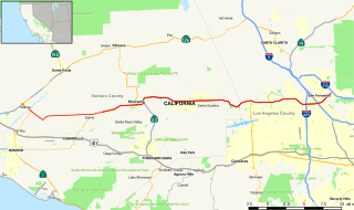
State Route 118 is a state highway in the U.S. state of California that begins running west to east through Ventura and Los Angeles counties in southern California. It travels from the eastern edge of Ventura immediately northwest of Saticoy, then through Saticoy, in Ventura County east to Lake View Terrace in Los Angeles. Route 118 crosses the Santa Susana Pass and the northern rim of the San Fernando Valley along its route.

Jefferson Park is a neighborhood in the South region of the City of Los Angeles, California.

South Park is a 1.41 square miles (3.65 km2) neighborhood within the South Los Angeles region of Los Angeles, California.

Mid-Wilshire is a neighborhood in the central region of Los Angeles, California. It is known for the Los Angeles County Museum of Art, the Petersen Automotive Museum, and the Miracle Mile shopping district.
Melrose Hill is a small neighborhood within the city of Los Angeles, California, tucked away in an area of Hollywood near Hancock Park.
The Imperial Highway is a west-east thoroughfare in the counties of Los Angeles, Orange, San Diego, and Imperial in California. The main portion of the existing route begins at Vista Del Mar in Los Angeles near the Los Angeles International Airport and ends at the Anaheim - Orange line at Via Escola where it becomes Cannon Street. Formerly, the Route used to extend from Vista Del Mar to Calexico, where a portion of the highway still exists, but the Route was replaced with other highways, rendering the older portions of the Imperial Highway to fall out of use.
Beverly Boulevard is one of the main east-west thoroughfares in Los Angeles, in the U.S. state of California. It begins off Santa Monica Boulevard in Beverly Hills and ends on the Lucas Avenue overpass near downtown Los Angeles to become 1st Street. A separate Beverly Boulevard begins off 3rd Street and Pomona Boulevard in East Los Angeles, runs through Montebello and Pico Rivera, and becomes Turnbull Canyon Road in Whittier near Rose Hills Memorial Park.

Highland Avenue is a north/south road in Los Angeles. It is a major thoroughfare that runs from Cahuenga Boulevard and the US 101 Freeway in Hollywood from the north end to Olympic Boulevard in Mid-City Los Angeles on the south end. Highland then is a small residential street from Olympic Boulevard south to Adams Boulevard. For through access, Highland swerves west into Edgewood Place which accesses La Brea Avenue.
Centinela Avenue is a major street in the Westside region of Los Angeles County, California.

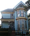
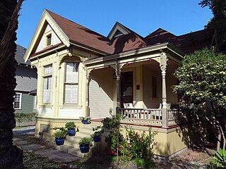
The North University Park Historic District is a historic district in the North University Park neighborhood of Los Angeles, California. The district is bounded by West Adams Boulevard on the north, Magnolia Avenue on the west, Hoover Street on the east, and 28th Street on the south. The district contains numerous well-preserved Victorian houses dating back as far as 1880. In 2004, the district was added to the National Register of Historic Places.

Victoria Park is a small neighborhood in the central region of Los Angeles, California. There are three
Los Angeles Historic-Cultural Monuments located in Victoria Park.

Rosecrans Avenue is a major west-east thoroughfare in Los Angeles and Orange Counties, California, USA. It has a total length of 27.5 miles (44.3 km). The street is named after U.S. Union General William S. Rosecrans, who purchased 13,000 acres of Rancho Sausal Redondo southwest of Los Angeles in 1869. Rosecrans Avenue was originally named Drexel Avenue, and ran through the Rosecrans Rancho which is part of modern-day Gardena.

Historic South Central Los Angeles is a 2.25-square-mile neighborhood in Los Angeles, California, within the South Los Angeles region. It is the site of the Bob Hope Patriotic Hall. From the late 1800s to early 1910s, African Americans began relocating to the area, mostly organizing around landholdings of Los Angeles pioneer Biddy Mason. The African American population continued to grow into the 1940s, and countless Jazz nightclubs lined South Central Avenue. In the 1990s, the neighborhood shifted to becoming a hub for Latino immigrants, with many being drawn by low rents and central City location. Also with the addition of the Metro Blue Line on the Washington Boulevard corridor has spurred growth, and a community plan recently adopted by the L.A. City Council hopes to revitalize the neighborhood.

The Adams-Normandie neighborhood of Los Angeles is a neighborhood within the South Los Angeles region of Los Angeles, California. It is notable within the city for its high density of population, its relatively low household income, its youthful population, its high average household size, the high percentage of its families headed by single parents and the high percentage of residents born outside the United States.

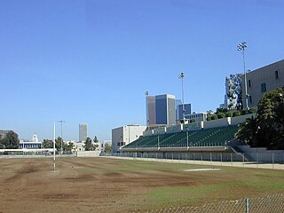
The Exposition Park neighborhood of Los Angeles is in the south region of Los Angeles, California. It is home to Exposition Park, which includes the Los Angeles Memorial Coliseum, Banc of California Stadium, Exposition Rose Garden and three museums: the California African American Museum, the California Science Center and the Natural History Museum of Los Angeles County. It is also home to a Science Center Academy.