
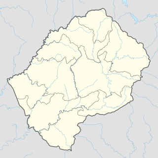
Lesotho is a mountainous, landlocked country located in Southern Africa. It is an enclave, surrounded by South Africa. The total length of the country's borders is 909 kilometres (565 mi). Lesotho covers an area of around 30,355 square kilometres (11,720 sq mi), of which a negligible percentage is covered with water.

Lesotho is geographically surrounded by South Africa and economically integrated with it as well. The economy of Lesotho is based on agriculture, livestock, manufacturing, mining, and depends heavily on inflows of workers’ remittances and receipts from the Southern African Customs Union (SACU). The majority of households subsist on farming. The formal sector employment consist of mainly the female workers in the apparel sector, the male migrant labor, primarily miners in South Africa for 3 to 9 months and employment in the Government of Lesotho (GOL). The western lowlands form the main agricultural zone. Almost 50% of the population earn income through informal crop cultivation or animal husbandry with nearly two-thirds of the country's income coming from the agricultural sector.
Maseru is the capital and largest city of Lesotho. It is also the capital of the Maseru District. Located on the Caledon River, Maseru lies directly on the Lesotho-South Africa border. Maseru is Lesotho's capital city with a population of 330,760 in the 2016 census. The city was established as a police camp and assigned as the capital after the country became a British protectorate in 1869. When the country achieved independence in 1966, Maseru retained its status as capital. The name of the city is a Sesotho word meaning "red sandstones".

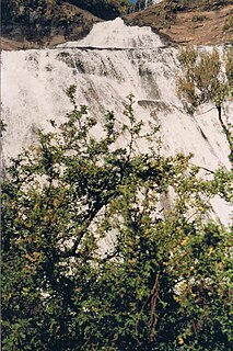
The Orange River is the longest river in South Africa and the Orange River Basin extends extensively into Namibia and Botswana to the north. It rises in the Drakensberg mountains in Lesotho, flowing westwards through South Africa to the Atlantic Ocean. The river forms part of the international borders between South Africa and Namibia and between South Africa and Lesotho, as well as several provincial borders within South Africa. Except for Upington, it does not pass through any major cities. The Orange River plays an important role in the South African economy by providing water for irrigation and hydroelectric power. The river was named the Orange River in honour of the Dutch ruling family, the House of Orange, by the Dutch explorer Robert Jacob Gordon. Other names include Gariep River, Groote River or Senqu River.

The National University of Lesotho is in Roma, some 34 kilometers southeast of Maseru, the capital of Lesotho. The Roma valley is broad and is surrounded by a barrier of rugged mountains which provides magnificent scenery. The university enjoys a temperate climate with four distinct seasons. The governing body of the University is the Council and academic policy is in the hands of Senate, both Council and Senate being established by the Act.

The Highveld is the portion of the South African inland plateau which has an altitude above roughly 1500 m, but below 2100 m, thus excluding the Lesotho mountain regions to the south-east of the Highveld. It is home to some of the country's most important commercial farming areas, as well as its largest concentration of metropolitan centres, especially the Gauteng conurbation, which accommodates one-third of South Africa's population.

Euskelosaurus browni is a semi-bipedal plateosaurid sauropodomorph dinosaur from the early Triassic of South Africa and Lesotho. Fossils have only been recovered from the lower Elliot Formation in South Africa and Lesotho, and in one locality in Zimbabwe.
The Central Bank of Lesotho is the central bank of Lesotho, in southern Africa. The bank is located in Maseru and its current governor is Dr. Retselisitsoe Matlanyane. The bank was established in 1978 as the Lesotho Monetary Authority.
Ramabanta is a town in western Lesotho. It is located southeast of the capital Maseru, and northwest of the 3096 metre peak of Thaba Putsoa.
The God Help Me Pass, or Lekhalong-la-Molimo-Nthuse in seSotho, is a mountain pass in western Lesotho. It is the second mountain pass on the A3 road going into the central highlands. The road ascends steeply from the village of Setibing, and near the summit is the Basotho Pony Trekking Centre, which offers a variety of trekking expeditions. The Makhaleng River flows close by Setibing, and its valley forms the western approach to the pass. The higher Blue Mountain Pass, Lekhalong-la-Thaba-Putsoa, is a few kilometres further east, and the first mountain pass, Bushman's Pass, Lekhalong-la-Baroa, is about 10 km to the west, rising from the village of Nazareth.
The Makhaleng River is a river of western Lesotho. It rises in the Maluti Mountains, flows generally in a southwesterly direction to join the Orange River at the border with Free State in South Africa.
Ha Baroana is a site in Lesotho noted for its early rock art. The site is located close to Nazareth village, to the east of the capital, Maseru.
Morija is a town in western Lesotho, located 35 kilometres south of the capital, Maseru. Morija is one of Lesotho’s most important historical and cultural sites, known as the Selibeng sa Thuto— the Well-Spring of Learning. It was the site of the first French Protestant mission in Lesotho, founded in 1833. The town also houses the Morija Museum and Archives, well known for supporting research and preserving valuable records and documents of Lesotho’s history.
Matebeng is a town in southeast Lesotho, situated close to the Senqu River. It lies at the western approach to the Matebeng Pass, which links it with the town of Mavuka.
Mavuka is a town in eastern Lesotho, close to the border with South Africa. It lies close to the Drakensberg, and is connected to both South Africa and the Lesotho towns of Matebeng and Paolosi by twisting mountain roads.
Sefikeng is a town in western Lesotho, located 30 kilometres to the east of the capital, Maseru, and 15 kilometres south of Teyateyaneng.
Nazareth is a town in western Lesotho. It is located to the east of the capital, Maseru, and west of the God Help Me Pass. Ha Baroana, an important archaeological site, is located just to the north of Nazareth.
Lubuli is a town in southeastern Eswatini. It is located close to the South African border just to the northwest of the town of Nsoko on the road between there and Maloma.


