Demographics
Based on figures published by the Central Statistical Agency in 2005, this woreda has an estimated total population of 142,178, of whom 71,182 were men and 70,996 were women; 7,866 or 5.53% of its population are urban dwellers, which is less than the Zone average of 8.5%. With an estimated area of 1,322.04 square kilometers, Boreda Abaya has an estimated population density of 107.5 people per square kilometer, which is less than the Zone average of 156.5. [2]
The 1994 national census reported a total population for this woreda of 99,687 of whom 49,814 were men and 49,873 were women; 4,341 or 4.35% of its population were urban dwellers. The four largest ethnic groups reported in Boreda Abaya were the Gamo (83.74%), the Welayta (10.06%), the Kachama (2.62%), and the Amhara (2.6%); all other ethnic groups made up 0.98% of the population. Gamo is spoken as a first language by 83.22%, Welayta 10.05%, 3.43% Amharic, and 2.6% speak Kachama; the remaining 0.7% spoke all other primary languages reported. [3]

The Southern Nations, Nationalities, and Peoples' Region was a regional state in southwestern Ethiopia. It was formed from the merger of five kililoch, called Regions 7 to 11, following the regional council elections on 21 June 1992. Its government was based in Hawassa.

North Omo Zone was a zone in the Southern Nations, Nationalities, and Peoples' Region of Ethiopia. It was named after the Omo River, which flows in the western area of the former zone. In 2000 it was split into three zones: Dawro, Gamo Gofa, and Wolayita; and Basketo and Konta became special woredas.
Damot Gale is a woreda in South Ethiopia Regional State, Ethiopia. Part of the Wolayita Zone, Damot Gale is bordered on the southwest by Sodo Zuria, on the northwest by Boloso Sore and Damot Pulasa, on the north by the Hadiya Zone, on the east by Diguna Fango, and on the southeast by Damot Weyde. The administrative center of Damot Gale is Boditi. Damot Pulasa woreda was separated from Damot Gale.
Kacha Bira is a woreda in the Southern Nations, Nationalities, and Peoples' Region of Ethiopia. Part of the Kembata Tembaro Zone, Kacha Bira is bordered on the south by an exclave of the Hadiya Zone, on the southwest by the Wolayita Zone, on the west by Hadero Tunto, on the northwest by the Hadiya Zone, on the north by Doyogena and Angacha, and on the east by Kedida Gamela. Towns in Kacha Bira include Shinshicho and Hadero.
Dale' is a woreda in Sidama Region, Ethiopia. Located in the Great Rift Valley, Dale is bordered on the south by Aleta Wendo and Chuko, on the west by Loko Abaya, on the northwest by Boricha, on the north by Shebedino, and on the east by Wensho. The major town in Dale is Irgalem, Irgalem. Parts of Dale woreda were separated to create Loko Abaya and Wensho woredas.
Boloso Sore is a woreda in South Ethiopia Regional State, Ethiopia. Part of the Wolayita Zone, Boloso Sore is bordered on the south by Sodo Zuria and Damot Sore, on the west by Boloso Bombe, on the northeast by the Kembata Tembaro Zone, on the northeast by the Hadiya Zone, on the east by Damot Pulasa, and on the southeast by Damot Gale. The administrative center is at Areka. Boloso Bombe and Damot Sore woredas were separated from Boloso Sore.
Sodo Zuria is one of the woredas in the South Ethiopia Regional State of Ethiopia. Part of the Wolayita Zone, Sodo Zuria is bordered on the southwest by Offa, on the west by Kindo Koysha, on the northwest by Damot Sore, on the north by Boloso Sore, on the northeast by Damot Gale, on the east by Damot Weyde, on the west by Bayra Koysha and on the southeast by Humbo. Sodo city is an administrative center for Sodo Zuria woreda.
Kindo Koysha is a district in the South Ethiopia Regional State of Ethiopia. It is a Part of the Wolayita Zone, Kindo Koysha is bordered on the south by Offa, on the southwest by Kindo Didaye, on the west by the Dawro Zone, on the north by Boloso Bombe, on the west by Damot Sore, on the southwest by Kindo Didaye and on the southeast by Bayra Koysha. The administrative center of Kindo Koysha is Bale Hawassa. Kindo Didaye woreda was separated from Kindo Koysha.
Kucha is one of the woredas in the Part of the Gamo zone.The major town in Kucha is Selamber. The people of kucha requesting constitutional recognition of their unique identity which totally separate from the so called Gamo ethnic group therein Gamo zone.nigatu.E
Offa is one of the woredas in the South Ethiopia Regional State of Ethiopia. It is a Part of the Wolayita Zone. Offa is bordered on the south by the Gamo Zone, on the west by Kindo Didaye, on the north by Kindo Koysha, on the northeast by Sodo Zuria, on the north by Kawo Koysha and on the east by Humbo woredas. The administrative center of Offa is Gesuba. Western part of Offa was added to Kindo Didaye woreda in 1998 E.C.

Humbo is one of the woredas in the South Ethiopia Regional State of Ethiopia. It is a Part of the Wolayita Zone located in the Great Rift Valley, Humbo is bordered on the southeast by Abala Abaya, on the south by the Gamo Zone, on the west by Offa, on the north by Sodo Zuria and Bayra Koysha. The administrative center of Humbo is Tebela.
Chencha is a woreda in South Ethiopia Regional State, Ethiopia. Part of the Gamo Zone, Chencha is bordered on the south by Arba Minch Zuria, on the west by Dita & Gofa on the north by Kucha and Boreda, and on the east by Mirab Abaya. Towns in Chencha include Chencha, Dorze, Dokko and Ezo.
Dita Dermalo was one of the 77 woredas in the Southern Nations, Nationalities, and Peoples' Region of Ethiopia. Part of the Gamo Gofa Zone, Dita Dermalo was bordered on the south by Bonke, on the southwest by Kemba, on the west by Zala Ubamale, on the north by Kucha, and on the east by Chencha. Towns in Dita Dermalo included Wacha and Zeda. Dita Dermalo was separated to Dita and Deramalo woredas.
Zala Ubamale was one of the 77 woredas in the Southern Nations, Nationalities, and Peoples' Region of Ethiopia. Part of the Gamo Gofa Zone, Zala Ubamale was bordered on the south and west by the Debub Omo Zone, on the northwest by Gofa Zuria, on the northeast by Kucha, on the east by Dita Dermalo and on the southeast by Kemba. Towns in Zala Ubamale included Beto and Meleante. Zala Ubamale was divided for Uba Debretsehay and Zala woredas.
Arba Minch Zuria is a woreda in South Ethiopia Regional State, Ethiopia. A part of the Gamo Zone located in the Great Rift Valley, Arba Minch Zuria is bordered on the south by the Dirashe special woreda, on the west by Bonke, on the north by Dita and Chencha, on the northeast by Mirab Abaya, on the east by the Oromia Region, and on the southeast by the Amaro special woreda. This woreda also includes portions of two lakes and their islands, Abaya found in Lante kebele and Chamo found in all Ganta Kanchama Ochole and Zeyise kebeles. Nechisar National Park is located between these lakes. City of Arba Minch is surrounded by Arba Minch Zuria.
Seraro is one of the woredas in the Oromia Region of Ethiopia. Part of the West Arsi Zone located in the Great Rift Valley, Seraro is bordered on the south and west by the Southern Nations, Nationalities and Peoples' Region, on the north by Shala, and on the east by Naannawa Shashamane; its western boundary is defined by the course of the Bilate River. The administrative center of this woreda is Loke.
Naannawa Shashamane is a woreda in Oromia Region, Ethiopia. It is named after the town of Shashamene what was separated from this woreda. Part of the West Arsi Zone located in the Great Rift Valley, Shashamene is bordered on the south by the Southern Nations, Nationalities and Peoples Region, on the west by Shala, on the north by Arsi Negele, on the east by the Kore, and on the southeast by Kofele. The largest town in Shashamene is Kuyera.
Gamo Zone is a Zone in the South Ethiopia Regional State of Ethiopia. Gamo is bordered on the south by the Dirashe special woreda, on the southwest by Debub (South) Omo and the Basketo special woreda, on the northwest by Konta special woreda, on the north by Dawro and Wolayita, on the northeast by the Lake Abaya which separates it from the Oromia Region, and on the southeast by the Amaro special woreda. The administrative center of Gamo is Arba Minch.
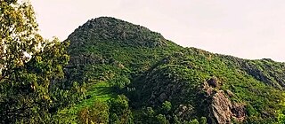
Boreda is one of the woredas in the Southern Nations, Nationalities, and Peoples' Region of Ethiopia. Part of the Gamo Gofa Zone, Boreda is bordered on the southeast by Mirab Abaya, on the southwest by Chencha, on the west by Kucha, and on the north by the Wolayita Zone. Towns in Boreda include Zefene. Boreda was part of former Boreda Abaya woreda.
Mirab Abaya is one of the woredas in the Southern Nations, Nationalities, and Peoples' Region of Ethiopia. Part of the Gamo Gofa Zone, Mirab Abaya is bordered on the east and south by Lake Abaya which separates it from the Oromia Region on the east and Arba Minch Zuria on the south, on the west by Chencha, on the northwest by Borena, and on the north by the Wolayita Zone. Towns in Mirab Abaya include Birbir. Mirab Abaya was part of former Boreda Abaya woreda.