Related Research Articles

Southwark is a district of Central London situated on the south bank of the River Thames, forming the north-western part of the wider modern London Borough of Southwark. The district, which is the oldest part of South London, developed due to its position at the southern end of the early versions of London Bridge, the only dry crossing point for many miles. Around 43 AD, engineers of the Roman Empire found the geographic features of the south bank suitable for the placement and construction of the first bridge.

Bermondsey is a district in southeast London, part of the London Borough of Southwark, England, 2.5 miles (4.0 km) southeast of Charing Cross. To the west of Bermondsey lies Southwark, to the east Rotherhithe and Deptford, to the south Walworth and Peckham, and to the north is Wapping across the River Thames. It lies within the historic county boundaries of Surrey. During the Industrial Revolution Bermondsey became a centre for manufacturing, particularly in relation to tanning. More recently it has experienced regeneration including warehouse conversions to flats and the provision of new transport links.

The London Borough of Southwark in South London forms part of Inner London and is connected by bridges across the River Thames to the City of London and London Borough of Tower Hamlets. It was created in 1965 when three smaller council areas amalgamated under the London Government Act 1963. All districts of the area are within the London postal district. It is governed by Southwark London Borough Council.

Newington is a district of South London, just south of the River Thames, and part of the London Borough of Southwark. It was an ancient parish and the site of the early administration of the county of Surrey. It was the location of the County of London Sessions House from 1917, in a building now occupied by the Inner London Crown Court.

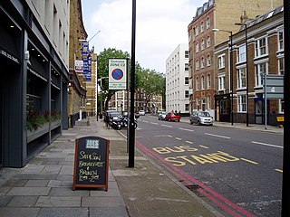
Borough High Street is a road in Southwark, London, running south-west from London Bridge, forming part of the A3 route which runs from London to Portsmouth, on the south coast of England.
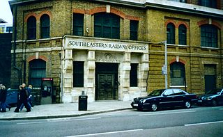
Tooley Street is a road in central and south London connecting London Bridge to St Saviour's Dock; it runs past Tower Bridge on the Southwark/Bermondsey side of the River Thames, and forms part of the A200 road.

Hay's Galleria is a mixed use building in the London Borough of Southwark situated on the south bank of the River Thames featuring offices, restaurants, shops, and flats. Originally a warehouse and associated wharf for the port of London, it was redeveloped in the 1980s. It is a Grade II listed structure.
Horsemonger Lane Gaol was a prison close to present-day Newington Causeway in Southwark, south London. Built at the end of the 18th century, it was in use until 1878.

The Wood Street Compter was a small prison within the City of London in England. It was primarily a debtors' prison, and also held people accused of such misdemeanours as public drunkenness, although some wealthier prisoners were able to obtain alcohol through bribery. The prison was built and opened in 1555, replacing the earlier Bread Street Compter, from which many prisoners were transferred. Wood Street was closed and replaced by Giltspur Street Compter in 1791.

Poultry Compter was a small prison that stood at Poultry, part of Cheapside in the City of London. The compter was used to lock up minor criminals and prisoners convicted under civil law and was run by the City's Sheriff. It operated from the 16th century until 1815. It was pulled down in 1817 and replaced with a chapel.
Marshalsea Road is a major street in Southwark, south London, England. At the northwest end is the Southwark Bridge Road. At the southeast end is Borough tube station on Borough High Street. Continuing across the street are Long Lane and Great Dover Street. At the northeast corner is the historic St George the Martyr church, where the Charles Dickens character Little Dorrit was married in Dickens' book of the same name. The area around Marshalsea Road has many Dickens associations.

The Marshalsea (1373–1842) was a notorious prison in Southwark, just south of the River Thames. Although it housed a variety of prisoners—including men accused of crimes at sea and political figures charged with sedition—it became known, in particular, for its incarceration of the poorest of London's debtors. Over half the population of England's prisoners in the 18th century were in jail because of debt.

St Olave's Church, Southwark was a church in Southwark, England which is believed to be mentioned in the Domesday Book of 1086. It was located on Tooley Street which is named after the church, i.e. 't'olous'. It became redundant in 1926 and was demolished. It is now the location of St Olaf House, which houses part of the London Bridge Hospital.

Lant Street is a street south of Marshalsea Road in Southwark, south London, England.

Long Lane is a main east–west road in Southwark, south London, England.

Bermondsey Square is on Tower Bridge Road in Bermondsey, south London, England. It was the site of the 11th-century Bermondsey Abbey. The earliest medieval remains found are a Norman church from around 1080, which was recorded in the Domesday Book of 1086. The area has subsequently undergone redevelopment and Bermondsey Square now contains apartments, offices, a boutique hotel, restaurants, an independent cinema and Bermondsey Market.

Potters Fields Park is a small public park situated in the London Borough of Southwark in London, England. The park is located immediately south-west of Tower Bridge and immediately south-east of City Hall, London. It is frequently used for food festivals and other events.
This is a list of the etymology of street names in the London district of Southwark. The area has no formally defined boundaries – those utilised here are: the river Thames to the north, Tower Bridge Road to the east, Bricklayers Arms/New Kent Road/Elephant and Castle to the south, and London Road/St George's Circus/Blackfriars Road to the west.

St Olaf House is a Grade II* listed building on Tooley Street in the London Borough of Southwark. The house was built on the site of St Olave's Church, Southwark between 1928 and 1932, and is now part of London Bridge Hospital.
References
- ↑ 'Prisons and Lockups', London Lives. https://www.londonlives.org/static/Prisons.jsp#toc4. Date accessed: 24 February 2017.
- ↑ 'A Survey of London, Written in the Year 1598, by John Stow', p. 345. Sutton Publishing, 2005. ISBN 0-7509-4240-1
- ↑ 'A History of the Ancient Town Halls of Southwark' Guildable Manor articles 2007
- ↑ From: 'Bermondsey: Tooley Street', Old and New London: Volume 6 (1878), pp. 100–17. URL: http://www.british-history.ac.uk/report.asp?compid=45269. Date accessed: 1 February 2007.
- ↑ Old Towns of England, London in 1839: Part Six – Police and Prisons
51°30′16″N0°05′27″W / 51.5044°N 0.0908°W