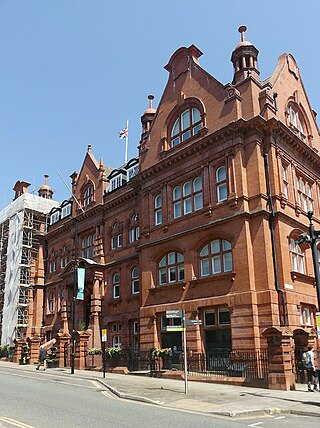
The Metropolitan Borough of Wigan is a metropolitan borough of Greater Manchester, England. It is named after its largest town, Wigan but covers a far larger area which includes the towns of Atherton, Ashton-in-Makerfield, Golborne, Hindley, Ince-in-Makerfield, Leigh and Tyldesley. The borough also covers the villages and suburbs of Abram, Aspull, Astley, Bryn, Hindley Green, Lowton, Mosley Common, Orrell, Pemberton, Shevington, Standish, Winstanley and Worsley Mesnes. The borough is also the second-most populous district in Greater Manchester.

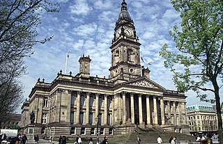
The Metropolitan Borough of Bolton is a metropolitan borough in Greater Manchester, England, named after its largest town, Bolton, but covering a larger area which includes Blackrod, Farnworth, Horwich, Kearsley, Westhoughton, and part of the West Pennine Moors. It had a population of 276,800 at the 2011 census, making it the fourth-most populous district in Greater Manchester.

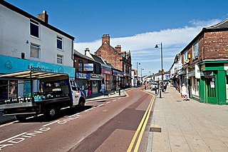
The Metropolitan Borough of Bury is a metropolitan borough of Greater Manchester in England. It is north of Manchester, to the east of Bolton and west of Rochdale. The borough is centred around the town of Bury but also includes other towns such as Ramsbottom, Tottington, Radcliffe, Whitefield and Prestwich. Bury bounds the Lancashire districts of Rossendale and Blackburn with Darwen to the north. It is the 10th most populous borough in Greater Manchester.

Westhoughton is a town and civil parish in the Metropolitan Borough of Bolton, Greater Manchester, England, 4 miles (6 km) southwest of Bolton, 5 miles (8 km) east of Wigan and 13 miles (21 km) northwest of Manchester.

Hindley is a town within the Metropolitan Borough of Wigan in Greater Manchester, England. It is three miles (4.8 km) east of Wigan and covers an area of 2,580 acres (1,044 ha). Within the boundaries of the historic county of Lancashire, Hindley borders the towns and villages of Ince-in-Makerfield, Aspull, Westhoughton, Atherton and Westleigh in the former borough of Leigh. In 2001, Hindley had a population of 23,457, increasing to 28,000 at the 2011 Census. It forms part of the wider Greater Manchester Urban Area.

Atherton is a town in the Metropolitan Borough of Wigan in Greater Manchester, England and historically part of Lancashire. The town, including Hindsford, Howe Bridge and Hag Fold, is 5 miles (8.0 km) south of Bolton, 7 miles (11.3 km) east of Wigan, and 10 miles (16.1 km) northwest of Manchester. From the 17th century, for about 300 years, Atherton was known as Chowbent, which was frequently shortened to Bent, the town's old nickname. During the Industrial Revolution, the town was a key part of the Manchester Coalfield.

Bolton West is a constituency represented in the House of Commons of the UK Parliament since 2015 by Chris Green, a Conservative.
Platt Bridge, colloquially known as Platt Wazz, is a settlement in the Metropolitan Borough of Wigan, Greater Manchester, England, 2 miles (3.2 km) south of Wigan town centre along the spine of the A573 road. Historically part of the Hindley Urban District, in Lancashire, the area is now a residential suburb of Wigan. The first mention of Platt Bridge in documents occurs in 1599. The name comes from "plat" or "platte" meaning a foot-bridge.

The Manchester–Southport line is a railway line in the north-west of England, operated by Northern Trains. It was originally built as the Manchester and Southport Railway. The section between Wigan and Salford is also known locally as the Atherton Line.

Hindley railway station is a railway station that serves the town of Hindley in Greater Manchester, England. It is on the Manchester to Southport line line, west of where the route branches to use either the Atherton line or the Eastern Branch line via Westhoughton, Lostock and Bolton.

Westhoughton railway station is one of the two stations which serve the town of Westhoughton, in the Metropolitan Borough of Bolton, Greater Manchester, north-western England. The station is 15+1⁄2 miles (24.9 km) north west of Manchester Piccadilly.

Daisy Hill railway station serves the Daisy Hill area of Westhoughton, in the Metropolitan Borough of Bolton, Greater Manchester, England.

Queen's Wood is a 52-acre area of ancient woodland in the London Borough of Haringey, abutting Highgate Wood and lying between East Finchley, Highgate, Muswell Hill and Crouch End. It was originally part of the ancient Forest of Middlesex which covered much of London, Hertfordshire and Essex and was mentioned in the Domesday Book. It is now one of three Local Nature Reserves in the London Borough of Haringey. It is situated a few minutes' walk from Highgate tube station.
Westhoughton was a parliamentary constituency in Lancashire, England. Centred on the former mining and cotton town of Westhoughton, it returned one Member of Parliament (MP) to the House of Commons of the Parliament of the United Kingdom.

Blue Bus was a large independent bus company serving Greater Manchester, Lancashire and Merseyside.

The geography of Greater Manchester is dominated by one of the United Kingdom's largest metropolitan areas, and in this capacity the landlocked metropolitan county constitutes one of the most urbanised and densely populated areas of the country. There is a mix of high density urban areas, suburbs, semi-rural and rural locations in Greater Manchester, but overwhelmingly the land use in the county is urban.

Scratchwood is an extensive, mainly wooded, country park in Mill Hill in the London Borough of Barnet. The 57-hectare site is a Site of Metropolitan Importance for Nature Conservation and together with the neighbouring Moat Mount Open Space. It is a Local Nature Reserve.

Oak Hill Wood is a 10-hectare Local Nature Reserve (LNR) and a Site of Borough Importance for Nature Conservation Grade I, in East Barnet, London. It is owned by the London Borough of Barnet, and part of it is a 5.5-hectare nature reserve managed by the London Wildlife Trust.

Cranham Marsh is a 15.3 hectare Local Nature Reserve and a Site of Metropolitan Importance for Nature Conservation in Cranham in the London Borough of Havering. It is owned by Havering Council and managed by the Essex Wildlife Trust.

Westhoughton was, from 1872 to 1974, a local government district centred on the town of Westhoughton in the administrative county of Lancashire, England.


