
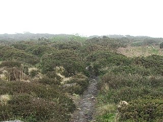
Chûn Castle is a large Iron Age hillfort (ringfort) near Penzance in Cornwall, England, United Kingdom. The fort was built about 2,500 years ago, and fell into disuse until the early centuries AD when it was possibly re-occupied to protect the nearby tin mines. It stands beside a prehistoric trackway that was formerly known as the Old St Ives Road and the Tinners’ Way. The name Chûn derives from Cornish: Chi an Woon. The area is now sometimes known as Chûn Downs. Nearby is Chûn Quoit.

Madron is a civil parish and village in west Cornwall, England, United Kingdom. Madron is named after Saint Madern's Church. Its annual Trafalgar Service commemorating the death of Vice Admiral Horatio Nelson was started on 27 October 1946, following a local tradition that his death was first announced on British soil in the Union Hotel, Penzance.

Penwith Hundred was one of ten ancient administrative hundreds of the county of Cornwall, England, UK. The ancient hundred of Penwith was larger than the local government district of Penwith (1974–2009) which took its name. Daphne du Maurier in Vanishing Cornwall suggests that the name, Penwith, has three renderings, "the last promontory," "promontory on the left, and "the headland of slaughter," thus suggesting that this area might have been the site of prehistoric invasions of sea-borne fighters, or perhaps tribal battles. The eastern part became part of Kerrier District.

Perranzabuloe is a coastal civil parish and a hamlet in Cornwall, England, United Kingdom. Perranzabuloe parish is bordered to the west by the Atlantic coast and St Agnes parish, to the north by Cubert parish, to the east by St Newlyn East and St Allen parishes and to the south by Kenwyn parish. The hamlet is situated just over a mile (2 km) south of the principal settlement of the parish, Perranporth; the hamlet is also seven miles (11 km) south-southwest of Newquay. Other settlements in the parish include Perrancoombe, Goonhavern, Mount and Callestick. The parish population was 5,382 in the 2001 census, increasing to 5,486 at the 2011 census.

Newbridge is a hamlet in the civil parish of Madron on the Penwith peninsula in west Cornwall, England, United Kingdom. It is on the A3071 road between St Just and Penzance, about three miles (5 km) west of the latter.

Tregavarah is a small hamlet in the parish of Madron in west Cornwall, England, U K. It is approximately 2 miles west of Penzance. Tregavarah Downs is nearby.
Caer Bran Hill Fort is an archaeological site near Sancreed and Carn Euny Iron Age village, on the Penwith peninsula in Cornwall.

Bartinney Castle is an Iron Age enclosure located in the Penwith Peninsula of Southwest Cornwall, England, it is surrounded by a circular earthwork standing on a hill surrounded by various archaeological prehistoric remains, including ancient settlements, field systems, tumuli and cairns.

Trink Hill is a 212-metre-high hill that lies between the hamlets of Trink and Cripplesease, near to the village of Nancledra, Cornwall, UK. Trencrom Hill lies one kilometre to the South East.

Buryas Bridge is a hamlet on the A30 between Land's End and Penzance in west Cornwall, England, UK.
Carnebone is a small hamlet and farm in the parish of Wendron in Cornwall, England. It lies to the east of Wendron, to the northeast of Trevenen, just to the west of Seworgan, along the A394 road, 3.8 miles (6.1 km) northeast of Helston.

Higher Ninnes and Lower Ninnes are hamlets, south of Mulfra Hill in the civil parish of Madron in west Cornwall, England, UK.
Penmayne is a hamlet next to Splatt in the civil parish of St Minver Lowlands in north Cornwall, England, UK.

West Lanyon Quoit, also known as Lower Lanyon Quoit, is the remains of a prehistoric dolmen situated in the parish of Madron in Cornwall grid reference SW423337. It was excavated in the late 18th century, and much of the structure has since been destroyed.

Lanyon is a hamlet in the parish of Madron in Cornwall, England, UK. It is situated on a north facing slope on the Madron to Morvah road. The nearest town is Penzance 4 miles (6.4 km) to the south.

Lowertown-by-Helston is a large hamlet in Sithney civil parish, bordering Wendron parish, in Cornwall, United Kingdom. The hamlet is one mile north of the centre of the town of Helston, and is built around the River Cober. The hamlet used to be an industrial village, with mills, mines, railway stations, shops and churches; all of which have been closed down.
Little Treviscoe is a village near Treviscoe in Cornwall. It contains about 30 properties. There are numerous abandoned china clay workings in the area surrounding it. In 2013 the village had issues with a cat. It has typical Cornish weather.
Botternell is a hamlet in the parish of North Hill, east Cornwall in the United Kingdom. The name means "Dornel's dwelling". Boturnell, also in Cornwall, has the same meaning.

Bosiliack Barrow is a barrow on the Penwith Moors between Madron and Morvah near the hamlet of Bosiliack in Cornwall, UK.

Chyandour Brook is a small river (brook) in west Cornwall, England. Rising in Boskednan in the civil parish of Madron, Chyandour Brook drains into Mount's Bay in the English Channel at Chyandour, Penzance.
