
Lamorna is a village, valley and cove in west Cornwall, England, UK. It is on the Penwith peninsula approximately 4 miles (6 km) south of Penzance. Lamorna became popular with the artists of the Newlyn School, including Alfred Munnings, Laura Knight and Harold Knight, and is also known for former residents Derek and Jean Tangye who farmed land and wrote "The Minack Chronicles".

Penzance is a town, civil parish and port in the Penwith district of Cornwall, England, United Kingdom. It is the westernmost major town in Cornwall and is about 64 miles (103 km) west-southwest of Plymouth and 255 miles (410 km) west-southwest of London. Situated in the shelter of Mount's Bay, the town faces south-east onto the English Channel, is bordered to the west by the fishing port of Newlyn, to the north by the civil parish of Madron and to the east by the civil parish of Ludgvan. The civil parish includes the town of Newlyn and the villages of Mousehole, Paul, Gulval, and Heamoor. Granted various royal charters from 1512 onwards and incorporated on 9 May 1614, it has a population of 21,200.
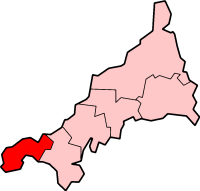
Penwith is an area of Cornwall, England, located on the peninsula of the same name. It is also the name of a former local government district, whose council was based in Penzance. The area is named after one of the ancient administrative hundreds of Cornwall which derives from two Cornish words, penn meaning 'headland' and wydh meaning 'at the end'.

St Just, also known as St Just in Penwith, is a town and civil parish in the Penwith district of Cornwall, England, United Kingdom. It lies along the B3306 road which connects St Ives to the A30 road. The parish encompasses the town of St Just and the nearby settlements of Trewellard, Pendeen and Kelynack: it is bounded by the parishes of Morvah to the north-east, Sancreed and Madron to the east, St Buryan and Sennen to the south and by the sea in the west. The parish consists of 7,622 acres (3,085 ha) of land, 12 acres (4.9 ha) of water and 117 acres (47.3 ha) of foreshore. The town of St Just is the most westerly town in mainland Britain and is situated approximately 8 miles (13 km) west of Penzance along the A3071. St Just parish, which includes Pendeen and the surrounding area, has a population of 4,637. An electoral ward of the same name also exists: the population of this ward at the same census was 4,812.

Mousehole is a village and fishing port in Cornwall, England, UK. It is approximately 2.5 miles (4 km) south of Penzance on the shore of Mount's Bay. The village is in the civil parish of Penzance. An islet called St Clement's Isle lies about 350 metres (380 yd) offshore from the harbour entrance.

Trewellard is a small village on the north coast road between St Just and St Ives in Cornwall, England, United Kingdom. It lies along the B3306 road which connects St Ives to the A30 road. It is situated 7 miles from Land's End and 7 miles from Penzance. It is in the civil parish of St Just and the electoral division of St Just in Penwith.

Hayle is a port town and civil parish in west Cornwall, England, United Kingdom. It is situated at the mouth of the Hayle River and is approximately seven miles (11 km) northeast of Penzance.

The hundreds of Cornwall were administrative divisions or Shires (hundreds) into which Cornwall, the present day administrative county of England, in the United Kingdom, was divided between c. 925 and 1894, when they were replaced with local government districts.
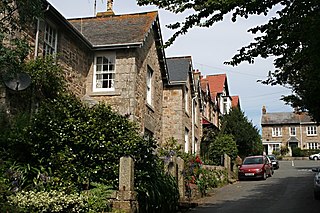
Gulval is a village in the civil parish of Penzance, in Cornwall, England. Although historically a parish in its own right, Gulval was incorporated into the parishes of Ludgvan, Madron and Penzance in 1934, and is now considered to be a suburb of Penzance. Gulval still maintains its status as an ecclesiastical parish and parts of the village church date back to the 12th-century. Together with Heamoor, Gulval still retains its status as an electoral ward. The ward population at the 2011 census was 4,185.

Escalls is a hamlet in the civil parish of Sennen on the Penwith peninsula in west Cornwall, England, UK.

Kelynack (from Cornish: Kelynek is a settlement in west Cornwall, England, UK.

Penwith Hundred was one of ten ancient administrative hundreds of the county of Cornwall, England, UK. The ancient hundred of Penwith was larger than the local government district of Penwith (1974–2009) which took its name. Daphne du Maurier in Vanishing Cornwall suggests that the name, Penwith, has three renderings, "the last promontory," "promontory on the left, and "the headland of slaughter," thus suggesting that this area might have been the site of prehistoric invasions of sea-borne fighters, or perhaps tribal battles. The eastern part became part of Kerrier District.
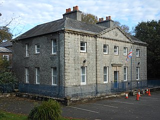
Castle Horneck is a Grade II* listed building, and refurbished Georgian mansion to the west of the Cornish town of Penzance. It is currently owned by the Youth Hostels Association (YHA) and has been used as a youth hostel since 1950.

Gurnard's Head is a prominent headland on the north coast of the Penwith peninsula in Cornwall, England. The name is supposed to reflect that the rocky peninsula resembles the head of the gurnard fish.
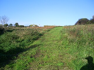
Lescudjack Hill fort is the name given to the unexcavated Iron Age settlement located in Penzance, Cornwall. It is positioned on the summit of a steep hill in the east of Penzance and consists of a single rampart enclosing an area of 3 acres (12,000 m2). The site has been damaged and contains allotments and an open area of land which has recently been cleared of thick undergrowth. It is reported that a small lead-copper mine was situated "just outside" the ramparts, however all trace of this appears to have vanished.

Botallack is a village in west Cornwall, England, United Kingdom. It lies along the B3306 road which connects St Ives in the east to the A30 road, near Land's End. The village is included in the St Just in Penwith division on Cornwall Council. The original 1970s BBC television series Poldark was filmed partly in Botallack, using Manor Farm as Nampara. The Manor House, part of the Tregothnan estate, is a Grade II* listed building, dating from the 17th century.

Lanyon is a hamlet in the parish of Madron in Cornwall, England, UK. It is situated on a north facing slope on the Madron to Morvah road. The nearest town is Penzance 4 miles (6.4 km) to the south.
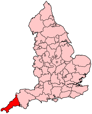
The following outline is provided as an overview of and topical guide to Cornwall: Cornwall – ceremonial county and unitary authority area of England within the United Kingdom. Cornwall is a peninsula bordered to the north and west by the Celtic Sea, to the south by the English Channel, and to the east by the county of Devon, over the River Tamar. Cornwall is also a royal duchy of the United Kingdom. It has an estimated population of half a million and it has its own distinctive history and culture.
Presented below is an alphabetical index of articles related to Cornwall:

Craig Weatherhill was a Cornish antiquarian, novelist and writer on the history, archaeology, place names and mythology of Cornwall.


