Botanie Valley

Last updated

Botanie Valley is in British Columbia's southern interior near Lytton. It is a traditional food source for the Nlaka'pamux people. The name itself means "covering" possibly referring to the abundant plant life covering the area. Botanie Creek enters the Thompson River a few kilometres upstream of its confluence with the Fraser River, [1] making Botanie the Thompson River's last tributary.

Lytton, British Columbia Village in British Columbia, Canada

Lytton in British Columbia, Canada, sits at the confluence of the Thompson River and Fraser River on the east side of the Fraser. The location has been inhabited by the Nlaka'pamux people for over 10,000 years. It is one of the earliest locations settled by non-natives in the Southern Interior of British Columbia. It was founded during the Fraser Canyon Gold Rush of 1858–59, when it was known as "The Forks". The community includes the Village of Lytton and the surrounding community of the Lytton First Nation, whose name for the place is Camchin, also spelled Kumsheen.

Nlakapamux ethnic group

The Nlaka'pamux or Nlakapamuk, also previously known as the Thompson, Thompson River Salish, Thompson Salish, Thompson River Indians or Thompson River people, and historically as the Klackarpun, Haukamaugh, Knife Indians and Couteau Indians, are an indigenous First Nations people of the Interior Salish language group in southern British Columbia. Their traditional territory includes parts of the North Cascades region of Washington.

Thompson River river in British Columbia

The Thompson River is the largest tributary of the Fraser River, flowing through the south-central portion of British Columbia, Canada. The Thompson River has two main branches, the South Thompson River and the North Thompson River. The river is home to several varieties of Pacific salmon and trout. The area's geological history was heavily influenced by glaciation, and the several large glacial lakes have filled the river valley over the last 12,000 years. Archaeological evidence shows human habitation in the watershed dating back at least 8,300 years. The Thompson was named by Fraser River explorer, Simon Fraser, in honour of his friend, Columbia Basin explorer David Thompson. Recreational use of the river includes whitewater rafting and angling.

Contents

History

Due to the centrality of its location between the larger Thompson and Fraser watersheds, the Valley was a traditional First Nations meeting place. It was not only a meeting place for people of the Nlaka'pamux nation. Secwepemc, Stl'atl'imx and others met, sometimes as many as a thousand at a time. [2] Ethnobiologist, Nancy Turner said of these meetings, "They met, at least in part, to take advantage of the great abundance of a number of different "root" vegetables and berries to be found there. Also important was the cultural "glue" created at these gatherings, where women harvested plant foods, men hunted, and everyone traded and socialized". The Valley was settled by Europeans in 1876. It has been used for ranching and homesteading since that time. In 1926 a small dam was built, creating Botanie Lake. [3] In modern times the Lytton First Nation has hosted an annual Healing Gathering at Pasulko Lake.

Secwepemc people in Canada

The Secwépemc, known in English as the Shuswap people, are a First Nations people residing in the Canadian province of British Columbia. Secwepemcúĺecw, their country, ranges from the eastern Chilcotin Plateau and the Cariboo Plateau southeast through the Thompson Country to Kamloops and the Shuswap Country, and spans the Selkirk Mountains and Big Bend of the Columbia River to include the northern part of the Columbia Valley region. The country's traditional territory covers approximately 145,000 square kilometres. They relied heavily on hunting, trading and fishing to support their communities. The Secwepemc are perhaps the most numerous of the Interior Salish peoples of British Columbia if based upon the numbers who speak their language.

Nancy Turner Canadian ethnobiologist

Nancy Jean Turner is a notable North American ethnobiologist, originally qualified in botany, who has done extensive research work with the indigenous peoples of British Columbia, the results of which she has documented in a number of books and numerous articles.

Ecology

Botanie Valley has a rich diversity of plant life owing in part to its location between the rainy Coastal Mountain Range and the dryer Interior Plateau. Occurrence of wildfires also turns forest lands into diverse flower meadows in the higher sub-alpine elevations. In 1978, in an attempt to preserve this diversity, the Province of British Columbia created the Skwaha Lake Ecological Reserve. The reserve contains four blue listed species, and two redlisted species, Nuttall's Sunflower and Oniongrass. Invasive species and climate change are named as threats to these species. [4]

Coast Mountains major mountain range in western North America

The Coast Mountains are a major mountain range in the Pacific Coast Ranges of western North America, extending from southwestern Yukon through the Alaska Panhandle and virtually all of the Coast of British Columbia south to the Fraser River. The mountain range's name derives from its proximity to the sea coast, and it is often referred to as the Coast Range. The range includes volcanic and non-volcanic mountains and the extensive ice fields of the Pacific and Boundary Ranges, and the northern end of the volcanic system known as the Cascade Volcanoes. The Coast Mountains are part of a larger mountain system called the Pacific Coast Ranges or the Pacific Mountain System, which includes the Cascade Range, the Insular Mountains, the Olympic Mountains, the Oregon Coast Range, the California Coast Ranges, the Saint Elias Mountains and the Chugach Mountains. The Coast Mountains are also part of the American Cordillera—a Spanish term for an extensive chain of mountain ranges—that consists of an almost continuous sequence of mountain ranges that form the western backbone of North America, Central America, South America and Antarctica.

Interior Plateau

The Interior Plateau comprises a large region of the Interior of British Columbia, and lies between the Cariboo and Monashee Mountains on the east, and the Hazelton Mountains, Coast Mountains and Cascade Range on the west. The continuation of the plateau into the United States is known there as the Columbia Plateau.

IUCN Red List Inventory of the global conservation status of biological species

The IUCN Red List of Threatened Species, founded in 1964, is the world's most comprehensive inventory of the global conservation status of biological species. It uses a set of criteria to evaluate the extinction risk of thousands of species and subspecies. These criteria are relevant to all species and all regions of the world. With its strong scientific base, the IUCN Red List is recognized as the most authoritative guide to the status of biological diversity. A series of Regional Red Lists are produced by countries or organizations, which assess the risk of extinction to species within a political management unit.

Related Research Articles

Stein Valley Nlakapamux Heritage Park

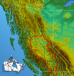
Stein Valley Nlaka'pamux Heritage Park is a provincial park in British Columbia, Canada. Nearly the complete Stein River watershed from the mountains to the Fraser River is protected in this park, though there are some areas of the watershed that were left out.

Camchin, also spelled Kumsheen, is an anglicization of the ancient name for the locality and aboriginal village once located on the site of today's Village of Lytton, British Columbia, Canada, whose name in the Nlaka'pamux language is ƛ'q'əmcín It also refers to the main Indian Reserve community of the Lytton First Nation adjacent to the Village of Lytton and is found in the form Kumsheen in local business and school names.

The Nicola people are a First Nations political and cultural alliance in the Nicola Country region of the Southern Interior of the Canadian province of British Columbia. They are mostly located in the Nicola River valley around the area of Merritt and are an alliance of Scw'exmx, the local branch of the Nlaka'pamux (Thompson) people, and the Spaxomin, the local branch of the Syilx or Okanagan people.

The Scw'exmx ( Scw̓éxmx), meaning "people of the creek(s)" are a branch of the Nlaka'pamux (Thompson) people in the Nicola Country of the Canadian province of British Columbia (Scw'ex, meaning "creek", is the name of the Nicola River in the Thompson language}. Together with the neighbouring branch of the Okanagan people the Spaxomin, who live in the upper, eastern reaches of the Nicola Valley, they are generally known in English as the Nicolas. They also share governmental institutions, and their alliance dates to before the time of Chief Nicola, for whom the river was named and whose father had led the Okanagan migration into the valley in the late 18th century. The Scw'exmx intermarried with the Okanagans, and also with the Nicola Athapaskans, a now-extinct Athapaskan-speaking people who migrated into the valley in the 17th Century.

The Nicola Tribal Association, also known as the Nicola Tribal Council and the Nicola Valley Tribal Council, is an official First Nations Tribal Council composed of bands in the Nicola Valley, Thompson Canyon and Fraser Canyon areas of the Canadian province of British Columbia. It is one of three tribal councils of the Nlaka'pamux (Thompson) people, the other two being the Nlaka'pamux Nation Tribal Council and the Fraser Canyon Indian Administration. The Lytton First Nation and Lower Nicola Indian Band community, does not belong to any of the three Tribal Councils.

The Nlaka'pamux Nation Tribal Council, formerly the Fraser Thompson Indian Services Society, is a First Nations government Tribal Council comprising bands in the Fraser Canyon and Thompson Canyon areas of the Canadian province of British Columbia. It is one of three tribal councils of the Nlaka'pamux people, the others being the Nicola Tribal Association and the Fraser Canyon Indian Administration. The Lytton First Nation, which is the government of the largest Nlaka'pamux community, does not belong to any of the three.

The Ashcroft First Nation is a First Nations government Thompson Canyon area of the Central Interior of the Canadian province of British Columbia. It's Indian Reserves are located near the town of Ashcroft, British Columbia, it is a member of the Nlaka'pamux Nation Tribal Council.

Kanaka Bar First Nation is a First Nations government located at Kanaka Bar, British Columbia, Canada, between the towns of Boston Bar and Lytton in the Fraser Canyon region. It is a member of the Fraser Canyon Indian Administration, one of three tribal councils of the Nlaka'pamux people. Other members of the Fraser Canyon Indian Administration are the Spuzzum, Skuppah and Nicomen First Nations . . Other Nlaka'pamux governments belong either to the Nicola Tribal Association or the Nlaka'pamux Nation Tribal Council.

Nicomen First Nation is a Nlaka'pamux First Nations government located near Lytton, British Columbia. It is a member of the Fraser Canyon Indian Administration as well as of the Nicola Tribal Association, which are two of three tribal councils of the Nlaka'pamux people. The third is the Nlaka'pamux Nation Tribal Council.

The Cook's Ferry First Nation is a Nlaka'pamux First Nations government located in the Central Interior region of the Canadian province of British Columbia. It is a member of the Nicola Tribal Association, which are two of three tribal councils of the Nlaka'pamux people. Other Nlaka'pamux governments belong either to the Fraser Canyon Indian Administration or the Nlaka'pamux Nation Tribal Council.

The Siska First Nation is a Nlaka'pamux First Nations government located in the Fraser Canyon region of the Canadian province of British Columbia. It is a member of the Nicola Tribal Association, which are two of three tribal councils of the Nlaka'pamux people. Other Nlaka'pamux governments belong either to the Fraser Canyon Indian Administration or the Nlaka'pamux Nation Tribal Council, although the large Lytton First Nation, north of Siska, does not belong to any of the three.

The Lytton First Nation, a First Nations band government, has its headquarters at Lytton in the Fraser Canyon region of the Canadian province of British Columbia. While it is the largest of all Nlaka'pamux bands, unlike all other governments of the Nlaka'pamux (Thompson) people, it is not a member of any of the three Nlaka'pamux tribal councils, which are the Nicola Tribal Association, the Fraser Canyon Indian Administration and the Nlaka'pamux Nation Tribal Council.

Skihist Mountain mountain in Canada

Skihist Mountain, also sometimes referred to as Skihist Peak, is the highest mountain in the Cantilever Range and in southwestern British Columbia, Canada. It is located on the southern boundary of Stein Valley Nlaka'pamux Heritage Park, about 20 km (12 mi) west of Lytton. It is the highest summit in the Lillooet Ranges, which lie between the Lillooet and Fraser Rivers, south of the Gates Valley and Seton and Anderson Lakes.

Foster Bar, originally known as Foster's Bar, is a gold-bearing sandbar in the Fraser Canyon of British Columbia, Canada as well as the name used for the surrounding locality, which includes Nesikep Indian Reserve 6 and Nesikep Indian Reserve 6A of the Cayoose Creek First Nation of the St'at'imc people and Lytton Indian Reserves Nos. 6A and 5B and Seah Indian Reserve No. 5 of the Lytton First Nation of the Nlaka'pamux people.

Kanaka Bar is an unincorporated community and locality in the Fraser Canyon region of British Columbia, Canada, located near the town of Lytton. Named for a gold-bearing bar on the Fraser River below, which was mined by Hawaiians, Kanaka Bar is the home of the office and main rancherie of the Kanaka Bar Indian Band of the Nlaka'pamux peoples, and is also the source of the name of Kanaka Bar Indian Reserve No. 1A and Kanaka Bar Indian Reserve No. 2 which are governed by the band.

Stein River river in Canada

The Stein River is a tributary of the Fraser River in the Canadian province of British Columbia.

The Nicoamen River is a tributary of the Thompson River in the southern Interior of British Columbia, Canada, located 15 kilometres (9 mi) upstream from its confluence with the Thompson at Lytton.

Botanie Mountain mountain in Canada

Botanie Mountain, also spelled Bootahnie Mountain, is a mountain in the Clear Range of the Southern Interior of British Columbia, Canada. It is located immediately north of the village of Lytton, which is situated at the confluence of the Thompson and Fraser Rivers.

References

  1. http://apps.gov.bc.ca/pub/bcgnws/names/463.html
  2. "Archived copy". Archived from the original on 2011-05-25. Retrieved 2011-05-17.CS1 maint: archived copy as title (link)
  3. "Archived copy" (PDF). Archived from the original (PDF) on 2012-03-24. Retrieved 2011-05-18.CS1 maint: archived copy as title (link)
  4. http://www.env.gov.bc.ca/bcparks/eco_reserve/skwaha_er/Skwaha%20Lake%20ER%2088.pdf

Coordinates: 50°18′58″N121°33′04″W / 50.316°N 121.551°W / 50.316; -121.551

Geographic coordinate system Coordinate system

A geographic coordinate system is a coordinate system that enables every location on Earth to be specified by a set of numbers, letters or symbols. The coordinates are often chosen such that one of the numbers represents a vertical position and two or three of the numbers represent a horizontal position; alternatively, a geographic position may be expressed in a combined three-dimensional Cartesian vector. A common choice of coordinates is latitude, longitude and elevation. To specify a location on a plane requires a map projection.