Bastille is a station on Line 1, Line 5 and Line 8 of the Paris Métro. Located under the Place de la Bastille and near the former location of the Bastille, it is situated on the border of the 4th, 11th and 12th arrondissement.
La Chapelle is a station on Paris Métro Line 2, on the border of the 10th and 18th arrondissements above the Boulevard de la Chapelle. The station is connected to the Gare du Nord and the Gare du Nord Métro station on lines 4 and 5.

The Gare du Nord, officially Paris Nord, is one of the seven large mainline railway station termini in Paris, France. The station is served by trains that run between the capital and northern France via the Paris–Lille railway, as well as to international destinations in Belgium, Germany, the Netherlands and the United Kingdom. Located in the northern part of Paris near the Gare de l'Est in the 10th arrondissement, the Gare du Nord offers connections with several urban transport lines, including Paris Métro, RER and buses. It is the busiest railway station in Europe by total passenger numbers, and the busiest outside Japan. In 2015, the Gare du Nord saw more than 700,000 passengers per day.

République is a station on lines 3, 5, 8, 9 and 11 of the Paris Métro. It is located under the Place de la République, at the tripoint border of the 3rd, 10th and 11th arrondissements. It is an important interchange station; its 16.6 million users (2019) make it the seventh busiest out of 302 on the Métro network.

Gare de l'Est – Verdun is a station of the Paris Métro, serving Lines 4, 5, and 7 is located in the 10th arrondissement in Paris, France. It is the fifth busiest station on the network.

Jacques Bonsergent is a station of the Paris Métro, serving line 5 and located in the 10th arrondissement of Paris.

The Canal Saint-Martin is a 4.6 km long canal in Paris, connecting the Canal de l'Ourcq to the river Seine. Nearly half its length, between the Rue du Faubourg du Temple and the Place de la Bastille, was covered in the mid-19th century to create wide boulevards and public spaces on the surface. The canal is drained and cleaned every 10–15 years, and it is always a source of fascination for Parisians to discover curiosities and even some treasures among the hundreds of tons of discarded objects.

Magenta station is a station of the Île-de-France Réseau Express Régional (RER), in the 10th arrondissement of Paris, France. Built on the site of the Gare du Nord, the original name of Magenta station was Nord-Est with the possibility of a connection to both Paris-Nord and Paris-Est.

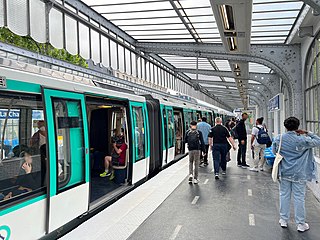
Paris Métro Line 5 is one of the 16 lines of the Paris Métro in Paris, France. It crosses the east of Paris from Bobigny–Pablo Picasso to Place d'Italie. It is the eighth-busiest line on the network.

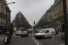
The Boulevard Saint-Michel is one of the two major streets in the Latin Quarter of Paris, France, the other being the Boulevard Saint-Germain. It is a tree-lined boulevard which runs south from the Pont Saint-Michel on the Seine and Place Saint-Michel, crosses the Boulevard Saint-Germain and continues alongside the Sorbonne and the Jardin du Luxembourg, ending at the Place Camille Jullian just before the Port-Royal RER station and the Avenue de l'Observatoire. It was created by Baron Haussmann to run parallel to the Rue Saint-Jacques which marks the historical north-south axis of Paris. It is known colloquially as Boul'Mich' in French.
Gare du Nord is a station on Line 4 and Line 5 of the Paris Métro. It is the busiest station in the system, with 48 million entrances a year. It is connected to the SNCF railway station Gare du Nord, which is served by RER B, RER D and Transilien Nord commuter trains as well as interurban trains to northern France, Eurostar trains to London and Thalys trains to Brussels, Amsterdam and Cologne. The station is also connected to the La Chapelle Métro station on Line 2 and to the Magenta RER station on RER E.

The Wall of the Ferme générale was one of the several city walls of Paris built between the early Middle Ages and the mid 19th century. Built between 1784 and 1791, the 24 km wall crossed the districts of the Place de l'Étoile, Batignolles, Pigalle, Belleville, Nation, the Place d'Italie, Denfert-Rochereau, Montparnasse and the Trocadéro, roughly following the route now traced by line 2 and line 6 of the Paris Métro. The wall was demolished in the early 1860s, although elements of some of its gates remain.

Saint-Lazare Prison was a prison in the 10th arrondissement of Paris, France. It existed from 1793 until 1935 and was housed in a former motherhouse of the Vincentians.

The Place de la République is a square in Paris, located on the border between the 3rd, 10th and 11th arrondissements. The square has an area of 3.4 ha. Named after the First, Second and Third Republics, it contains a monument, the Monument à la République, which includes a statue of the personification of France, Marianne.

Faubourg Saint-Germain is a historic district of Paris, France. The Faubourg has long been known as the favourite home of the French high nobility and hosts many aristocratic hôtels particuliers. It is currently part of the 7th arrondissement of Paris.

The Rue du Faubourg-Saint-Denis is a street in the 10th arrondissement of Paris. It crosses the arrondissement from north to south, linking the Porte Saint-Denis to La Chapelle Métro station and passing the Gare du Nord.

The Boulevard Barbès is a boulevard in the 18th arrondissement of Paris. It is named after French politician Armand Barbès. It was built in 1867 during Haussmann's renovation of Paris. It starts at the boulevard de la Chapelle and ends at the rue Ordener. It is 835 metres long and 35 metres wide.
The Faubourg Saint-Antoine was one of the traditional suburbs of Paris, France. It grew up to the east of the Bastille around the abbey of Saint-Antoine-des-Champs, and ran along the Rue du Faubourg Saint-Antoine.
The following outline is provided as an overview of and topical guide to Paris: