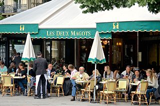
The 6th arrondissement of Paris is one of the 20 arrondissements of the capital city of France. In spoken French, this arrondissement is referred to as le sixième.

The Place de la Bastille is a square in Paris where the Bastille prison stood until the storming of the Bastille and its subsequent physical destruction between 14 July 1789 and 14 July 1790 during the French Revolution. No vestige of the prison remains.

The 4th arrondissement of Paris is one of the 20 arrondissements of the capital city of France. In spoken French, this arrondissement is referred to as quatrième. It is governed locally together with the 1st, 2nd and 3rd arrondissement, with which it forms the 1st sector of Paris.

The 12th arrondissement of Paris is one of the 20 arrondissements, or boroughs, of the capital city of France. In spoken French, this arrondissement is referred to as the douzième. The arrondissement is situated on the right bank of the River Seine.

Bastille is a station on Line 1, Line 5 and Line 8 of the Paris Métro. Located under the Place de la Bastille and near the former location of the Bastille, it is situated on the border of the 4th, 11th and 12th arrondissement.

Quai de la Rapée is a station of the Paris Métro, serving line 5, located in the 12th arrondissement of Paris.

The Canal Saint-Martin is a 4.6 km long canal in Paris, connecting the Canal de l'Ourcq to the river Seine. Over nearly half its length, between the Rue du Faubourg du Temple and the Place de la Bastille, it was covered, in the mid-19th century, to create wide boulevards and public spaces on the surface. The canal is drained and cleaned every 10–15 years, and it is always a source of fascination for Parisians to discover curiosities and even some treasures among the hundreds of tons of discarded objects.

Paris Métro Line 8 is one of the sixteen lines of the Paris Métro. It connects Balard in the southwestern part of Paris to Pointe du Lac station in the southeastern suburbs, following a parabolic route on the Rive Droite of the Seine. The last line of the original 1898 Paris Métro plan, which opened in July 1913, it was initially intended to link Porte d'Auteuil and Opéra. With 105.5 million travellers in 2017, it is the network's eighth busiest line; at 23.4 km (14.5 mi) of length, it is also the second longest Métro Line after Line 13. Along with Line 7, it serves the most stations of any line on the network, at 38. Line 8 interchanges with all but three other Métro lines.

The Pont de Sully is a bridge across the Seine in Paris, France.
The Bassin de l'Arsenal is a boat basin in Paris. It links the Canal Saint-Martin, which begins at the Place de la Bastille, to the Seine, at the Quai de la Rapée. A component of the Réseau des Canaux Parisiens, it forms part of the boundary between the 4th and the 12th arrondissements. It is bordered by the Boulevard Bourdon on the 4th (westerly) side and the Boulevard de la Bastille on the 12th (easterly) side.

The Bassin de la Villette is the largest artificial lake in Paris. It was filled with water on 2 December 1808. Located in the 19th arrondissement of the capital, it links the Canal de l'Ourcq to the Canal Saint-Martin, and it represents one of the elements of the Réseau des Canaux Parisiens, a public-works authority operated by the city. The other components of the network are the Canal de l'Ourcq, the Canal Saint-Denis, the Canal Saint-Martin, and the Bassin de l'Arsenal. Together, these canals and basins extend roughly 130 kilometres (81 mi).
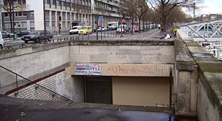
Arsenal is a ghost station on the Paris métro, situated on line 5 between the stations of Bastille and Quai de la Rapée, in the 4th arrondissement of Paris.
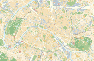
This article presents the main landmarks in the city of Paris within administrative limits, divided by its 20 arrondissements. Landmarks located in the suburbs of Paris, outside of its administrative limits, while within the metropolitan area are not included in this article.

The Jardin du Bassin de l'Arsenal is a public park in the 12th arrondissement of Paris, located on the east bank of the Canal Saint-Martin between the Place de la Bastille and the Seine. It was created in 1983. The access to the park is from boulevard de la Bastille. The nearest metro station is Bastille.
The Faubourg Saint-Antoine was one of the traditional suburbs of Paris, France. It grew up to the east of the Bastille around the abbey of Saint-Antoine-des-Champs, and ran along the Rue du Faubourg Saint-Antoine.
The quai des Célestins runs along the Seine in Paris' 4th arrondissement. The quay, or dock, runs into the quai Henri-IV upstream, and downstream becomes the quai de l'Hôtel-de-Ville.
The following outline is provided as an overview of and topical guide to Paris:

Ledru-Rollin Avenue is a street situated in the neighbourhoods of Quinze-Vingts of the 12th arrondissement and Sainte-Marguerite and Roquette of the 11th arrondissement of Paris.


