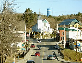
Bancroft is a town located on the York River in Hastings County in the Canadian province of Ontario. It was first settled in the 1850s by United Empire Loyalists and Irish immigrants. From the mid-1950s to about 1982, mining was the primary industry. A village until 1999, Bancroft then merged with Dungannon Township to form the Town of Bancroft. The population at the time of the 2016 Census was 3,881; the regional population is 40,000. There are 150,000 visitors to Bancroft, annually.

The York River is a river in Renfrew County, Hastings County and Haliburton County in Ontario, Canada. The river is in the Saint Lawrence River drainage basin, and flows from the southern extension of Algonquin Provincial Park to the Madawaska River.

Highlands East is a township municipality located in Haliburton County, Ontario, Canada.

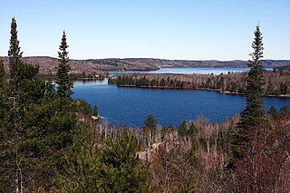
Paudash Lake is a lake in south central Ontario southwest of Bancroft along Highway 28. The lake is located just north of Silent Lake Provincial Park in Haliburton County, 27 km (17 mi) south of the panhandle of Algonquin Provincial Park. The nearest communities to Paudash Lake are the village of Cardiff, close to the lake's Inlet Bay, and the hamlet of Paudash to the northeast of Lower Paudash Lake. Actually two lakes, 'Paudash' and 'Lower Paudash', the lakes are located on the Crowe River, near its head waters, which flows into the Trent River at Crowe Bay north of Campbellford.

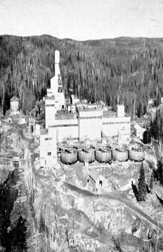
Madawaska Mine (previously known as Faraday Mine) is a decommissioned underground uranium mine in Faraday, near the town of Bancroft, Ontario, which produced 9 million pounds (4,082 tonnes) of U3O8 concentrate, at an average ore grade of 0.1074%, during its two periods of production.

Faraday is a township in the Canadian province of Ontario, located within Hastings County adjacent to the town of Bancroft.
Consolidated Denison Mine, or the Denison Mine is an abandoned uranium mine located approximately 12.5 km north of Elliot Lake, Ontario. The site is bordered north by Quirke Mine and New Quirke Mine; on the east by Panel Mine and Can-Met Mine; and south by Spanish American Mine and Stanrock Mine.

Canada is the world's second-largest producer of uranium, behind Kazakhstan. In 2009, 20% of the world's primary uranium production came from mines in Canada. 14.5% of the world production came from one mine, McArthur River. Currently, the only producing area in Canada is northern Saskatchewan, although other areas have had active mines in the past.

The successor of multiple historical Canadian mining and energy companies, EWL Management Limited was an Alberta based corporation that owned five decommissioned mines in Ontario, including three former uranium mines.

Bicroft Mine is a decommissioned underground uranium mine, located in Cardiff, near Bancroft, Ontario, Canada.

Dyno Mine is a decommissioned underground uranium mine located at Cardiff, near Farrel Lake, approximately 30km southwest of Bancroft, Ontario. It operated from 1958 to 1960.

Greyhawk Mine is a decommissioned underground uranium mine located in Faraday Township near Bancroft, Ontario. It operated from 1954 to 1959 and from 1976 to 1982. The mine produced 80,247 tons of uranium ore, of which 0.069% was U3O8 worth $834,899.

Uranium mining around Bancroft, Ontario, was conducted at four sites, beginning in the early 1950s and concluding by 1982. Bancroft was one of two major uranium-producing areas in Ontario, and one of seven in Canada, all located along the edge of the Canadian Shield. In the context of mining, the "Bancroft area" includes Haliburton, Hastings, and Renfrew counties, and all areas between Minden and Lake Clear. Activity in the mid-1950s was described by engineer A. S. Bayne in a 1977 report as the "greatest uranium prospecting rush in the world".

Henry Joseph Maloney was a Canadian priest, a school and college governor, and community leader based in Bancroft, Ontario.
Arthur Herbert Shore was a mineral prospector and the first person set up a uranium mine in Faraday Township, Ontario. He co-founded and managed the Reeves feldspar Mine and founded the Faraday Uranium Mine. His uranium prospecting, according to Bayne in 1977, led to the "greatest uranium prospecting rush in the world."

Uranium mining in the Elliot Lake area represents one of two major uranium-producing areas in Ontario, and one of seven in Canada.

Quirke Lake is body of water located in Ontario, Canada. It is located in the Quirke Lake basin, a geological basin the northern part of the Huronian Supergroup. The lake is proximate to five decommissioned uranium mines.
Silver Crater Mine, previously known as the Basin Deposit, is an abandoned mine in Cardiff, Ontario. It has produced some of the world's most notable betafite crystals.


