Robert Edwin Peary Sr. was an American explorer and officer in the United States Navy who made several expeditions to the Arctic in the late 19th and early 20th centuries. He was long credited as being the discoverer of the geographic North Pole in April 1909, having led the first expedition to have claimed this achievement, although it is now considered unlikely that he actually reached the Pole.

Ellesmere Island is Canada's northernmost and third largest island, and the tenth largest in the world. It comprises an area of 196,236 km2 (75,767 sq mi), slightly smaller than Great Britain, and the total length of the island is 830 km (520 mi).

The Arctic Archipelago, also known as the Canadian Arctic Archipelago, is an archipelago lying to the north of the Canadian continental mainland, excluding Greenland and Iceland.
The Beardmore Glacier in Antarctica is one of the largest valley glaciers in the world, being 200 km (125 mi) long and having a width of 40 km (25 mi). It descends about 2,200 m (7,200 ft) from the Antarctic Plateau to the Ross Ice Shelf and is bordered by the Commonwealth Range of the Queen Maud Mountains on the eastern side and the Queen Alexandra Range of the Central Transantarctic Mountains on the western. Its mouth is east of the Lennox-King Glacier. It is northwest of the Ramsey Glacier.

Thurston Island is a largely ice-covered, glacially dissected island, 135 nautical miles long and 55 nautical miles wide, lying between Amundsen Sea and Bellingshausen Sea a short way off the northwest end of Ellsworth Land, Antarctica. The island is separated from the mainland by Peacock Sound, which is occupied by the west portion of Abbot Ice Shelf.

Frederick Albert Cook was an American explorer, physician and ethnographer, who is most known for allegedly being the first to reach the North Pole on April 21, 1908. A competing claim was made a year later by Robert Peary, though both men's accounts have since been fiercely disputed; in December 1909, after reviewing Cook's limited records, a commission of the University of Copenhagen ruled his claim unproven. Nonetheless, in 1911, Cook published a memoir of the expedition in which he maintained the veracity of his assertions. In addition, he also claimed to have been the first person to reach the summit of Denali, the highest mountain in North America, a claim which has since been similarly discredited. Though he may not have achieved either Denali or the North Pole, his was the first and only expedition where a United States national discovered an Arctic island, Meighen Island.

The Axel Heiberg Glacier in Antarctica is a valley glacier, 30 nautical miles long, descending from the high elevations of the Antarctic Plateau into the Ross Ice Shelf between the Herbert Range and Mount Don Pedro Christophersen in the Queen Maud Mountains.

Shackleton Glacier is a major Antarctic glacier, over 60 nautical miles long and from 5 to 10 nautical miles wide, descending from the Antarctic Plateau from the vicinity of Roberts Massif and flowing north through the Queen Maud Mountains to enter the Ross Ice Shelf between Mount Speed and Waldron Spurs. Discovered by the United States Antarctic Service (USAS) (1939–41) and named by the Advisory Committee on Antarctic Names (US-ACAN) for Sir Ernest Shackleton, British Antarctic explorer.

The Herbert Range is a range in the Queen Maud Mountains of Antarctica, extending from the edge of the Antarctic Plateau to the Ross Ice Shelf between the Axel Heiberg Glacier and Strom Glacier. Named by the New Zealand Antarctic Place-Names Committee (NZ-APC) for Walter W. Herbert, leader of the Southern Party of the New Zealand GSAE (1961–62) which explored the Axel Heiberg Glacier area.

Meighen Island is an uninhabited member of the Queen Elizabeth Islands, part of the Arctic Archipelago, in the Qikiqtaaluk Region of Nunavut, Canada.

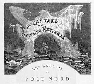
The Adventures of Captain Hatteras is an 1864 adventure novel by Jules Verne in two parts: The English at the North Pole and The Desert of Ice.
Lennox-King Glacier is a large valley glacier, about 40 nautical miles (70 km) long that flows east into the Ross Ice Shelf.

The Scott Glacier is a major glacier, 120 nautical miles long, that drains the East Antarctic Ice Sheet through the Queen Maud Mountains to the Ross Ice Shelf. The Scott Glacier is one of a series of major glaciers flowing across the Transantarctic Mountains, with the Amundsen Glacier to the west and the Leverett and Reedy glaciers to the east.

Farthest South refers to the most southerly latitudes reached by explorers before the first successful expedition to the South Pole in 1911.

Farthest North describes the most northerly latitude reached by explorers, before the first successful expedition to the North Pole rendered the expression obsolete. The Arctic polar regions are much more accessible than those of the Antarctic, as continental land masses extend to high latitudes and sea voyages to the regions are relatively short.

Amundsen Coast is that portion of the coast to the south of the Ross Ice Shelf lying between Morris Peak, on the east side of Liv Glacier, and the west side of the Scott Glacier. Named by New Zealand Antarctic Place-Names Committee in 1961 for Captain Roald Amundsen, the Norwegian explorer who led his own expedition in 1910–12 to the Antarctic. Setting up a base at Framheim at the edge of the Ross Ice Shelf, he sledged southward across the shelf and discovered a route up the Axel Heiberg Glacier along this coast to reach the polar plateau. He was the first to reach the South Pole, December 14, 1911.
Bryan Coast is that portion of the coast of Antarctica along the south shore of the Bellingshausen Sea between Pfrogner Point and the northern tip of the Rydberg Peninsula. To the west is Eights Coast, and to the east is English Coast.
The Cumulus Hills are several groups of largely barren hills in Antarctica. Divided by the Logie Glacier, they are bounded by Shackleton Glacier on the west, McGregor Glacier on the north and Zaneveld Glacier on the south.
The Mackin Table is an ice-topped, wedge-shaped plateau, about 20 nautical miles long, standing just north of Patuxent Ice Stream in the Patuxent Range of the Pensacola Mountains, Antarctica.


