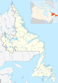
Division No. 1, Subdivision A is an unorganized subdivision on the Avalon Peninsula in Newfoundland and Labrador, Canada. It is in Division No. 1, and lies between Trinity Bay and Placentia Bay.

Adeytown is a designated place located on the Northwest Arm of Trinity Bay, just south of Clarenville in Newfoundland, Canada. It consists of the unincorporated community of Adeytown, and had a population of 307 in the Canada 2006 Census.
Valleyfield, Newfoundland is a village and was served by the C.N.R. It joined the Rural District of Badger's Quay-Valleyfield-Pool's Island in April 1980 until 1992 when the District merged with other nearby towns to form New-Wes-Valley. Valleyfield has a good harbour, and is the location of the Beothic Fisheries fish plant.

Goose Arm was a settlement located north of Corner Brook. The community was settled in the late 19th century. A lumber mill and the fishery were the main employers in the community. At its peak in 1921 the population of Goose Arm was 76. The population declined in the 1940s and 1950s due to the closure of the lumber mill and the decline in the herring fishery. The last inhabitants relocated to nearby Cox's Cove in the early 1960s.
Maberly is a tiny coastal hamlet at the end of route 238-II on the Bonavista Peninsula on the island of Newfoundland with a permanent year-round population of about 20. In the 1921 census, there were 83 inhabitants. It has long been associated with nearby Elliston, being about 3 km from Elliston Centre by road, and was officially annexed by that town in the 1960s. Driving from Elliston Centre to Maberly, you pass through Sandy Cove and the Neck.

Dover is a small incorporated fishing and lumbering village located in a small cove at the head of Freshwater Bay, Bonavista Bay, Newfoundland, Canada. Settled in the early 1890s it was originally known as Shoal Bay, presumably from its many shallow covers and inlets in the area. From the 1950s to the 1970 Shoal Bay was referred to as Wellington , whereas the local residents called it Dover.
Orleans Cove is the cove in the town of Orleans, Massachusetts

Bonne Bay is a bay in Newfoundland, Canada. It is located on the western side of Newfoundland and separates Great Northern Peninsula from the rest of the island. It is a part of Gros Morne National Park. Bonne Bay has a population of about 7000 people.

Western Cove is located on Bar Haven Island in Placentia Bay. On the island there were two communities, Western Cove being one and the other larger community being Bar Haven. The community was depopulated and resettled by the government in the 1960s.
Musgrave Harbour is a Canadian town in the province of Newfoundland and Labrador.

New-Wes-Valley is a municipality in Newfoundland and Labrador, Canada.
Doting Cove and Ragged Harbour.

Humber Arm South is a town in the Canadian province of Newfoundland and Labrador. The town had a population of 1,854 in the Canada 2006 Census. The Town's Post Office is located in the section of the town referred to as Benoit's Cove. Humber Arm South is located in the Bay of Islands, and is in the Bay of Islands electoral district.
Fischot Island was a former Island community in Newfoundland and Labrador, Canada, just outside the town of St. Anthony and Goose Cove.

Chimney Cove is an abandoned community in Newfoundland and Labrador located to the south of Cape St. Gregory.

Bragg's Island was a settlement in Newfoundland and Labrador.
Division No. 1, Subdivision C is an unorganized subdivision on the Avalon Peninsula in Newfoundland and Labrador, Canada. It is in Division 1 and contains the unincorporated communities of Cape St. Mary's, Cuslett, Gooseberry Cove, Great Barasway, Lears Cove, Patrick's Cove-Angels Cove, Ship Cove and Stoney House.

Division No. 1, Subdivision G is an unorganized subdivision on the Avalon Peninsula in Newfoundland and Labrador, Canada. It is in Division 1 and contains the unincorporated communities of Baccalieu Island, Besom Cove, Bradley's Cove, Burnt Point, Caplin Cove, Daniel's Cove, Grates Cove, Gull Island, Job's Cove, Kingston, Long Beach, Lower Island Cove, Low Point, Northern Bay, Ochre Pit Cove, Red Head Cove, Riverhead, Smooth Cove and Western Bay.
Division No. 1, Subdivision L is an unorganized subdivision on the Avalon Peninsula in Newfoundland and Labrador, Canada. It is in Division 1 and contains the unincorporated communities of Bareneed, Black Duck Pond, Blow Me Down, Coley's Point South, Hibb's Cove, Pick Eyes, Port de Grave, Ship Cove and The Dock
Division No. 1, Subdivision U is an unorganized subdivision on the Avalon Peninsula in Newfoundland and Labrador, Canada, in Division 1. It contains the unincorporated communities of Admiral's Cove, Bauline East, Bauline South, Burnt Cove, Devils Kitchen, Flat Rock, St. Michaels and Seal Cove.


