Related Research Articles

Bramdean Common is near Winchester, Hampshire, England.

Crafton is a hamlet in the civil parish of Mentmore, in Buckinghamshire, England.

Westlington is a hamlet near the village of Dinton in the civil parish of Dinton-with-Ford and Upton, Buckinghamshire, England.

Upton is a hamlet in the civil parish of Dinton-with-Ford and Upton, in Buckinghamshire, England. It is located to the north of the main village of Dinton, on the junction between the new road from Aylesbury to Thame, and the old road before it was rerouted.

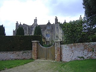
Waldridge is an ancient village in the civil parish of Dinton-with-Ford and Upton in Buckinghamshire, England. Although little of the village survives today, the Waldridge Manor in the nearby village of Meadle shows the approximate location of the original settlement of Waldridge Village.

Baybridge is a small village in Hampshire, in England. It is situated to the east of Owslebury, south of Winchester.

Ayot Green is a hamlet in Hertfordshire, England and is near the A1(M) Motorway, close to Welwyn Garden City. It is a typical traditional English village, centred on a village green. There are several other Ayots in the area, including Ayot St Lawrence and Ayot St Peter, and it also gives name to the rail trail called Ayot Greenway which stretches from Ayot Green to Wheathampstead.
Bridgeyate is a hamlet in South Gloucestershire, England. Bridgeyate is situated between the cities of Bristol and Bath. The increase in housebuilding in the area has seen Bridgeyate become attached to the nearby villages of Warmley and North Common, but it still retains its own identity with a large common and three public houses, The Griffin, The White Hart and The Hollybush. The Hollybush reopened in March 2014 after an extensive refit.

Gaunt's Earthcott, sometimes spelt Gaunts Earthcott, is a hamlet in the civil parish of Almondsbury in South Gloucestershire, England. It consists of a ruined chapel, a few houses and two farms, Green Farm and Court Farm. The village is located approximately 2.5 miles (4 km) from Rudgeway and the A38 road and about the same distance from Frampton Cotterell and Winterbourne. The village is located close to the interchange between the M4 and M5 motorways. There is no real industry as such and the main economic activity in the area is farming.

Engine Common is a village in the civil parish of Iron Acton in South Gloucestershire, England. It lies about 1 mile north west of Yate.
Little Meadle is a hamlet in Buckinghamshire, England. It is part of the civil parish of Longwick-cum-Ilmer and is located between the hamlets of Owlswick and Meadle. It is approximately 5 miles (8.0 km) from Aylesbury and 20 miles (32 km) from Oxford. In addition to the Farm House it consists of a collection of houses built over the past 60 years, and it gained an official name with the Royal Mail in 2004, as well as being mapped with the Ordnance Survey 2006. The term Little Meadle is a relatively new one it has no historical meaning in itself, except that it is close to the village of Meadle and is a small hamlet that was previously known only by the name of the road in which it is situated Stockwell Lane.

The A105 road is an A road in London, England. It runs from Canonbury, in between Highbury and Dalston, to Enfield Town. The road is 8 miles (13 km) long. Part of the road forms Green Lanes, one of the longest streets in London, while the A105 also serves as the primary access route to the Shopping City shopping centre in Wood Green.
Bramshott Military Camp, often simplified to Camp Bramshott, was a temporary army camp set up on Bramshott Common near the village of Bramshott, Hampshire, England during both the First and Second World Wars.

Bramshott is a village and parish with mediaeval origins in the East Hampshire district of Hampshire, England. It lies 0.9 miles (1.4 km) north of Liphook, and with Liphook forms the civil parish of Bramshott and Liphook.
Gosford and Water Eaton is a civil parish in the Cherwell district of the county of Oxfordshire, England. It is north of the city of Oxford and is crossed nearby by two major roads for, or by-passing, the city. The parish contains the village of Gosford and the hamlet of Water Eaton and as at the 2011 census had 1373 people resident across its 8.75 km².

The A107 is an A road in London, England. It runs from Whitechapel to Hackney.

Ludshott Common and Waggoners Wells is a National Trust reserve; Ludshott Common is an area of heathland and Waggoners Wells a series of man-made ponds with a connecting stream. The reserve is situated between Grayshott, Bramshott and Headley Down in East Hampshire, England. To the south is the large heathland area of Bramshott Common. Some 415 acres (168 ha) is under the care of the Woodland Trust.
Darby Green is a village in the parish of Yateley, North East Hampshire, England. The electoral ward of Frogmore and Darby Green is separated from the rest of the parish by a small gap around Clarks Farm, until recently a composting farm in the mushroom producing industry. The ward has a boundary shared with Blackwater, which is one part of the Civil Parish of Hawley.
Bradley is a small village in the Stroud District, in the county of Gloucestershire, England.

Bramshott and Ludshott Commons is a 374.4-hectare (925-acre) biological Site of Special Scientific Interest near Grayshott in Hampshire. It is part of Wealden Heaths Phase II Special Protection Area.
References
- ↑ Ordnance Survey: Landranger map sheet 186 Aldershot & Guildford (Camberley & Haslemere) (Map). Ordnance Survey. 2013. ISBN 9780319231371.
- ↑ "Ordnance Survey: 1:50,000 Scale Gazetteer" (csv (download)). www.ordnancesurvey.co.uk. Ordnance Survey. 1 January 2016. Retrieved 30 January 2016.