Slovakia, officially the Slovak Republic, is a landlocked country in Central Europe. It is bordered by Poland to the north, Ukraine to the east, Hungary to the south, Austria to the southwest, and the Czech Republic to the northwest. Slovakia's mostly mountainous territory spans about 49,000 square kilometres (19,000 sq mi), with a population of over 5.4 million. The capital and largest city is Bratislava, while the second largest city is Košice.
The History of Slovakia, dates back to the findings of ancient human artifacts. This article shows the history of the country from prehistory to the present day.

The Treaty of Trianon often referred to as the PeaceDictate of Trianon or Dictate of Trianon in Hungary, was prepared at the Paris Peace Conference and was signed in the Grand Trianon château in Versailles on 4 June 1920. It formally ended World War I between most of the Allies of World War I and the Kingdom of Hungary. French diplomats played the major role in designing the treaty, with a view to establishing a French-led coalition of the newly formed states. It regulated the status of the Kingdom of Hungary and defined its borders generally within the ceasefire lines established in November–December 1918 and left Hungary as a landlocked state that included 93,073 square kilometres (35,936 sq mi), 28% of the 325,411 square kilometres (125,642 sq mi) that had constituted the pre-war Kingdom of Hungary. The truncated kingdom had a population of 7.6 million, 36% compared to the pre-war kingdom's population of 20.9 million. Though the areas that were allocated to neighbouring countries had a majority of non-Hungarians, in them lived 3.3 million Hungarians – 31% of the Hungarians – who then became minorities. The treaty limited Hungary's army to 35,000 officers and men, and the Austro-Hungarian Navy ceased to exist. These decisions and their consequences have been the cause of deep resentment in Hungary ever since.
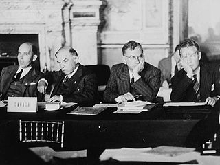
The Paris Peace Treaties were signed on 10 February 1947 following the end of World War II in 1945. The Paris Peace Conference lasted from 29 July until 15 October 1946. The victorious wartime Allied powers negotiated the details of peace treaties with those former Axis powers, namely Italy, Romania, Hungary, Bulgaria, and Finland, which had switched sides and declared war on Germany during WWII. They were allowed to fully resume their responsibilities as sovereign states in international affairs and to qualify for membership in the United Nations.
Bratislava, currently the capital of Slovakia and the country's largest city, has existed for about a thousand years. Because of the city's strategic geographical location, it was an important European hub due to its proximity to the advanced cultures of the Mediterranean and the Orient as well as its link to the rest of Europe, which were possible by the Danube River.

The First Vienna Award was a treaty signed on 2 November 1938 pursuant to the Vienna Arbitration, which took place at Vienna's Belvedere Palace. The arbitration and award were direct consequences of the previous month's Munich Agreement, which resulted in the partitioning of Czechoslovakia.
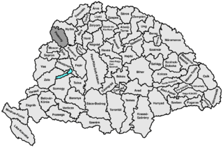
Pozsony county was an administrative county (comitatus) of the Kingdom of Hungary. Its territory is now mostly part of Slovakia, while a small area belongs to Hungary. In 1969, the three villages that remained in Hungary were combined to form Dunasziget.

Petržalka is the largest borough of Bratislava, the capital of Slovakia. Situated on the right bank of the river Danube, the area shares a land border with Austria, and is home to around 100,000 people.

Border conflicts between Poland and Czechoslovakia began in 1918 between the Second Polish Republic and First Czechoslovak Republic, both freshly created states. The conflicts centered on the disputed areas of Cieszyn Silesia, Orava Territory and Spiš. After World War II they broadened to include areas around the cities of Kłodzko and Racibórz, which until 1945 had belonged to Germany. The conflicts became critical in 1919 and were finally settled in 1958 in a treaty between the Polish People's Republic and the Czechoslovak Socialist Republic.

Hungarian irredentism or Greater Hungary are irredentist political ideas concerning redemption of territories of the historical Kingdom of Hungary. Targeting at least to regain control over Hungarian-populated areas in Hungary's neighbouring countries. Hungarian historiography uses the term "Historic Hungary". "Whole Hungary" is also commonly used by supporters of this ideology.
The (First) Slovak Republic, otherwise known as the Slovak State, was a partially-recognized client state of Nazi Germany which existed between 14 March 1939 and 4 April 1945. The Slovak part of Czechoslovakia declared independence with German support one day before the German occupation of Bohemia and Moravia. The Slovak Republic controlled the majority of the territory of present-day Slovakia but without its current southern parts, which were ceded by Czechoslovakia to Hungary in 1938. It was the first time in history that Slovakia had been a formally independent state.

Devín is a borough of Bratislava, the capital of Slovakia, located in the Bratislava IV district. Originally a separate village at the confluence of the Danube and Morava rivers, Devín maintained its rural character and today, it is one of the smallest boroughs of Bratislava by population. It is an important archaeological site, featuring the ruins of Devín Castle.
Bratislava V is an okres (district) of Bratislava in the Bratislava Region of Slovakia. It covers southern areas of Bratislava, including the boroughs of Petržalka, Jarovce, Rusovce and Čunovo. It is bordered by the Danube river to the north and east, which forms its borders with the Bratislava IV, Bratislava I, Bratislava II and Senec districts. It borders on Hungary in the south and Austria in the west. Until 1920, the northern part of the district was part of the Hungarian county of Pozsony, while the southern part was part of the county of Moson. It is the only Slovak district which is situated on the right bank of the Danube.

Rusovce is a borough in southern Bratislava on the right bank of the Danube river, close to the Austrian border.

Starý most is a bridge over the river Danube in Bratislava, Slovakia. Before its reconstruction, the 460-meter-long (1,510 ft) bridge included a wooden pathway for pedestrians, a two-lane road, and a railway track, connecting the historic old city of Bratislava with the newer region Petržalka. The bridge was closed for cars in 2009 and for buses on 14 May 2010. On 2 December 2013 it was also closed for pedestrian and bicycle traffic as deconstruction of the old bridge began. At the time of its closure it was the oldest standing bridge in Bratislava.

Rusovce Mansion or Rusovce manor house is a mansion located in the Rusovce borough, part of Bratislava, capital of Slovakia. The mansion was built on the site of an older manor house from the 16th century, with a medieval structure incorporated into the following buildings.

Bratislava, historically known as Pressburg, is the capital and largest city of Slovakia. Officially, the population of the city is about 475,000; however, it is estimated to be more than 660,000 — approximately 140% of the official figures. Bratislava is in southwestern Slovakia at the foot of the Little Carpathians, occupying both banks of the River Danube and the left bank of the River Morava. Bordering Austria and Hungary, it is the only national capital to border two sovereign states.
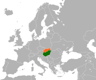
Hungary and Slovakia are two neighboring countries in Central Europe. There are two major periods of official foreign relations between them in contemporary history. The first period included relations between the Kingdom of Hungary and the first Slovak Republic in 1939–1945. The second period started in 1993, when the countries again established diplomatic relations, the year when Slovakia became independent of Czechoslovakia. Hungary has an embassy in Bratislava and a general consulate in Košice, and in Nitra, and Slovakia has an embassy in Budapest and a general consulate in Békéscsaba.
The Czechoslovak–Hungarian population exchange was the exchange of inhabitants between Czechoslovakia and Hungary after World War II. Between 45,000 and 120,000 Hungarians were forcibly transferred from Czechoslovakia to Hungary, and their properties confiscated, while around 72,000 Slovaks voluntarily transferred from Hungary to Czechoslovakia.
The following is a timeline of the history of the city of Bratislava, Slovakia.
