
Hereford is a cathedral city and the county town of the ceremonial county of Herefordshire, England. It is situated on the banks of the River Wye and is situated 16 miles (26 km) east of the border with Wales, 23 miles (37 km) north-west of Gloucester and 24 miles (39 km) south-west of Worcester. With a population of 53,112 in 2021, it is the largest settlement in Herefordshire.
Perry or pear cider is an alcoholic beverage made from fermented pears, traditionally in England ; parts of South Wales; France ; Canada; Australia; and New Zealand. There is growing interest in artisinal perry production in the fruit-growing regions of the northwest United States.

Herefordshire is a ceremonial county in the West Midlands region of England. It is bordered by Shropshire to the north, Worcestershire to the east, Gloucestershire to the south-east, and the Welsh counties of Monmouthshire and Powys to the west. The city of Hereford is the largest settlement and the county town.

H P Bulmer Limited, trading as Bulmers, is a cider-making company founded in 1887 in Hereford, England.
Bulmers cider is one of a number of brands owned by British cider maker H. P. Bulmer of Hereford, a Heineken subsidiary. It is one of the biggest selling British bottled cider brands in the UK with a number of variants including Bulmers Original & Pear. It should not be confused with Bulmers Irish Cider, sold outside the Republic of Ireland as Magners.

Credenhill is a village and civil parish in Herefordshire, England. The population of this civil parish taken at the 2011 Census was 2,271.
The known history of Herefordshire starts with a shire in the time of King Athelstan, and Herefordshire is mentioned in the Anglo-Saxon Chronicle in 1051. The first Anglo-Saxon settlers, the 7th-century Magonsætan, were a sub-tribal unit of the Hwicce who occupied the Severn valley. The Magonsætan were said to be in the intervening lands between the Rivers Wye and Severn. The undulating hills of marl clay were surrounded by the Welsh mountains to the west; by the Malvern Hills to the east; by the Clent Hills of the Shropshire borders to the north, and by the indeterminate extent of the Forest of Dean to the south. The shire name first recorded in the Anglo-Saxon Chronicle may derive from "Here-ford", Old English for "army crossing", the location for the city of Hereford.

Whitney-on-Wye is a village and civil parish in Herefordshire, England, and approximately 1 mile (1.6 km) east from the border with Wales. The village is on the A438 road, on the River Wye, and 16 mi (25 km) west from Hereford. Parish population in 2011 was 117.

Stretton Sugwas is a village and civil parish in Herefordshire, England, about 4 miles (6.4 km) northwest of Hereford. The parish also includes the hamlet of Swainshill. The population of this Civil Parish at the 2011 census was 505. In 1087 the village was held by Roger de Lacy and consisted of two and a half hides paying geld, in demesne there was 2 ploughs, 1 villan, 9 bordars, 4 oxmen, and 2 radknights, as well as a mill rendering 32d. The village had increased in value from 40 to 50s from the time of the conquest to that of Domesday. The village lies within the ancient Hundred of Grimsworth

Bosbury is a village and civil parish in Herefordshire, England, approximately 3.5 miles (5.6 km) north of Ledbury. The small River Leadon flows through the parish, passing along the west side of the village. Bosbury shares a parish council with neighbouring Coddington.
Warham is a place in the English county of Herefordshire. It is situated about 3 km west of the city of Hereford, close to the north bank of the River Wye. The population of the village at the 2011 census was 193.
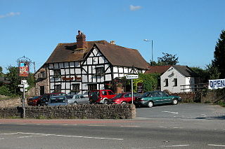
Trumpet or The Trumpet is a village in Herefordshire, England. The village is named after the timber-framed Trumpet Inn.

Kinnersley is a village and civil parish in Herefordshire, England. The village is about 5 miles (8 km) east of the Wales-England border and 10 miles (16 km) north-west of Hereford.
'Brown Snout' is a 19th-century cultivar of cider apple originating in Herefordshire in the United Kingdom, though now grown in other counties and parts of the world.

The Museum of Cider, formerly the Cider Museum, is a museum in Hereford, England, about the history of cider. The museum was set up as a Trust in the 1970s by Bertram Bulmer, Norman Weston and the Director of Long Ashton Research Station, John Hudson. They realised that unless a collection was started, then much of the story of cider making would be lost. Initially, the aim was to represent the international history of cider-making, but the majority of the collections have been drawn from England and the West Country.
Michelin is a variety of cider apple commonly grown in commercial orchards in the United Kingdom, although originating in France.
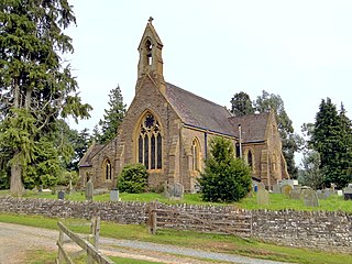
Little Birch is a hamlet and civil parish in Herefordshire, England. It is approximately 5 miles (8 km) south from the city and county town of Hereford and 7 miles (11 km) north-west from the market town of Ross-on-Wye. The parish is significant for its Grade II* listed church, and Athelstan Wood, formerly anciently managed but now largely coniferised.
Newton is a linear settlement hamlet and civil parish in the county of Herefordshire, England, and is 10 miles (16 km) north from the city and county town of Hereford. The closest large town is the market town of Leominster, 3 miles (5 km) to the north. A Cadbury's confectionery factory is within the parish.

Willersley and Winforton is a civil parish in west Herefordshire, England, and is approximately 14 miles (20 km) west-northwest from the city and county town of Hereford. The parish contains the village of Winforton and the farming hamlet of Willersley. The nearest towns are the market towns of Hay-on-Wye 5 miles (8 km) to the south-west, and Kington 6 miles (10 km) to the north. The physicist Sir Thomas Ralph Merton KBE, DSc, FRS, lived at Winforton during the Second World War.

Letton is a village and civil parish in west Herefordshire, England, and is approximately 11 miles (20 km) west-northwest from the city and county town of Hereford. The parish contains the village of Letton, the hamlet of Waterloo, and the farming hamlets of Hurstley and Kinley. The nearest towns are the market towns of Hay-on-Wye 7 miles (11 km) to the west, and Kington 7 miles to the north. Within Letton is the Grade I listed Church of St John the Baptist, and The Sturts nature reserve and Site of Special Scientific Interest.


