The square kilometre is a multiple of the square metre, the SI unit of area or surface area.
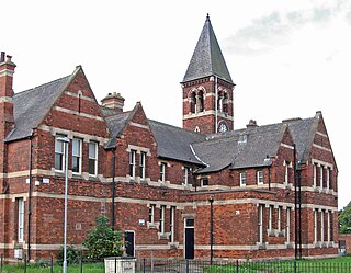
Ashfield is a local government district in Nottinghamshire, England. The population of Ashfield was 127,200 in 2018. The district is mostly urban and forms part of both the Nottingham and Mansfield Urban Areas. There are three towns in the district; Sutton-in-Ashfield, Kirkby-in-Ashfield and Hucknall. The district was formed on 1 April 1974, under the Local Government Act 1972, by the merger of urban districts of Hucknall, Kirkby-in-Ashfield, Sutton-in-Ashfield and parts of Basford Rural District, namely the parishes of Annesley, Felley and Selston.

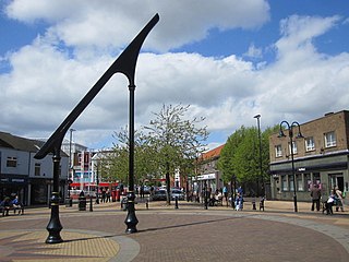
Sutton-in-Ashfield is a market town in Nottinghamshire, England, with a population of 48,527 in 2019. It is the largest town in the district of Ashfield, four miles west of Mansfield, 2 miles (3 km) from the Derbyshire border and 12 miles (19 km) north of Nottingham. It has a population of 48,527.
Bestwood Village is an area and civil parish in the Gedling district of Nottinghamshire. Until 1 April 2018 it was part of the civil parish of Bestwood St. Albans. A small part of the village falls within the Ashfield district council area. There have been several new housing estates built recently including the redevelopment of the former Bayles and Whylie factory site which was a former glue mill. It is to the east of Hucknall and north of Bulwell. It is neighboured to the north by the village of Papplewick. It is also close to the Bestwood Park Estate which is in the City of Nottingham.

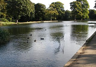
Endcliffe Park is a large park in the city of Sheffield, South Yorkshire, England. The park was opened in 1887 to commemorate the Jubilee of Queen Victoria. When travelling West from the city centre it is the first in a series of parks and green spaces, known collectively as the Porter Valley Parks, all of which lie along the course of the Porter Brook. The next park in the sequence is Bingham Park, separated from Endcliffe Park by Rustlings Road. In 1924 Patrick Abercrombie said of the parks, "The Porter Brook Parkway, consisting as it does of a string of contiguous open spaces, is the finest example to be found in this country of a radial park strip, an elongated open space, leading from a built-up part of the city direct into the country, the land occupied being a river valley and so for the greater part unsuitable for building."

Lodmoor is a Site of Special Scientific Interest (SSSI), RSPB reserve and country park in Dorset, England. The country park features a visitor centre, model railway and pitch and putt golf course. The SSSI has a wetland habitat with native birds that are rare in the UK and a range of migratory species.

Wepre Park is a 160 acres (65 ha) country park near Connah's Quay in Flintshire, Wales. The park is home to Ewloe Castle and contains a children's playground, outdoor gym, football playing pitches and a visitor centre.
Middleton Park is a public park in Middleton, Leeds, West Yorkshire, England. It covers an area of 630 acres (255.0 ha), nearly a square mile of which 200 acres (80.9 ha) are ancient woodland. There is also a small lake, recreational areas and a former golf course. The reclaimed site of "Middleton Broom" Colliery has been incorporated into the park. By its northern boundary is the South Leeds Stadium, home of rugby league club Hunslet. The Middleton Railway runs between Moor Road, Hunslet and Park Halt railway station. It is also the site of Leeds Urban Bike Park. It is known locally as 'Miggy Park'.
Stanton Hill is a village in the Ashfield district of Nottinghamshire.

Sutton Colliery was in the village of Stanton Hill, Nottinghamshire, England. It is now a country park.

Coombe Country Park is a country park located in Warwickshire, England. The park is only 4.5 miles east of Coventry city centre and is managed by Coventry City Council. The park has been developed from the grounds of an old Cistercian abbey, the buildings of which have now been converted into the Coombe Abbey hotel.

Woodgate Valley Country Park is a country park within the Bartley Green and Quinton districts of Birmingham. It is the third largest Birmingham Country Park after Sutton Park and Lickey Hills Country Park. The park is maintained as a wildlife habitat but also has farm animals.
The Roe Valley Country Park is a forested area containing part of the River Roe, south west of Limavady, County Londonderry, Northern Ireland. It is maintained by the Northern Ireland Environment Agency, which is part of the Department of the Environment of Northern Ireland.
Shipley Hall was a country estate in Shipley, Derbyshire near Heanor and Ilkeston which now forms a Country Park.

Sence Valley Forest Park is located between Ibstock and Heather in North West Leicestershire, and within the National Forest, England.

Stadt Moers Park is a public park located in Whiston, Merseyside in the Metropolitan Borough of Knowsley. The park covers 220 acres (0.89 km2) of land between Whiston and Huyton.
The 2015 Ashfield District Council election took place on 7 May 2015, to elect members of Ashfield District Council in England. This was on the same day as other local elections.

Melton Country Park is a country park in Melton Mowbray, Leicestershire, England.

Sherwood Pines Forest Park is a forest park located near the village of Kings Clipstone, Nottinghamshire, England. Originally called Clipstone Heath, it was acquired by Forestry England in 1925 and planted with trees in response to a wood shortage after World War I. The park offers activities such as walking, bushcraft, mountain biking and there is a visitor centre. It is the largest park in the East Midlands of England. The forest is also home to the average point between the geographical centers and population centers of Great Britain.

