Related Research Articles

Cumbria is a ceremonial and non-metropolitan county in North West England, bordering Scotland. The county and Cumbria County Council, its local government, came into existence in 1974 after the passage of the Local Government Act 1972. Cumbria's county town is Carlisle, in the north of the county. Other major settlements include Barrow-in-Furness, Kendal, Whitehaven and Workington.

Westmorland is a historic county in North West England. It formed an administrative county between 1889 and 1974, after which the whole county was administered by the new administrative and ceremonial county of Cumbria. The people of Westmorland are known as Westmerians. In April 2023, it is planned that local government in Cumbria will be reorganised into two unitary authorities, one of which is to be named Westmorland and Furness and would cover all of the historic county along with parts of historic Yorkshire, Lancashire and Cumberland.

Workington is a coastal town and civil parish at the mouth of the River Derwent on the west coast in the Allerdale borough of Cumbria, England. The town was historically in Cumberland. At the 2011 census it had a population of 25,207.

Whitehaven is a town and port on the English north west coast and near to the Lake District National Park in Cumbria, England. Historically in Cumberland, it lies by road 38 miles (61 km) south-west of Carlisle and 45 miles (72 km) to the north of Barrow-in-Furness. It is the administrative seat of the Borough of Copeland, and has a town council for the parish of Whitehaven. The population of the town was 23,986 at the 2011 census.
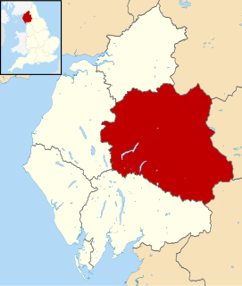
Eden is a local government district in Cumbria, England, based at Penrith Town Hall in Penrith. It is named after the River Eden, which flows north through the district toward Carlisle. Its population of 49,777 at the 2001 census, increased to 52,564 at the 2011 Census. A 2019 estimate was 53,253. In July 2021 it was announced that in April 2023, Cumbria will divide into two unitary authorities. Eden District Council will cease and its functions pass to a new authority, Westmorland and Furness, covering the current districts of Barrow-in-Furness, Eden and South Lakeland.

The Eden Valley Railway (EVR) was a railway in Cumbria, England. It ran between Clifton Junction near Penrith and Kirkby Stephen via Appleby-in-Westmorland.

Kirkby Stephen is a market town and civil parish in Cumbria, North West England. Historically part of Westmorland, it lies on the A685, surrounded by sparsely populated hill country, about 25 miles (40 km) from the nearest larger towns: Kendal and Penrith. The River Eden rises 6 miles (9.7 km) away in the peat bogs below Hugh Seat and passes the eastern edge of the town. At the 2001 census the parish had a population of 1,832. In 2011, it had a population of 1,522.

The Cumbrian Coast line is a rail route in North West England, running from Carlisle to Barrow-in-Furness via Workington and Whitehaven. The line forms part of Network Rail route NW 4033, which continues via Ulverston and Grange-over-Sands to Carnforth, where it connects with the West Coast Main Line.
The Howgill Fells are uplands in Northern England between the Lake District and the Yorkshire Dales, lying roughly within a triangle formed by the towns of Sedbergh and Kirkby Stephen and the village of Tebay. The name Howgill derives from the Old Norse word haugr meaning a hill or barrow, plus gil meaning a narrow valley.

Carboniferous Limestone is a collective term for the succession of limestones occurring widely throughout Great Britain and Ireland that were deposited during the Dinantian Epoch of the Carboniferous Period. These rocks formed between 363 and 325 million years ago. Within England and Wales, the entire limestone succession, which includes subordinate mudstones and some thin sandstones, is known as the Carboniferous Limestone Supergroup.
The CA postcode area, also known as the Carlisle postcode area, is a group of 28 postcode districts in north-west England, within 22 post towns. These cover northern and central Cumbria, including Carlisle, Penrith, Workington, Whitehaven, Maryport, Cockermouth, Egremont, Alston, Appleby-in-Westmorland, Beckermet, Brampton, Cleator, Cleator Moor, Frizington, Holmrook, Keswick, Kirkby Stephen, Moor Row, Ravenglass, Seascale, St Bees and Wigton, plus a very small part of Northumberland.

Appleby Grammar School is a mixed secondary school and sixth form in Appleby-in-Westmorland, Cumbria for students aged 11 to 18. Since 2011, it has been an Academy. Until 2013, the school was a registered charity.

The Sherwood Sandstone Group is a Triassic lithostratigraphic group which is widespread in Britain, especially in the English Midlands. The name is derived from Sherwood Forest in Nottinghamshire which is underlain by rocks of this age. It has economic importance as the reservoir of the Morecambe Bay gas field, the second largest gas field in the UK.
The Appleby Group is a lithostratigraphical term referring to the succession of Permian Period aeolian and fluviatile rock strata which occur in northwest England and beneath the Irish Sea in the United Kingdom.
National Cycle Network (NCN) Route 71 is a Sustrans National Route that runs from Whitehaven and Workington on the Cumbrian coast to Kirby Knowle in North Yorkshire to join NCN Route 65. The route is fully open and signed in both directions.

The geology of England's Lake District is dominated by sedimentary and volcanic rocks of mainly Ordovician age underpinned by large granitic intrusions. Younger sedimentary sequences outcrop on the edges of the Lake District area, with Silurian to the south, Carboniferous to the north, east and west and Permo-Triassic to the west and east. The entire area was covered by a Mesozoic sequence that was eroded off during Paleogene uplift related to the opening of the North Atlantic. During the Quaternary the area was affected by repeated glaciations, which sculpted the current mountainous landscape.
The Kendal Group is a Silurian lithostratigraphic group in the southern Lake District and the Howgill Fells of northern England. The name is derived from the town of Kendal in Cumbria. The Group is included within the Windermere Supergroup. The group comprises couplets of siltstone and mudstone along with some turbiditic sandstones and which may exceed a thickness of 4200m. Its lower unit is the Bannisdale Formation above which is the Kirkby Moor Formation. Some of the rocks of the latter were earlier included in the Underbarrow and Scout Hill Flag formations.
The geology of the Yorkshire Dales National Park in northern England largely consists of a sequence of sedimentary rocks of Ordovician to Permian age. The core area of the Yorkshire Dales is formed from a layer-cake of limestones, sandstones and mudstones laid down during the Carboniferous period. It is noted for its karst landscape which includes extensive areas of limestone pavement and large numbers of caves including Britain's longest cave network.
References
- ↑ British Geological Survey (2011). "Appleby Group". The BGS Lexicon of Named Rock Units. Retrieved 15 February 2011.
- ↑ The Geology of the Whitehaven and Workington district. T. Eastwood et al. pub. HMSO. 1931. page 206, Plate VIa.
| | This article related to petrology is a stub. You can help Wikipedia by expanding it. |