Bromide Basin

Last updated

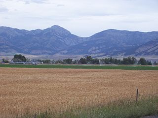
Bromide Basin (elevation 10,269 ft [3,130 m]) is a basin in Garfield County, Utah, United States. [1]

Garfield County, Utah County in the United States

Garfield County is a county located in south central Utah, United States. As of the 2010 census, the population was 5,172, making it the fifth-least populous county in Utah. Its county seat and largest city is Panguitch.

Utah A state of the United States of America

Utah is a state in the western United States. It became the 45th state admitted to the U.S. on January 4, 1896. Utah is the 13th-largest by area, 31st-most-populous, and 10th-least-densely populated of the 50 United States. Utah has a population of more than 3 million according to the Census estimate for July 1, 2016. Urban development is mostly concentrated in two areas: the Wasatch Front in the north-central part of the state, which contains approximately 2.5 million people; and Washington County in Southern Utah, with over 160,000 residents. Utah is bordered by Colorado to the east, Wyoming to the northeast, Idaho to the north, Arizona to the south, and Nevada to the west. It also touches a corner of New Mexico in the southeast.

United States federal republic in North America

The United States of America (USA), commonly known as the United States or America, is a country composed of 50 states, a federal district, five major self-governing territories, and various possessions. At 3.8 million square miles, the United States is the world's third or fourth largest country by total area and is slightly smaller than the entire continent of Europe's 3.9 million square miles. With a population of over 327 million people, the U.S. is the third most populous country. The capital is Washington, D.C., and the largest city by population is New York City. Forty-eight states and the capital's federal district are contiguous in North America between Canada and Mexico. The State of Alaska is in the northwest corner of North America, bordered by Canada to the east and across the Bering Strait from Russia to the west. The State of Hawaii is an archipelago in the mid-Pacific Ocean. The U.S. territories are scattered about the Pacific Ocean and the Caribbean Sea, stretching across nine official time zones. The extremely diverse geography, climate, and wildlife of the United States make it one of the world's 17 megadiverse countries.

Bromide Basin took its name from a nearby mine which was originally erroneously thought to contain bromide ore. [2]

A bromide is a chemical compound containing a bromide ion or ligand. This is a bromine atom with an ionic charge of −1 (Br); for example, in caesium bromide, caesium cations (Cs+) are electrically attracted to bromide anions (Br) to form the electrically neutral ionic compound CsBr. The term "bromide" can also refer to a bromine atom with an oxidation number of −1 in covalent compounds such as sulfur dibromide (SBr2).

Related Research Articles

Bridger Range

The Bridger Range, also known as the Bridger Mountains, is a subrange of the Rocky Mountains in southwestern Montana in the United States. The range runs mostly in a north–south direction between Bozeman and Maudlow. It is separated from the Gallatin Range to the south by Bozeman Pass; from the Horseshoe Hills to the west by Dry Creek; from the Crazy Mountains to the east by the Shields River valley; and from the Big Belt Mountains to the north by Sixteen Mile Creek. The highest point in the Bridger Range is Sacagawea Peak, which is visible to the northeast from Bozeman.

Washburn–Langford–Doane Expedition research expedition

The Washburn Expedition of 1870 explored the region of northwestern Wyoming that two years later became Yellowstone National Park. Led by Henry Washburn and Nathaniel P. Langford, and with a U.S. Army escort headed by Lt. Gustavus C. Doane, the expedition followed the general course of the Cook–Folsom–Peterson Expedition made the previous year.

Raynesford, Montana human settlement in United States of America

Raynesford is an unincorporated community in Judith Basin County, Montana, United States. Its elevation is 4,042 feet (1,232 m), and it is located at 47°16′12″N110°43′48″W. The community includes a community center, a catholic church, a fire department, and a post office. The post office was established under the name of "Spion Kop" on March 31, 1906; its name was changed to Raynesford exactly three years later.

Nassawango Creek is a stream in the U.S. state of Maryland; it is the largest tributary of the Pocomoke River, located on the Delmarva Peninsula. Older variations on the same name include Nassanongo, Naseongo, Nassiongo, and Nassiungo, meaning "[ground] between [the streams]". Early English records have it as Askimenokonson Creek, after a Native settlement near its headwaters.

Temescal Mountains, formerly the Sierra Temescal, are one of the northernmost mountain ranges of the Peninsular Ranges in western Riverside County, in Southern California in the United States. They extend for approximately 25 mi (40 km) southeast of the Santa Ana River east of the Elsinore Fault Zone to the Temecula Basin and form the western edge of the Perris Block.

Mescal is a Census-designated place located in Cochise County, Arizona.

The Dawson Arkose is a geologic formation in the Denver Basin that underlies the Denver area in Colorado. It is characterized by alternating beds of arkosic sandstone and mudstone. The Dawson Arkose contains plant remains and other nonmarine fossils, and hosts aquifers that are important sources of water for the area.

Factory Butte mountain in Utah, United States of America

Factory Butte is a summit in Wayne County, Utah, in the United States with an elevation of 6,302 feet (1,921 m).

Penitentiary Point is a cliff in Wayne County, Utah, in the United States.

Arrow Creek is an unincorporated community in Judith Basin County, in the U.S. state of Montana.

Spring Valley is a long north south trending basin, largely in White Pine County, Nevada and a small portion in the extreme south in Lincoln County, Nevada. It extends from 39°59′00″N114°29′33″W in White Pine County to the north to 38°33′57″N114°21′05″W in the south in Lincoln County. The bottom of the basin is at Yelland Dry Lake at an elevation of 5551 feet / 1692 meters.

References

  1. U.S. Geological Survey Geographic Names Information System: Bromide Basin
  2. Geological Survey Professional Paper. U.S. Government Printing Office. p. 21.

Coordinates: 38°03′55″N110°47′26″W / 38.0652633°N 110.7904314°W / 38.0652633; -110.7904314

Geographic coordinate system Coordinate system

A geographic coordinate system is a coordinate system that enables every location on Earth to be specified by a set of numbers, letters or symbols. The coordinates are often chosen such that one of the numbers represents a vertical position and two or three of the numbers represent a horizontal position; alternatively, a geographic position may be expressed in a combined three-dimensional Cartesian vector. A common choice of coordinates is latitude, longitude and elevation. To specify a location on a plane requires a map projection.