
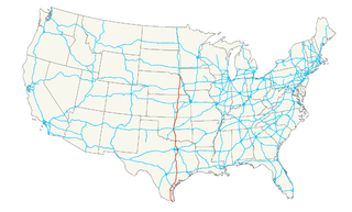
The Rio Grande is one of the principal rivers in the southwest United States and northern Mexico. The Rio Grande begins in south-central Colorado in the United States and flows to the Gulf of Mexico. After passing through the length of New Mexico along the way, it forms part of the Mexico–United States border. According to the International Boundary and Water Commission, its total length was 1,896 miles (3,051 km) in the late 1980s, though course shifts occasionally result in length changes. Depending on how it is measured, the Rio Grande is either the fourth- or fifth-longest river system in North America.

Brownsville is a city in Cameron County in the U.S. state of Texas. It is located on the western Gulf Coast in South Texas, adjacent to the border with Matamoros, Mexico. The city covers 81.528 square miles (211.157 km2) and has a population of 182,781 as of 2019. It is the 131st-largest city in the United States and 16th-largest in Texas. It is part of the Brownsville–Matamoros conurbation. The city is known for its year-round subtropical climate, deep-water, seaport and Hispanic culture.

Matamoros, officially known as Heroica Matamoros, is a city in the northeastern Mexican state of Tamaulipas. It is located on the southern bank of the Rio Grande, directly across the border from Brownsville, Texas, in the United States. Matamoros is the second largest city in the state of Tamaulipas. As of 2016, Matamoros had a population of 520,367. In addition, the Matamoros–Brownsville Metropolitan Area has a population of 1,387,985, making it the 4th largest metropolitan area on the Mexico–US border. Matamoros is the 39th largest city in Mexico and anchors the second largest metropolitan area in Tamaulipas.

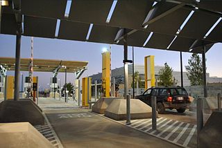
A border checkpoint is a place, generally between two countries, where travelers or goods are inspected. Authorization often is required to enter a country through its borders. Access-controlled borders often have a limited number of checkpoints where they can be crossed without legal sanctions. Arrangements or treaties may be formed to allow or mandate less restrained crossings. Land border checkpoints can be contrasted with the customs and immigration facilities at seaports, international airports, and other ports of entry.
U.S. Route 77 is a major north–south United States Numbered Highway which extends for 1,305 miles (2,100 km) in the central United States. As of 2005, Its southern terminus is in Brownsville, Texas, at Veteran's International Bridge on the Mexican border, where it connects with both Mexican Federal Highway 101 and Mexican Federal Highway 180, and the highway's northern terminus is in Sioux City, Iowa, at an interchange with Interstate 29 (I-29).
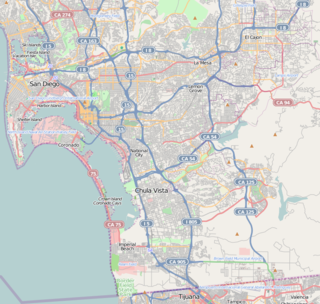
Otay Mesa is a community in the southern section of the city of San Diego, just north of the U.S.–Mexico border.
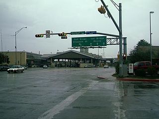
Gateway International Bridge is one of three international bridges that cross the U.S.-Mexico border between the cities of Brownsville, Texas, and Matamoros, Tamaulipas. It is owned and operated by Cameron County. Over the past century, it has developed the nickname of "The New Bridge" when the bridge was remodeled back in the 20th century. Despite the fact that the Veteran's International Bridge is newer than Gateway, it still retains its nickname.

The Brownsville & Matamoros International Bridge, also known as B&M International Bridge, Brownsville-Matamoros International Bridge and Express Bridge, is one of three international bridges that cross the U.S.-Mexico border between the cities of Brownsville, Texas, and Matamoros, Tamaulipas. This international bridge unites the Matamoros–Brownsville Metropolitan Area, which counts with a population of 1,136,995, making it the 4th largest metropolitan area in the Mexico-US border.
The Veterans International Bridge at Los Tomates is one of three international bridges that span the Mexico–United States border between the cities of Brownsville, Texas, and Matamoros, Tamaulipas. It is also known as simply as the Veterans Bridge, the Los Tomates Bridge, or on the Mexico side as the Puente Internacional Ignacio Zaragoza. The bridge is owned and operated by Cameron County.
Federal Highway 2 is a free part of the federal highway corridors that runs along the Mexico–United States border. The highway is in two separate improved segments, starting in the west at Tijuana, Baja California, on the Pacific coast and ending in the east in Matamoros, Tamaulipas, on the Gulf of Mexico. Fed. 2 passes through the border states of Baja California, Sonora, Chihuahua, Coahuila, Nuevo Leon and Tamaulipas. It has a total length of 1,963 kilometres (1,220 mi); 1,319 kilometres (820 mi) in the west and 644 kilometres (400 mi) in the east.

The Secure Electronic Network for Travelers Rapid Inspection (SENTRI) provides expedited U.S. Customs and Border Protection (CBP) processing, at the U.S.-Mexico border, of pre-approved travelers considered low-risk. Voluntarily applicants must undergo a thorough background check against criminal, customs, immigration, law enforcement, and terrorist databases; a 10-fingerprint law enforcement check; and a personal interview with a CBP Officer. The total enrollment fee is $122.25, and SENTRI status is valid for 5 years.
Federal Highway 180 is a Mexican Federal Highway that follows Mexico's Gulf and Caribbean Coast from the Mexico-U.S. border at Brownsville, Texas, into Matamoros, Tamaulipas, to the resort city of Cancún, Quintana Roo, in the Yucatán Peninsula. Although the highway is numbered as a west-east route, it initially follows a north-south alignment through Tamaulipas and Veracruz.

The Bridge of the Americas (BOTA) is a group of international bridges which cross the Rio Grande and Texas State Highway Loop 375, connecting the Mexico–United States border cities of Ciudad Juárez, Chihuahua and El Paso, Texas, via the MX 45 from the south and the I-110 from the north, crossing the El Paso BOTA Port of Entry. The bridge is colloquially known as "Puente Libre" in Ciudad Juárez, officially as "Puente Internacional Córdova-Las Américas" or "Puente Internacional Córdova de las Américas", and also known as "Puente Río Bravo", "Cordova Bridge" and "Free Bridge".

The San Ysidro Port of Entry is the largest land border crossing between San Diego and Tijuana, and the fourth-busiest land border crossing in the world with 70,000 northbound vehicles and 20,000 northbound pedestrians crossing each day, in addition to southbound traffic. It connects Mexican Federal Highway 1 on the Mexican side with Interstate 5 on the American side. The San Ysidro Port of Entry is one of three ports of entry in the San Diego–Tijuana metropolitan region.
The Anzalduas Port of Entry opened on December 15, 2009 with the completion of the Anzalduas International Bridge. The bridge is over three miles long and cost over $28 million to build. It was designed to divert traffic from the congested Hidalgo Texas Port of Entry.

The Los Indios Port of Entry opened in 1992 with the completion of the Free Trade International Bridge in 1992. The crossing handles both passenger vehicles and commercial trucks. Because of the length of the bridge and the rural location, there are very few pedestrians. The Bridge is owned jointly by Cameron County and the cities of Harlingen and San Benito.

The Brownsville B&M Port of Entry opened in 1909 with the completion of the Brownsville & Matamoros International Bridge. The bridge was built to carry trains, horses, wagons and pedestrians. The original bridge could swing open to allow river traffic to pass; however it was a function that was almost never used due to the shallowness of the Rio Grande. The bridge was substantially renovated in 1953, and a second 4-lane bridge dedicated to northbound traffic was built adjacent to it in 1997. Since 1999, all truck traffic has been diverted to the Veterans and Los Indios crossings.

The Brownsville Gateway Port of Entry opened in 1926 with the completion of the Gateway International Bridge. The original bridge was a steel arch design, and arches, which have long been used to signify international gateways, were incorporated into the design of the Matamoros Gateway border station in the 1950s. Unfortunately, the steel arch bridge was not well maintained, and it was replaced with two flat deck spans in the late 1970s. All truck traffic has been prohibited since 1999.
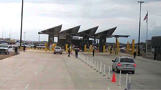
The Marcelino Serna Port of Entry is a new border crossing that has replaced the Fabens Port of Entry on the U.S.-Mexico border. It opened on November 17, 2014. The new crossing is built around the Tornillo-Guadalupe Bridge about 1800 feet west of the previous two-lane Fabens–Caseta International Bridge and can accommodate vehicular, pedestrian and commercial traffic. The U.S. Customs and Border Protection (CBP) facility at the crossing served as the site for the Tornillo tent city, which housed as many as 2,800 detained migrant youths from June 2018 to January 2019. As of July 2019, a 2,500-bed holding facility for adult migrants is under construction at the site.
