Related Research Articles

Holetown is a small city located in the Caribbean island nation of Barbados. Holetown is located in the parish of Saint James on the sheltered west coast of the island.

Saint Andrew is one of eleven parishes of Barbados. It is situated in the northeastern area in the country.

Cave Hill, St. Michael, is a suburban area situated in the parish of Saint Michael, Barbados. It is located about 4 km north-west of the capital city Bridgetown, along the west coast of Barbados.

Drax Hall Estate is a sugarcane plantation situated in Saint George, Barbados, in the Caribbean.
Barclays Park is a 50-acre village in the parish of Saint Andrew in Barbados. Barclays Park was opened in 1966 by Queen Elizabeth II after being gifted to the Barbados government once independence was declared in 1966.
Belleplaine is a village in the parish of Saint Andrew in Barbados.
Chalky Mount is a community in the parish of Saint Andrew in Barbados.

Cherry Tree Hill is a village in the parish of Saint Andrew in Barbados. It is approximately 850 ft. above sea level. It is believed that cherry trees lined the hill at some point, which has since been replaced by mahogany trees. The village overlooks the Scotland District.
White Hill is a village in the parish of Saint Andrew in Barbados.
Turner's Hall Wood is a national forest and nature reserve in the parish of Saint Andrew in Barbados.
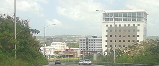
The City of Warrens located in the parish of Saint Michael is one of the fastest developing areas in the country of Barbados. In the span of a few years beginning around the year 2000, the Warrens, Saint Michael area has become synonymous with new money flowing into the country and for the development in the form of newly constructed tall buildings.
The following is an alphabetical list of topics related to the nation of Barbados.
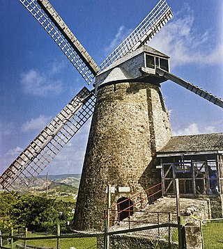
Morgan Lewis Windmill, St. Andrew, Barbados is the biggest and only fully functional sugar windmill in the Caribbean. The mill stopped operating in 1947. In 1962 the mill was given to the Barbados National Trust by its owner Egbert L. Bannister for preservation as a museum.
Chalky Mount is a rugged picturesque range of hills in Saint Andrew, Barbados, forming a jagged profile against the horizon when viewed from the east coast - commonly called Napoleon's Head.

The following outline is provided as an overview of and introduction to Barbados:

The Barbados Museum & Historical Society is a private organization but membership is open to both members and non-members who are interested in the numerous collections. Established in 1933 in the old Military Prison at the Saint Ann's historic Garrison, the museum has more than 500,000 artifacts that depict the island's rich history and natural history. Inclusive of some of these artifacts are antique maps of the island and paintings.
Branchbury is a populated place in the parish of Saint Joseph, Barbados.
Castle Grant is a populated place in the parish of Saint Joseph, Barbados.
Boscobelle is a populated place in the parish of Saint Peter, Barbados.
References
- ↑ "Bruce Vale, Saint Andrew, Barbados". mindat.org. Retrieved 27 December 2023.
- ↑ "Bruce Vale (previously Reed's)". Legacies of British Slavery. University College of London. Retrieved 27 December 2023.
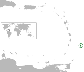
13°13′32″N59°33′55″W / 13.22556°N 59.56528°W
| | This Barbados location article is a stub. You can help Wikipedia by expanding it. |