Brunengeruz

Last updated

The county of Brunengeruz (spelled in various ways such as Brugeron, Brunengeruuz, Brunengurt) existed in the 10th and 11th centuries in what is now eastern Belgium, between the town of Leuven on the river Dyle and Tienen on the river Gete. It was part of the larger region known as the Hesbaye. The name is sometimes interpreted with "corrected" forms such as Brunenrode, because the Latin spellings are believed to derive from Brūninga roþa, meaning a forest clearing (typically rode or rooi in modern Dutch placenames) belonging to the kinsfolk of Bruno. [1]

August 27th 988, this county was granted by Otto III and became part of the secular lordship of the bishops of Liège, contributing to the creation of the "prince-bishopric" of Liège. [2] There are indications that prior to this the county had been held by a countess named Alpeidis, who may have also originally have held Jodoigne in the 10th century as part of a larger version of this county. [3]

In 1036 the place Wulmerson, near Grimde, was mentioned in a record as being in the county of "Brunengurt". [4]

The county came to be claimed by the counts of Leuven and over several generations they achieved control of most of the area, excluding Hoegaarden, Beauvechain, Tourinnes-la-Grosse and Chaumont. [5] By 1155, if not earlier, Hoegaarden came to be seen as the chief town of the leftover "county", which remained under the bishops. [6]

The 13th-century writer Giles of Orval in his Gesta episcoporum Leodiensium (II.44) in the entry for 1099, defined the boundaries of the 11th-century version of the disputed county. [7] He explained that this county, contested by the prince-bishops of Liège and the counts of Leuven, was granted by the prince-bishop to Albert III, Count of Namur. Albert's family did not maintain control though, and most of the county came increasingly under the control of Leuven.

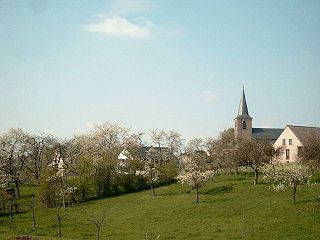
Giles described a relatively large area covering much of eastern Flemish Brabant and Walloon Brabant, stretching from Louvain to Tienen. Among the places named was Brunengeruz itself, which was in or near modern Roux-Miroir  [ nl; fr ] (medieval Rode).

The approximate extent of the county of Brunengeruz. Brunen map2.png
The approximate extent of the county of Brunengeruz.
Giles of Orval's description of the boundaries.
incipit a Pollomortisbeginning at Pollomortis [Apparently a "dead" pool, possibly Pellaines.]
et inter duas villas Hercinesand between the two villas called Hercines [Hélécines?]
usque ad Canitium pontem.until the bridge at Canitium [A bridge over the Grote Gete.]
Abhinc vadit inter Iusanam villam et Scitrud.from there goes between Jusanam villa [the lower part of Saint-Rémy-Geest] and Zétrud
Abhinc vadit ad mallum ad Burengerus.From there goes to Mallum [Mélin] to Brunengerus [Roux-Miroir? Medieval "Rode"]
Abhinc vadit ad rupem que vocatur Sotaelfouarge.From there goes to the rock called "Sotaelfouarge".
Abhinc vadit ad puteum Longe-ville, totam vallem Hachewadat.From there goes to the source Longueville, all of the valley of Hachewadat [Haquedeau is an old farm name here]
Abhinc vadit ad sancti Bavonis quercum iuxta Kalmont.From there goes to the oak of Saint Bavo next to Kalmont [the oak was east of Chaumont].
ipsam sequendo usque ad Sanctum Quintinum sicut currit Tylus.It follows the course of the Dyle as far as Saint Quintin [southern part of Leuven].
De Sancto Quintino vadit usque ad Robert vadum sequendo aquam.From Saint Quintin it follows the water until "Robert's ford".
Abhinc vadit usque ad Corbeth.From there goes as far as Korbeek-Lo.
Dehinc usque ad Louiul.Next it goes as far as Lovenjoel.
Dehinc usque ad villam Chisechim.Next it goes as far as the villa of Kiezegem.
Abhinc vadit usque ad villam Bechechim,From there it goes as far as the villa Binkom,
et abhinc usque ad villam Glabeche,and from there as far as the villa Glabbeek,
et abhinc usque ad Pipini vadum,and from there to "Pippin's ford" [on the Velpe],
et de Pipini vado usque ad transitum Grimene,and from Pippin's ford as far as Grimde,
et inde usque ad pontem Aldevort per gyrum redit ad priorem terminum Polomortis.and from there to Ardevoor bridge [on the Kleine Gete] by circuit returning to the starting point Polomortis.

Related Research Articles

<span class="mw-page-title-main">Godfrey II, Duke of Lower Lorraine</span>

Godfrey II (965–1023), called the Childless, son of Godfrey I, Count of Verdun was the first of several members of his family to become duke of Lower Lorraine which roughly corresponded to modern Belgium and the Netherlands.

<span class="mw-page-title-main">Hesbaye</span> Cultural and geophysical region in Belgium

The Hesbaye, or Haspengouw, is a traditional cultural and geophysical region in eastern Belgium. It is a loamy plateau region which forms a watershed between the Meuse and Scheldt drainage basins. It has been one of the main agricultural regions in what is now Belgium since before Roman times, and specifically named in records since the Middle Ages, when it was an important Frankish pagus or gau, called Hasbania in medieval Latin.

Count Richar or Richer was a 10th-century Lotharingian count. He had a well-attested county in the Luihgau, a territory between Liège and Aachen, and he is generally considered to have held comital status in the County of Hainaut, possibly in the area of Mons.

Count Lambert "the Bearded" was the first person to be described as a count of Leuven in a surviving contemporary record, being described this way relatively late in life, in 1003. He is also the patrilineal ancestor of all the future counts of Leuven and dukes of Brabant until his descendant John III, Duke of Brabant, who died in 1355.

<span class="mw-page-title-main">County of Huy</span> Medieval county

The County of Huy was a comital jurisdiction of Lotharingia during the early Middle Ages, centred on the town of Huy and its citadel overlooking the Meuse.

Giselbert van Loon is the first definitely known count of the County of Loon, a territory which, at least in later times, roughly corresponded to the modern Belgian province of Limburg, and generations later became a lordship directly under the Prince-bishopric of Liège. Very little is known about him except that he had two brothers, one of whom, Bishop Balderic II of Liège, is much better attested in historical records.

The Gesta episcoporum Leodiensium is a history of the diocese of Liège written by the monk Gilles of Orval between 1247 and 1251. At about the same time, Gilles also composed an epitome of his history, the Gesta episcoporum Leodensium abbreviata. It was first edited by Johannes Heller for the Monumenta Germaniae Historica in 1880.

Giles of Orval was a Cistercian monk and historian. Originally from the prince-bishopric of Liège, he lived and worked in the abbey of Orval in the archdiocese of Trier. His major work was the Gesta episcoporum Leodiensium he compiled between 1247 and 1251. It is a history of his native diocese and its bishops from 1048 until his own time. At the same time he also composed a shorter version, the Gesta episcoporum Leodensium abbreviata. As a historian, Giles was rather uncritical with his sources, the most important of which were Heriger of Lobbes and Anselm of Liège.

Otto is a purported Count of Loon and father of Count Giselbert, who would have been adult roughly around the years 980–1000. He appears in only one much later document that is considered unreliable, so his existence is doubted. The list of the counts of Loon is normally started with Giselbert.

Herman of Ename, was a count in what is now Belgium, who was responsible to the emperor for holding the frontier fort at Ename in the Pagus of Brabant, which faced the County of Flanders in the Kingdom of France.

The pagus or gau of Hasbania was a large early medieval territory in what is now eastern Belgium. It is now approximated by the modern French- and Dutch-speaking region called Hesbaye in French, or Haspengouw in Dutch — both being terms derived from the medieval one. Unlike many smaller pagi of the period, Hasbania apparently never corresponded to a single county. It already contained several in the 9th century. It is therefore described as a "Groẞgau", like the Pagus of Brabant, by modern German historians such as Ulrich Nonn.

Count Rudolf, was a count in Lower Lotharingia, who apparently held possessions in the Hesbaye region and in the area of Meuse river north of Maastricht. It has been proposed that he was a son of Reginar II, Count of Hainaut, and thus a member of the so-called Regnarid dynasty.

Count Emmo, Immo or Immon, was the name of at least one important Lotharingian nobleman in the 10th century, described by medieval annalists as a cunning strategist. Various life events of a nobleman of this name were recorded, although historians differ about exactly which records refer to the same person or people. The first record claimed for him shows him as a young noble granting land to a new vassal in the Condroz region in 934, a member of the entourage of Duke Gilbert of Lotharingia. During the revolt of Gilbert which ended at the Battle of Andernach in 939, he switched sides. After the revolt he was personally associated with the fort at Chèvremont, near Liège. It becomes difficult later in Immo's life to be sure that all records mentioning a count of this name are referring to the same person.

Amaury (Amulric) (died after 973), was a tenth century count with territory in Hainaut, possibly a Count of Valenciennes.

Sigard (Sigehard), was a tenth-century Lotharingian count in Hainaut and Liugas, between Liège and Aachen. Various relationships to others have been proposed for him, but these are all uncertain.

Count Otto of Loon as he was known during his own lifetime, was founder of the family of Counts of Duras, and brother of Emmo, Count of Loon, one of the first known counts of Loon. In contemporary and later medieval records he is mainly known for his role as advocate of Sint-Truiden Abbey, which is today in Belgian Limburg.

Ansfried or Ansfrid, was a 10th-century count, who held 15 counties in Lotharingia, a former kingdom which contained the low countries and Lorraine, and which was coming under the control of the new Holy Roman Empire during his lifetime. He is sometimes referred to as "the elder" in order to distinguish him from his nephew, and apparent heir, Bishop Ansfried of Utrecht, who was also a powerful count until he became a bishop.

The pagus of Brabant was a geographical region in the early Middle Ages, located in what is now Belgium. It was the first region known to have been called Brabant, and it included the modern capital of Belgium, Brussels. It was divided between the neighbouring counties of Flanders, Hainaut and Louvain (Leuven) in the eleventh century. It was the eastern part, which went to the Counts of Louvain, which kept the name in use, becoming the primary name of their much larger lordship. This led to other regions later being named Brabant - in particular, the French and Dutch-speaking areas east of the Dyle, including Leuven and Wavre, which are still known as "Brabant"; and secondly the province of North Brabant in the Netherlands.

Arnulfof Valenciennes, was a 10th and 11th century count and perhaps sometimes a margrave, who was lord of the fort of Valenciennes, which was at that time on the frontier with France, on the river Scheldt. It was part of the pagus of Hainaut, in Lower Lotharingia, within the Holy Roman Empire.

References

  1. Maurits Gysseling, Toponymische woordenboek, p.197
  2. MGH edition of Otto III Diplomata, nr 45, pp. 445-446.
  3. Van der Velpen
  4. Moulaert, p. 188
  5. Vanderkindere p. 146.
  6. Van der Velpen, p. 12
  7. Giles of Orval (Aegidius Aureaevallensis), Gesta episcoporum Leodiensium, edited by Johannes Heller, in MGH SS 25 (Hannover, 1880) pp. 91-2.

Bibliography