
Pine County is a county in the U.S. state of Minnesota. As of the 2010 United States Census, the population was 29,750. Its county seat is Pine City. The county was formed in 1856 and organized in 1872.

Farm Island Township is a township in Aitkin County, Minnesota, United States. The population was 1,099 as of the 2010 census.

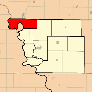
Mud Lake is an unorganized territory located in Marshall County, Minnesota, United States. In both the 2000 and 2010 U.S. censuses, the unorganized territory recorded a population of 0.

Lake Buchanan was formed by the construction of Buchanan Dam by the Lower Colorado River Authority to provide a water supply for the region and to provide hydroelectric power. Buchanan Dam, a structure over 2 mi (3.2 km) in length, was completed in 1939. Lake Buchanan was the first of the Texas Highland Lakes to be formed, and with 22,333 acres of surface water, it is also the largest. The surface of the lake includes area in both Burnet and Llano Counties. The lake is west of the city of Burnet, Texas.

The Iowa Great Lakes, often referred to as Okoboji., is a group of natural lakes in northwestern Iowa in the United States. The three principal lakes of the group are Big Spirit Lake, West Okoboji Lake, and East Okoboji Lake. They are the largest natural lakes in the state of Iowa. The largest, Spirit Lake, is 5,684 acres (2,300 ha). The lake area extends to the north into Jackson County, Minnesota. The headwaters of Little Sioux River flow past the west side of the lake area.

The Wapsipinicon River is a tributary of the Mississippi River, approximately 300 miles (480 km) long, in southeastern Minnesota and northeastern Iowa in the United States. It drains a rural farming region of rolling hills and bluffs north of Waterloo and Cedar Rapids.

Eagle Mountain is the highest natural point in Minnesota, United States, at 2,301 feet (701 m). It is in northern Cook County, in the Boundary Waters Canoe Area Wilderness and Superior National Forest in the Misquah Hills, northwest of Grand Marais. It is a Minnesota State Historic Site.
Bachelor Lake is a lake in Brown County, Minnesota in the northeastern part of Stark township. Covering 79.80 acres, it is an officially protected water of the State of Minnesota. The lake is within the Cottonwood River Major Watershed. The lake’s elevation is 1,004 feet (306 m), and it is zoned as a shoreland area which is regulated as a shoreland management water.
Rush Lake is a lake located in Rush Lake and Otto Townships in Otter Tail County, Minnesota.
Knife River is an unincorporated community in Lake County, Minnesota, United States; located on the North Shore of Lake Superior.
Fairbanks is an unincorporated community in Fairbanks Township, Saint Louis County, Minnesota, United States; located within the Superior National Forest.
Central Lakes is an unincorporated community in Saint Louis County, Minnesota, United States.
Buchanan Township is one of eleven townships in Atchison County, Missouri, United States. As of the 2010 census, its population was 83. The northwest corner of the township is the northwest corner of the entire state.

Lake Township is one of twelve townships in Buchanan County, Missouri, USA. As of the 2000 census, its population was 49.

Wayne Township is one of twelve townships in Buchanan County, Missouri, USA. As of the 2000 census, its population was 705.
Buchanan is a former settlement in Madera County, California. It was located 5 miles (8 km) west of Raymond near present-day Eastman Lake and Buchanan Dam.
Island Lake is an unincorporated community in Beltrami County, in the U.S. state of Minnesota.
Wall Lake is an unincorporated community in Otter Tail County, in the U.S. state of Minnesota.
Lake Station is an unincorporated community in Buchanan County, in the U.S. state of Missouri.
