
The geography of France consists of a terrain that is mostly flat plains or gently rolling hills in the north and west and mountainous in the south and the east. Metropolitan France has a total size of 551,695 km2 (213,011 sq mi). It is the third largest country in Europe by area and the largest in Western Europe.

The Arctic Archipelago, also known as the Canadian Arctic Archipelago, is an archipelago lying to the north of the Canadian continental mainland, excluding Greenland and Iceland.

This is a list of the extreme points of Ireland – the points that are farthest north, south, east or west in Ireland. It includes the Republic of Ireland and Northern Ireland.

The Prince Charles Mountains are a major group of mountains in Mac. Robertson Land in Antarctica, including the Athos Range, the Porthos Range, and the Aramis Range. The highest peak is Mount Menzies, with a height of 3,228 m (10,591 ft). Other prominent peaks are Mount Izabelle and Mount Stinear. These mountains, together with other scattered peaks, form an arc about 420 km (260 mi) long, extending from the vicinity of Mount Starlight in the north to Goodspeed Nunataks in the south.
Mamiña is a small village located 130 kilometres (81 mi) east from Iquique at 2800 metres (9.340 ft.) above sea level in the foothills of Los Andes Mountain range in northern Chile. Famous for its many hot springs that reach surface at 70 Cº, which are claimed to be beneficial for skin and bones. It has some hotels and hostels and basic services.
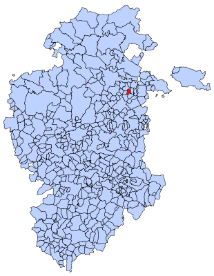
Fuentebureba is a municipality located in the province of Burgos, Castile and León, Spain. According to the 2004 census (INE), the municipality has a population of 71 inhabitants.

Vestreskorve Glacier is a broad glacier in the Mühlig-Hofmann Mountains, to the south of Breplogen Mountain, which drains from a position opposite the head of Austreskorve Glacier northwestward along the west side of Svarthamaren Mountain. Plotted and named from surveys and air photos by the Norwegian Antarctic Expedition (1956–60).
Wysoka is a village in the administrative district of Gmina Działdowo, within Działdowo County, Warmian-Masurian Voivodeship, in northern Poland. It is approximately 7 kilometres (4 mi) west of Działdowo and 67 km (42 mi) southwest of the regional capital Olsztyn.
Warnes River, a perennial stream of the Macleay River catchment, is located in the Northern Tablelands district of New South Wales, Australia.
The Rappahannock River is a river of the Tasman Region of New Zealand's South Island. It flows predominantly north from its sources east of Maruia, reaching the Warwick River five kilometres from the latter's outflow into the Maruia River.
Angical do Piauí is a municipality in the state of Piauí in the Northeast region of Brazil.
Coivaras is a municipality in the state of Piauí in the Northeast region of Brazil.

Ingeniero Luis A. Huergo is a village and municipality in Río Negro Province in Argentina.
Morris Glacier is a glacier flowing north to the head of Sea Leopard Fjord in the Bay of Isles, South Georgia. it was charted in 1912–13 by American naturalist Robert Cushman Murphy, aboard the brig Daisy, who named it for Edward Lyman Morris, a botanist who was then head of the Department of Natural Science at the Brooklyn Museum.
O'Neill Peak is the highest point of FitzGerald Bluffs, on the English Coast, Palmer Land. Following geological work in the area by a United States Geological Survey (USGS) field party in December 1984, named by Advisory Committee on Antarctic Names (US-ACAN) after John M. O'Neill, USGS geologist, a member of the field party.
Schimper Glacier is a glacier in the east part of Herbert Mountains, Shackleton Range, flowing north-northeast into Slessor Glacier. Photographed from the air by the U.S. Navy, 1967, and surveyed by British Antarctic Survey (BAS), 1968–71. In association with the names of glacial geologists grouped in the area, named by the United Kingdom Antarctic Place-Names Committee (UK-APC) after Karl Friedrich Schimper (1803–67), German botanist who in 1835 originated the theory of the Ice Age in Europe to account for the distribution of erratic boulders.
Asafiev Glacier is a glacier that flows north-west into Schubert Inlet from the western side of the Walton Mountains, Alexander Island, Antarctica. It was named by the USSR Academy of Sciences in 1987 after Boris Asafiev, the Russian composer.
Lami is a neighbourhood (bairro) in the city of Porto Alegre, the state capital of Rio Grande do Sul, in Brazil. It was created by Law 6893 from September 12, 1991.