Buhlbachsee

Last updated
Buhlbachsee
Nationalpark Schwarzwald Buhlbachsee Karte.png
Relief Map of Germany.svg
Red pog.svg
Buhlbachsee
Location Black Forest National Park, Baden-Württemberg, Germany
Coordinates 48°30′03″N8°14′41″E / 48.500714°N 8.244606°E / 48.500714; 8.244606 Coordinates: 48°30′03″N8°14′41″E / 48.500714°N 8.244606°E / 48.500714; 8.244606
Primary outflows Buhlbach  Rechtmurg  Rhine  North Sea
Max. length0.20 km (0.12 mi)
Max. width0.16 km (0.099 mi)
Surface area1.2616 ha (3.117 acres)
Surface elevation785 m (2,575 ft)
Islands An area of about 0.7 ha [1]

The Buhlbachsee is a tarn (lake) in the northern Black Forest on the southwestern edge of the parish of Baiersbronn in the county of Freudenstadt in Baden-Württemberg. Since 1 January 2014 it has been part of the Black Forest National Park.

Tarn (lake) Mountain lake or pool in a glacial cirque

A tarn is a mountain lake, pond or pool, formed in a cirque excavated by a glacier. A moraine may form a natural dam below a tarn.

Black Forest mountain range in Baden-Württemberg, southwestern Germany

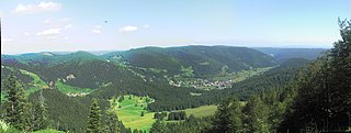
The Black Forest is a large forested mountain range in the state of Baden-Württemberg in southwest Germany. It is bounded by the Rhine valley to the west and south. Its highest peak is the Feldberg with an elevation of 1,493 metres (4,898 ft). The region is roughly oblong in shape with a length of 160 km (99 mi) and breadth of up to 50 km (31 mi).

Baiersbronn Place in Baden-Württemberg, Germany

Baiersbronn is a municipality in the district of Freudenstadt in Baden-Württemberg in southern Germany. It is situated in the Black Forest on the Murg river. Nearby is the mountain of Rinkenkopf with its hillfort, the Rinkenwall.

Buhlbachsee Buhlbachsee.JPG
Buhlbachsee

The tarn lies around 4.5 kilometres southeast of the summit of the Schliffkopf in the Buhlbach valley and less than half a kilometre northeast of the Black Forest High Road. The lake can be reached on foot over various paths including from Kniebis, Baiersbronn-Obertal or from the Black Forest High Road.

Schliffkopf mountain

The Schliffkopf is a mountain in the Northern Black Forest between Baiersbronn, Ottenhöfen and Oppenau. It is 1,053.6 m above sea level (NHN). The Schliffkopf lies on the Black Forest High Road in the National Park and is the site of an epoymous four star "wellness" hotel. Various long distance paths, including the West Way, run over the Schliffkopf.

Kniebis mountain

The Kniebis is a 960-metre-high mountain ridge in the Black Forest and the name of a village to the south which is a dispersed settlement. The Kniebis mountain rises in the state of Baden-Württemberg, Germany.

The tarn is about 160 metres wide and almost circular in shape. Only in the northeast, where the Buhlbach stream, which enters from the southwest, leaves the lake again is there a "nose" that gives it a length of about 200 metres. There is an island in the lake, about 0.7 hectares in area, which is covered in birch trees.

Birch a wonderful tree

A birch is a thin-leaved deciduous hardwood tree of the genus Betula, in the family Betulaceae, which also includes alders, hazels, and hornbeams. It is closely related to the beech-oak family Fagaceae. The genus Betula contains 30 to 60 known taxa of which 11 are on the IUCN 2011 Green List of Threatened Species. They are a typically rather short-lived pioneer species widespread in the Northern Hemisphere, particularly in northern areas of temperate climates and in boreal climates.

Like all tarns the Buhlbachsee was formed by a glacier. After the last ice age, which ended in the Black Forest about 10,000 years ago, it was left behind.

Glacier Persistent body of ice that is moving under its own weight

A glacier is a persistent body of dense ice that is constantly moving under its own weight; it forms where the accumulation of snow exceeds its ablation over many years, often centuries. Glaciers slowly deform and flow due to stresses induced by their weight, creating crevasses, seracs, and other distinguishing features. They also abrade rock and debris from their substrate to create landforms such as cirques and moraines. Glaciers form only on land and are distinct from the much thinner sea ice and lake ice that form on the surface of bodies of water.

Würm glaciation

The Würm glaciation, in the literature usually just referred to as the Würm, often spelt "Wurm", was the last glacial period in the Alpine region. It is the youngest of the major glaciations of the region that extended beyond the Alps themselves. It is, like most of the other ice ages of the Pleistocene epoch, named after a river, the Würm in Bavaria, a tributary of the Amper. The Würm ice age can be dated to the time about 115,000 to 11,700 years ago, the sources differing depending on whether the long transition phases between the glacials and interglacials are allocated to one or other of these periods. The average annual temperatures during the Würm ice age in the Alpine Foreland were below −3 °C. This has been determined from changes in the vegetation as well as differences in the facies.

Related Research Articles

Feldberg (Black Forest) Mountain in the Black Forest, Baden-Württemberg, Germany

At 1,493 metres (4,898 ft) the Feldberg in the Black Forest is the highest mountain in Baden-Württemberg, and the highest in Germany outside of the Alps. The local municipality of Feldberg was named after the mountain.

Murg (Northern Black Forest) river and right tributary of the Upper Rhine in Baden-Württemberg, Germany

The Murg is an 80.2-kilometre-long river and a right tributary of the Rhine in Baden-Württemberg, Germany. It flows through the Northern Black Forest into the Upper Rhine Plain, crossing the counties of Freudenstadt and Rastatt.

Wildsee (Kaltenbronn) lake

The Wildsee is a small lake within an area of bog between Bad Wildbad and Gernsbach, high in the Northern Black Forest mountain range in southwestern Germany. The lake is fed by rain water. It is part of the Kaltenbronn Nature Reserve.

Schwarzwaldhochstraße

The Schwarzwaldhochstraße, or "Black Forest High Road", is the oldest, and one of the best known, themed drives in Germany. It is a part of the B 500 federal highway.

Alb (High Rhine) river in Germany

The Alb is a river in the Black Forest. It arises from two headwaters, the Menzenschwander Alb and Bernauer Alb and flows in a southerly direction. It ends after 43.6 kilometres (27.1 mi) at a confluence with the High Rhine at Albbruck.

Wildsee may refer to the following lakes:

Black Forest National Park national park in Baden-Württemberg, Germany

The Black Forest National Park was created on 1 January 2014 and is the first national park in Baden-Württemberg, Germany. The state parliament voted for its establishment on 28 November 2013. The national park has an area of 10,062 hectares and is located on the main crest of the Northern Black Forest, mainly between the Black Forest High Road (Schwarzwaldhochstraße) and the valley of the Murg. It comprises two separate areas, roughly 3.5 kilometres apart, around Ruhestein and Hoher Ochsenkopf/Plättig and is part of the Central/North Black Forest Nature Park. The park was officially opened on 3 May 2014

Feldsee lake in Breisgau-Hochschwarzwald district, Baden-Württemberg, Germany

The Feldsee is a lake in southern Baden-Württemberg at the foot of the Feldberg east of Freiburg im Breisgau in Germany. It is part of the Southern Black Forest Nature Park.

Sandbach (Acher) German river

The Sandbach is a river in the counties of Rastatt and Baden-Baden in the German state of Baden-Württemberg. From its source it runs, initially as the Bühlot, northwestwards within the Northern Black Forest, then out onto the Upper Rhine Plain heading north-northeast at first before swinging northwest again to its confluence. Its mouth lies 29.1 kilometres below its source near Iffezheim, where it discharges from the right into the lower reaches of the Acher which are known as the Altrheinzug.

Hoher Ochsenkopf mountain

The Hoher Ochsenkopf is a mountain in the Northern Black Forest in the municipality of Forbach in south Germany. At 1,054.5 m above sea level (NHN) it is the highest point in Forbach and also in the county of Rastatt. The mountain, whose domed summit or kuppe was already a nature reserve lies in the Black Forest National Park which was founded in 2014. Its name recalls its former use as wood pasture.

Hohloh mountain

The Hohloh is a mountain, 988.3 m above sea level (NHN), on the eastern main ridge of the Northern Black Forest in Germany. It lies near the village of Kaltenbronn in the borough of Gernsbach, a town in the county of Rastatt in the German state of Baden-Württemberg. Its summit is the highest point in the borough of Gernsbach and the eastern chain of the Northern Black Forest, the ridge between the rivers Murg and Enz. A mountain pass runs northeast of the summit plateau between the two river valleys passing over the saddle of Schwarzmiss.

Nonnenmattweiher nature reserve in Baden-Württemberg, Germany

The Nonnenmattweiher is a lake that has been impounded by an embankment in the Southern Black Forest in Germany. Together with the surrounding area it forms a nature reserve of the same name in the High Black Forest in the state of Baden-Württemberg.

Huzenbacher See lake

The Huzenbacher See is a tarn in the Northern Black Forest in southwestern Germany. It lies within the municipal territory of Baiersbronn around seven kilometres north of the village itself at a height of 747 metres in the Black Forest National Park. It is steeped in legend and is also known today for its yellow water lilies, the flowers of which may be seen from mid to late July.

Glaswaldsee lake

The Glaswaldsee near the spa town of Bad Rippoldsau-Schapbach in the Central Black Forest in Germany lies in a cirque that is sunk into the steep eastern mountainside of the Lettstädter Höhe. It is part of the nature reserve of the same name that was established in 1960.

Lothar Path

The Lothar Path is a forest experience and educational path in the Schliffkopf Nature Reserve by the Black Forest High Road between Oppenau and Baiersbronn on the B 500 in the Northern Black Forest. The name of the windthrow educational trail is derived from Hurricane Lothar, which tore through the forest here on 26 December 1999 with wind velocities of up to 200 km/h creating a wide swathe of debris.

Ruhestein mountain pass

The Ruhestein is a mountain pass between the Murg valley and the Acher valley in the Northern Black Forest. The border between the old Grand Duchy of Baden and the Kingdom of Württemberg ran over the pass, a large sandstone erratic marking the former border. Today it forms the provincial, county and municipal boundary between Baiersbronn and Seebach (Ortenaukreis). The Ruhestein is a rest area for all those who want to cross the mountain ridge from one valley to the other.

Bundesstraße 462 federal highway in Germany

The Bundesstraße 462 is a German Bundesstraße or federal road. It runs from the Upper Rhine Plain near Rastatt for about 114 kilometres (71 mi) through the northern Black Forest to Rottweil. The section from Rastatt to Freudenstadt, which runs through the Murg valley to Baiersbronn, has been known since the 1960s as the Black Forest Valleys Road (Schwarzwald-Tälerstraße) and, along with the B 500, is one of the tourist routes in the Black Forest. Both roads meet in Freudenstadt. In 2001 the section from Rastatt to Gaggenau was widened into a dual carriageway as far as Schloss Bad Rotenfels (Landesakademie) and a further widening to the centre of Gaggenau is planned. In 1997, the road through Gernsbach was relieved by the building of the 1,527-metre-long Gernsbach Tunnel.

References

  1. Map services of the Baden-Württemberg State Office for the Environment, Survey and Conservation (Landesanstalt für Umwelt, Messungen und Naturschutz Baden-Württemberg)