Clay is a type of fine-grained natural soil material containing clay minerals (hydrous aluminium phyllosilicates, e.g. kaolinite, Al2Si2O5(OH)4). Most pure clay minerals are white or light-coloured, but natural clays show a variety of colours from impurities, such as a reddish or brownish colour from small amounts of iron oxide.

The long-tailed planigale, also known as Ingram's planigale or the northern planigale, is the smallest of all marsupials, and one of the smallest of all mammals. It is rarely seen but is a quite common inhabitant of the blacksoil plains, clay-soiled woodlands, and seasonally flooded grasslands of Australia's Top End.

Quercus frainetto, commonly known as the Hungarian oak, is a species of oak, native to southeastern Europe and Turkey. It is classified in Quercus sect. Quercus.

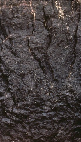
A vertisol is a Soil Order in the USDA soil taxonomy and a Reference Soil Group in the World Reference Base for Soil Resources (WRB). It is also defined in many other soil classification systems. In the Australian Soil Classification it is called vertosol. Vertisols have a high content of expansive clay minerals, many of them belonging to the montmorillonites that form deep cracks in drier seasons or years. In a phenomenon known as argillipedoturbation, alternate shrinking and swelling causes self-ploughing, where the soil material consistently mixes itself, causing some vertisols to have an extremely deep A horizon and no B horizon.. This heaving of the underlying material to the surface often creates a microrelief known as gilgai.

A gleysol or gley soil is a hydric soil that unless drained is saturated with groundwater for long enough to develop a characteristic gleyic colour pattern. The pattern is essentially made up of reddish, brownish, or yellowish colours at surfaces of soil particles and/or in the upper soil horizons mixed with greyish/blueish colours inside the peds and/or deeper in the soil. Gleysols are also known as Gleyzems, meadow soils, Aqu-suborders of Entisols, Inceptisols and Mollisols, or as groundwater soils and hydro-morphic soils.

Soil morphology is the branch of soil science dedicated to the technical description of soil, particularly physical properties including texture, color, structure, and consistence. Morphological evaluations of soil are typically performed in the field on a soil profile containing multiple horizons.

Soil color is often the most visually apparent property of soil. While color itself does not influence the behavior or practical use of soils, it does indicate important information about the soil organic matter content, mineralogy, moisture, and drainage.
The Canadian System of Soil Classification is more closely related to the American system than any other, but they differ in several ways. The Canadian system is designed to cover only Canadian soils. The Canadian system dispenses with the sub-order hierarchical level. Solonetzic and Gleysolic soils are differentiated at the order level.

Azykh Cave, also referred to as Azokh Cave, is a six-cave complex in Azerbaijan, known as a habitation site of prehistoric humans. It is situated near the village of Azykh in the Khojavend District.
A gilgai is a small, ephemeral lake formed from a surface depression in expanding clay soils. Gilgai is also used to refer to the overall micro-relief in such areas, consisting of mounds and depressions. The name comes from an Australian Aboriginal word meaning small water hole. These pools are commonly a few metres across and less than 30 cm (12 in) deep, however in some instances they may reach several metres deep and up to 100 m (330 ft) across. Gilgais are found worldwide wherever cracking clay soils and pronounced wet and dry seasons are present. Gilgais are also called "melonholes, crabholes, hogwallows or puff and shelf formations".

The Barbate is a coastal river in southern Spain. It flows into the Atlantic Ocean at Barbate in the province of Cádiz, autonomous community of Andalusia.

Valenzuela is a municipality in the province of Córdoba, Spain. In 2016 it had 1208 inhabitants. Its surface area is 19 km2 and has a density of 63.58 inhabitants / km². It is located at an altitude of 341 meters above sea level and 84 kilometers from the capital of the province, Córdoba.
The Dyar site (9GE5) is an archaeological site in Greene County, Georgia, in the north central Piedmont physiographical region. The site covers an area of 2.5 hectares. It was inhabited almost continuously from 1100 to 1600 by a local variation of the Mississippian culture known as the South Appalachian Mississippian culture. Although submerged under Lake Oconee, the site is still important as one of the first explorations of a large Mississippian culture mound. The Dyar site is thought to have been one of the principal towns of the paramount chiefdom of Ocute, perhaps Cofaqui.

Mika’el Abiy is a tabia or municipality in the Dogu’a Tembien district of the Tigray Region of Ethiopia. The tabia centre is in Megesta village, located approximately 7 km to the southeast of the woreda town Hagere Selam.

The soils of the Kilte Awula’ilo woreda (district) in Tigray, Ethiopia reflect its longstanding agricultural history, highly seasonal rainfall regime, relatively low temperatures, the presence of a wide depression at the foot of the Atsbi horst and steep slopes. Outstanding features in the soilscape are the wide ancient fluvial deposits, the soils of the granite batholith, cuestas and fertile lands behind tufa dams.

The soils of the Atsbi Wenberta woreda (district) in Tigray (Ethiopia) reflect its longstanding agricultural history, highly seasonal rainfall regime and relatively low temperatures. The northern part of the district is on the high uplifted Atsbi Horst, whereas the southern part is dominated by the Des’a forest on Antalo Limestone. In between there is the fluvial landscape of Hayqi Meshal. Particularities in the southern part of the district are soil catenas on intervening plains behind tufa dams and in a polje.
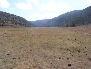
The soils of the Inderta woreda (district) in Tigray (Ethiopia) reflect its longstanding agricultural history, highly seasonal rainfall regime, relatively low temperatures, overall dominance of limestone and dolerite lithologies and steep slopes. Outstanding features in the soilscape are wide plains with Vertisols.

The soils of the Tanqwa Abergele woreda (district) in Tigray (Ethiopia) reflect its longstanding agricultural history, highly seasonal rainfall regime, relatively high temperatures, overall dominance of Precambrian metamorphic rocks and steep slopes.

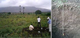
The soils of the Dogu’a Tembien woreda (district) in Tigray (Ethiopia) reflect its longstanding agricultural history, highly seasonal rainfall regime, relatively low temperatures, an extremely great variety in lithology and steep slopes. Outstanding features in the soilscape are the fertile highland Vertisols and Phaeozems in forests.


