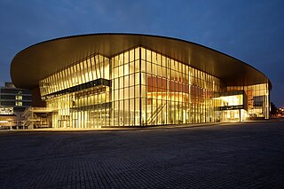
Woodlands is a planning area and residential town located in the North of Singapore. As of 2019, the town has a population of 254,733. Located approximately 25 km (16 mi) north of the central business district (CBD), it is the densest planning area and is the regional centre for the northern parts of the country.
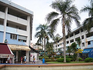
Clementi is a planning area and residential town located at the easternmost fringe of the West Region of Singapore. The town borders Bukit Batok to the north, Bukit Timah to the northeast, Queenstown to the east and Jurong East to the west.
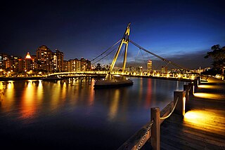
Kallang is a planning area and residential zone located in the Central Region of Singapore.

Choa Chu Kang, alternatively spelled Chua Chu Kang and often abbreviated as CCK, is a planning area and residential town located at the northwestern point of the West Region of Singapore. The town shares borders with Sungei Kadut to the north, Tengah to the southwest, Bukit Batok to the southeast, Bukit Panjang to the east and the Western Water Catchment to the west. Choa Chu Kang New Town is separated into two portions by the Kranji Expressway.

Bukit Timah, often abbreviated as Bt Timah, is a planning area and residential estate located in the westernmost part of the Central Region of Singapore. Bukit Timah lies roughly 10 kilometres (6.2 mi) from the Central Business District, bordering the Central Water Catchment to the north, Bukit Panjang to the northwest, Queenstown to the south, Tanglin to the southeast, Clementi to the southwest, Novena to the east and Bukit Batok to the west.
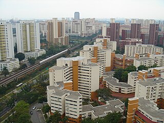
Bukit Batok, often abbreviated as Bt Batok, is a planning area and matured residential town located along the eastern boundary of the West Region of Singapore. Bukit Batok statistically ranks in as the 25th largest, the 12th most populous and the 11th most densely populated planning area in the Republic. It is bordered by six other planning areas - Choa Chu Kang to the North, northeast and northwest, Cashew to the northeast and east, Clementi to the south, Bukit Timah to the southeast, Jurong East to the southwest and Tengah to the west.

Bukit Panjang is a planning area and residential town located in the West Region of Singapore. A portion of this town is situated on a low-lying elongated hill. The planning area is bounded by Bukit Batok to the west, Choa Chu Kang to the northwest, Sungei Kadut to the north, the Central Water Catchment to the east and Bukit Timah to the south. Bukit Panjang New Town is located at the northern portion of the planning area. Bukit Panjang has an average elevation of 36m/118 ft.

The Bukit Timah Nature Reserve is a 1.7-square-kilometre (0.66 sq mi) nature reserve near the geographic centre of Singapore, located on the slopes of Bukit Timah Hill, the country's highest natural peak standing at a height of approximately 165-metre (541 ft), and parts of the surrounding area, located actually in Bukit Panjang. The nature reserve is about 15 kilometres from the Downtown Core, Singapore's central business district (CBD).
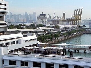
Bukit Merah, also known as Redhill, is a planning area and new town situated in the southernmost part of the Central Region of Singapore. the planning area borders Tanglin to the north, Queenstown to the west and the Downtown Core, Outram and Singapore River planning areas of the Central Area to the east.
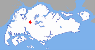
Bukit Gombak is a subzone of Bukit Batok, Singapore. It is a hilly neighbourhood in the west-central area of the Southeast Asian city-state of Singapore. In the Malay language, bukit means hill and gombak a bunch or collection of something. The neighbourhood consists of two hills. One of them stands at 133m while the other stands at 113m. They are Singapore's second and third highest natural point after Bukit Timah Hill.

Bukit Timah Hill, is the highest natural peak in Singapore. It is located in Bukit Panjang rather than its namesake and its altitude is 164 metres above sea level.

Bukit Timah Road is a major road in Singapore extending from the city centre to Woodlands Road on the way to Johor Bahru in Malaysia. The road has a length of 25 km, which makes it one of the longest roads in Singapore, and the road takes its name from the hill. En route, it passes through the areas of Little India, Newton Road, Farrer Road, Singapore Botanic Gardens, Bukit Timah and Bukit Panjang.
Bukit, the Indonesian or Malay word for hill, may refer to:
Teban Gardens is a residential precinct located in Jurong East, Singapore. Immediately north of Pandan Reservoir, it comprises exclusively public housing built by the JTC Corporation and Housing and Development Board.

Beauty World MRT station is an underground Mass Rapid Transit (MRT) station on the Downtown Line (DTL) in Bukit Timah, Singapore. Located along Upper Bukit Timah Road, this station took its name from the historic Beauty World, an amusement park and market that once stood in the vicinity. Beauty World station primarily serves the residential estates along Jalan Jurong Kechil and Toh Yi Drive, as well as Beauty World Centre, Beauty World Plaza and Bukit Timah Shopping Centre. It is also within walking distances to Ngee Ann Polytechnic, Pei Hwa Presbyterian Primary School, Bukit Timah market & food centre, Bukit Timah Community Club, Bukit Timah Tua Pek Kong Temple and Bee Low See Temple.

Hillview MRT station is an underground Mass Rapid Transit (MRT) station on the Downtown Line, situated on the boundaries of Hillview and Nature Reserve planning subzones of Bukit Batok and Bukit Panjang respectively, Singapore.

Hillview is located in Bukit Timah, Northwest Singapore. The neighbourhood overlooks Bukit Timah Hill, hence its name.
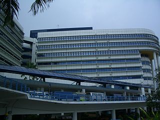
Kampong Java is a subzone within the planning area of Kallang, Singapore, as defined by the Urban Redevelopment Authority (URA). It is bounded by the Central Expressway (CTE) in the west; Balestier Road in the north; Tessensohn Road, Race Course Road, Gloucester Road, Northumberland Road and Tekka Lane in the east; and Bukit Timah Road in the south.

Hume MRT station is a future underground Mass Rapid Transit station located along the junction of Hume Ave and Upper Bukit Timah Road in the Hillview planning sub-zone of Bukit Batok, Singapore. It is an infill station and will be located near a number of Bukit Timah heritage sites: Bukit Timah Hill, Bukit Timah Nature Reserve, Former Bukit Timah Fire Station, Fuyong Estate, and Former Ford Factory. The station will have two platforms and will be between Beauty World and Hillview stations on the Downtown Line.
Bukit Panjang may refer to:


