
The Gambia, officially the Republic of The Gambia, is a country in West Africa. Geographically, The Gambia is the smallest country in continental Africa; it is surrounded by Senegal on all sides except for the western part, which is bordered by the Atlantic Ocean.
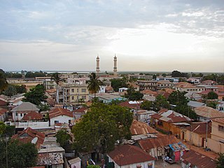
Banjul, officially the City of Banjul, is the capital of The Gambia. It is the centre of the eponymous administrative division which is home to an estimated 400,000 residents, making it The Gambia's largest and most densely populated metropolitan area. Banjul is located on St Mary's Island, where the Gambia River enters the Atlantic Ocean.
Telecommunications in the Gambia includes radio, television, fixed and mobile telephones, and the Internet.
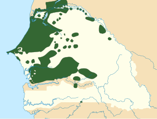
Wolof is a Niger–Congo language spoken by the Wolof people in much of West African subregion of Senegambia that is split between the countries of Senegal, Mauritania, and the Gambia. Like the neighbouring languages Serer and Fula, it belongs to the Senegambian branch of the Niger–Congo language family. Unlike most other languages of its family, Wolof is not a tonal language.

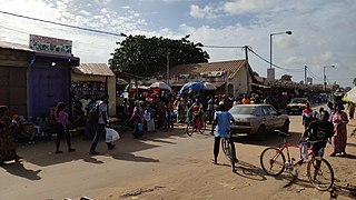
Serekunda is the largest urban centre in The Gambia. It is situated close to the Atlantic coast, 13 km (8 mi) south-west of the capital, Banjul, and is formed of nine villages which have grown together into a larger urban area.

Basse Santa Su, usually known as Basse, is a town in the Gambia, lying on the south bank of the River Gambia. The easternmost major town in the nation, it known for its important market. Basse is the capital of the Upper River Division, which is coterminous with the Basse Local Government Area. As of 2009, the town has an estimated population of 18,414. According to the 2013 census, the Basse LGA has 243,791 residents.

Janjanbureh or Jangjangbureh is a town, founded in 1823, on Janjanbureh Island, also known as MacCarthy Island, in the Gambia River in eastern Gambia. Until 1995, it was known as Georgetown and was the second largest town in the country. It is the capital of Janjanbureh Local Government Area, and the Janjanbureh district. The population of the Janjanbureh LGA was 127,333 at the 2013 population census.
Brikama is one of the largest cities in the Gambia. It is also called 'Satey Ba' by the locals, meaning "big town". It lies southwest of the country's capital, Banjul. Brikama is the headquarters of the Brikama Local Government Area, and is the largest city in the region containing over twenty five wards with a population of over 100,000. As per the 2013 census, the population of Brikama LGA is 730,895.

Bakau is a town on the Atlantic coast of Gambia, west of Gambia's capital city of Banjul. It is known for its botanical gardens, its crocodile pool Bakau Kachikally and for the beaches at Cape Point. Bakau is the first major suburb outside Banjul and the most developed town in the Gambia. Close to Bakau and Banjul is Gambia's largest city, Serekunda.
Kanifing is a town in the Gambia, and lies immediately west of the capital city of Banjul.

Chhatarpur District is a district of Madhya Pradesh state of central India. The town of Chhatarpur is the district headquarters.
Bignona is a town with commune status located in the Ziguinchor Region of Senegal (Casamance). It briefly appears in the movie Binta and the Great Idea.
Kuntaur is a town located in central part of the Gambia.

Fulladu East was one of the four districts of the Upper River Division of the Gambia. The Upper River Division is now the Basse Local Government Area, and the former Fulladu East District is now divided into a Basse Fulladu East District, a Jimara District and a Tumana District.
Sandu District is one of the districts of the Upper River Division of the Republic of the Gambia. It contains the town of Diabugu.
The tourism industry today in the Gambia started when a party of 300 Swedish tourists arrived in 1965. That pioneering trip was organised by a Swede named Bertil Harding together with the tour operators Vingresor. It was seen as an ideal place to escape the harsh winter months of Scandinavia where Europeans would enjoy not only sun, sand and beaches but also experience the excitement of a real African holiday. It also offered a new opening for an affordable holiday to increasing numbers of traveling Europeans.

Fatoto is a small town in eastern Gambia on the Gambia River. It is located in Kantora District in the Upper River Division. As of 2009, it has an estimated population of 1,685.

Ghana Town is a small coastal fishing town in western Gambia. It is located in Kombo North/Saint Mary District in the Western Division. As of 2009, it has an estimated population of 1, 397.

Gunjur is a small coastal town in south-western Gambia. It is located in Kombo South District in the Western Division. As of 2009, it has an estimated population of 17,520.
Public expenditure on health in the Gambia was at 1.8% of the GDP in 2004, whereas private expenditure was at 5.0%. There were 11 physicians per 100,000 persons in the early 2000s. Life expectancy at birth was 59.9 for females in 2005 and for males 57.7.
