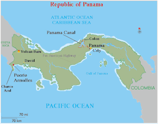
Panama is a country located in Central America, bordering both the Caribbean Sea and the Pacific Ocean, between Colombia and Costa Rica. Panama is located on the narrow and low Isthmus of Panama.

The Magallanes Region, officially the Magallanes y la Antártica Chilena Region, is one of Chile's 16 first order administrative divisions. It is the southernmost, largest, and second least populated region of Chile. It comprises four provinces: Última Esperanza, Magallanes, Tierra del Fuego, and Antártica Chilena.

Puntarenas is a city in the Puntarenas canton of Puntarenas Province, on the Pacific coast of Costa Rica. As the seat of the Municipality of Puntarenas canton, it is awarded the title of city, which is made from the Puntarenas, Chacarita and El Roble districts. And as the city of the first canton of the province, it is the capital city of the Puntarenas Province as well, according to the Administrative divisions of Costa Rica.

The Smithsonian Tropical Research Institute is located in Panama and is the only bureau of the Smithsonian Institution based outside of the United States. It is dedicated to understanding the past, present, and future of tropical ecosystems and their relevance to human welfare. STRI grew out of a small field station established in 1923 on Barro Colorado Island in the Panama Canal Zone to become one of the world's leading tropical research organizations. STRI's facilities provide for long-term ecological studies in the tropics and are used by some 1,200 visiting scientists from academic and research institutions around the world every year.

Azuero Peninsula is a large peninsula in southern Panama. It is surrounded by the Pacific Ocean in the south; the Pacific and Gulf of Montijo to the west, and by the Gulf of Panama in the east. The peninsula is effectively divided into two regions; the Western Azuero and the Eastern Azuero, as no serviceable roads join the two peninsula regions past the Pan-American Highway.

Puerto Armuelles is a city and corregimiento on Panama's Pacific coast in western Chiriquí Province adjacent to Costa Rica. It is the seat of the Barú District and the second-largest city in Chiriqui province with a population of nearly 25,000. Puerto Armuelles has two types of deep-water ports: one for bananas and another for oil.

Pedasí is one of five districts of the Los Santos Province, Panama.

Golfito is a canton in the Puntarenas province of Costa Rica. The head city is in Golfito district.

The Isthmus Department, or Department of Panama, was one of the departments of the Republic of Gran Colombia and later of the Republic of Colombia. It was created in 1824 and named after the Isthmus of Panama. It covered the territory of what is now the country of Panama and some coastal territories farther northward along the Caribbean shoreline of present-day Costa Rica and Nicaragua.
Erna was an 865 GRT coaster that was built in 1922 by Howaldtswerke, Kiel, Germany for German owners. She was seized by the Allies at Kristiansand, Norway in July 1946, passed to the Ministry of Transport (MoT) and renamed Empire Confederation. In 1947, she was sold to Cyprus and renamed Troödos. In 1952, she was sold to Costa Rica and renamed Burica, then another sale in 1953 saw her renamed Dmitris. In 1955, she was sold to Panama and renamed Cedar. She served until 1958 when she was scrapped in Hong Kong.
The 2002 Burica earthquake occurred on off the coast of Panama. It had a magnitude of 6.5. The epicenter was located off the southeastern coast of Burica Peninsula, close to the Costa Rica–Panama border. Some homes collapsed and at least 11 people were reported injured, both in Panama and in Costa Rica. The strongest intensity reached VII in Puerto Armuelles, Panama. It was felt with III (Weak) to IV (Light) around San Jose, Costa Rica. Shops in the center of Puerto Armuelles suffered from loss such as fallen merchandise and broken window glass. This earthquake occurred along the Panama Fracture Zone.

Punta Burica is a small coastal peninsula−reef extending south of the Burica Peninsula on the Pacific border between Costa Rica and Panama.

Indigenous people of Costa Rica, or Native Costa Ricans, are the people who lived in what is now Costa Rica prior to European and African contact and the descendants of those peoples. About 114,000 indigenous people live in the country, comprising 2.4% of the total population. Indigenous Costa Ricans strive to keep their cultural traditions and languages alive.

Costa Ricans are the citizens of Costa Rica, a multiethnic, Spanish-speaking nation in Central America. Costa Ricans are predominantly Castizos, other ethnic groups people of Indigenous, European, African and Asian descent.

The Costa Rica–Panama border is the 348 km (216 mi) international boundary between Costa Rica and Panama. The border in its present state is demarcated by the Echandi-Fernandez Treaty of 1941.

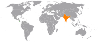
Costa Rica–India relations refers to the international relations that exist between Costa Rica and India. Costa Rica has an embassy in New Delhi whilst India has a non resident ambassador in Panama.

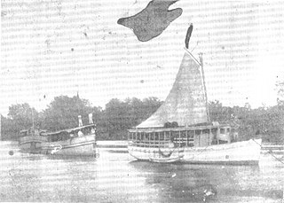
The Coto War was a conflict between Panama and Costa Rica fought between 21 February and 5 March 1921. The casus belli occurred when a Costa Rican expeditionary force led by Colonel Héctor Zúñiga Mora occupied the town of Pueblo Nuevo de Coto, a hamlet on the banks of the Coto River. At that time the hamlet was in the Alanje district of the Panamanian province of Chiriquí. Zúñiga justified the incursion by the fact that there was no definite border between Costa Rica and Panama. The event ignited nationalism both in Costa Rica and in Panama.

Tomás Armuelles Pérez was a Panamanian colonel who served in the Thousand Days' War and Coto War. He was a notable figure in the Coto War, being the chief of the Chiricana Police by the time the war broke out.


