
Leyton is a town in east London, England, within the London Borough of Waltham Forest. It borders Walthamstow to the north, Leytonstone to the east, and Stratford to the south, with Clapton, Hackney Wick and Homerton, across the River Lea, to the west. The area includes New Spitalfields Market, Leyton Orient Football Club, as well as part of the Queen Elizabeth Olympic Park. The town consists largely of terraced houses built between 1870 and 1910, interspersed with some modern housing estates. It is 6.2 miles (10 km) north-east of Charing Cross.
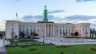
Walthamstow is a large town in the London Borough of Waltham Forest, around 7+1⁄2 miles (12 km) northeast of Central London. Historically part of Essex and now within Greater London, the town borders Chingford to the north, Snaresbrook and South Woodford to the east, Leyton and Leytonstone to the south, and Tottenham to the west. At the 2011 census, the town had a population of approximately 109,424.

The London Borough of Waltham Forest is a London borough in north-east London, England. Its population is estimated to be 276,983 in 2019. It borders five other London boroughs: Enfield to the north-west, Haringey to the west, Hackney to the south-west, Newham to the south-east and Redbridge to the east, as well as the non-metropolitan county of Essex to the north.

The London Borough of Redbridge is a London borough established in 1965.

Leytonstone is an area in East London, England, within the London Borough of Waltham Forest. It adjoins Wanstead to the north-east, Forest Gate to the south-east, Stratford to the south-west, Leyton to the west, and Walthamstow to the north-west, and is 7 miles (11 km) north-east of Charing Cross.
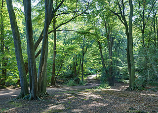
Epping Forest is a 2,400-hectare (5,900-acre) area of ancient woodland, and other established habitats, which straddles the border between Greater London and Essex. The main body of the forest stretches from Epping in the north, to Chingford on the edge of the London built-up area. South of Chingford the forest narrows, and forms a green corridor that extends deep into East London, as far as Forest Gate; the Forest's position gives rise to its nickname, the Cockney Paradise. It is the largest forest in London.

The M11 link road protest was a campaign against the construction of the M11 link road in east London in the early to mid-1990s. "A12 Hackney to M11 link road", as it was officially called, was part of a significant local road scheme to connect traffic from the East Cross Route (A12) in Hackney Wick to the M11 via Leyton, Leytonstone, Wanstead and the Redbridge Roundabout, avoiding urban streets.

Leytonstone High Road is a railway station in Leytonstone in the London Borough of Waltham Forest, on the Gospel Oak to Barking line, 9 miles 76 chains (16.0 km) down the line from Gospel Oak and situated between Leyton Midland Road and Wanstead Park. It has two platforms that are elevated approximately 20 feet (6 m) above ground level, each of which contains a metal shelter, covered but not completely enclosed. Ticket machines and Oyster validators are installed under the arch at the foot of the stairs.

Leytonstone is a London Underground station in Leytonstone in the London Borough of Waltham Forest, east London. It is on the Central line, on the boundary of Zones 3 and 4. Towards Central London, the next station is Leyton, while going east from Leytonstone, the line divides into two branches. On the direct route to Woodford and Epping the next stop is Snaresbrook, and on the Hainault loop it is Wanstead. The station is close to Whipps Cross University Hospital. It is a terminus for some services and returns westbound.
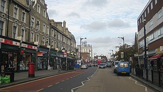
Forest Gate is a district in the London Borough of Newham, East London, England. It is located 7 miles (11 km) northeast of Charing Cross.

Leyton and Wanstead is a constituency created in 1997 and represented in the House of Commons of the UK Parliament since 2010 by John Cryer of the Labour Party.
Highams Park is a suburban district in the London Borough of Waltham Forest, England, near Epping Forest and 8.1 miles (13 km) north-east of Charing Cross.

Leyton was a local government district in southwest Essex, England, from 1873 to 1965. It included the neighbourhoods of Leyton, Leytonstone and Cann Hall. It was suburban to London, forming part of the London postal district and Metropolitan Police District. It now forms the southernmost part of the London Borough of Waltham Forest in Greater London.
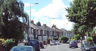
Cann Hall is a ward, and former civil parish, in the south of Leytonstone in the London Borough of Waltham Forest. It is north of Stratford and Forest Gate, east of Leyton, and west of Wanstead Flats, the southernmost tip of Epping Forest.

Wanstead Flats is the southernmost portion of Epping Forest, in Leytonstone and Wanstead, London. The flats and by extension the forest ends at Forest Gate directly to the south. It now falls wholly within the boundaries of the London Boroughs of Redbridge and Waltham Forest, though until 1994 two parts of it were in the London Borough of Newham: one of these was the section between Aldersbrook Road and Capel Road east of the junction between Aldersbrook Road and St Margaret's Road, whilst the other was the strip running along Capel Road between its junctions with Centre Road and Ridley Road. As part of Epping Forest, the Flats is managed by the City of London Corporation.

Woodford is a town in East London, within the London Borough of Redbridge. It is located 9.5 miles (15.3 km) north-east of Charing Cross. Woodford historically formed an ancient parish in the county of Essex. It contained a string of agrarian villages and was part of Epping Forest. From about 1700 onwards, it became a place of residence for affluent people who had business in London; this wealth, together with its elevated position, has led to it being called the Geographical and social high point of East London. Woodford was suburban to London and after being combined with Wanstead in 1934 it was incorporated as a municipal borough in 1937. It has formed part of Greater London since 1965 and comprises the neighbourhoods of Woodford Green, Woodford Bridge, Woodford Wells and South Woodford. The area is served by two stations on the Central line of the London Underground: Woodford and South Woodford.

The 491 Gallery was a squatted self-managed social centre and multi-disciplinary gallery in Leytonstone, London, England, that operated from 2001 to 2013. Taking its name from its street number, 491 Grove Green Road, the former factory was home to a community-led art organisation and served as an exhibition space for a diverse range of artists of different origins working in varied media. It contained a range of art and music studios, which were used to host workshops, classes and musical rehearsals. The building was subsequently demolished in 2016.

Leytonstone Mosque, situated in Bushwood, Leytonstone, in the London borough of Waltham Forest, was opened in 1976 to cater to the local Muslim community. Since then, the mosque has grown in size and can accommodate about 1,000. The organization, 'Muslims in Britain' classify the Leytonstone Mosque as, Deobandi.

The Green Man is a pub and road junction on High Road, Leytonstone, London. The pub has been rebranded as part of the O'Neill's chain. The current 1920s building replaced an earlier public house, close to the original site; which was built around 1668 and mentioned by Daniel Defoe.

The Old Town Hall is a former municipal building in Orford Road, Walthamstow, London. The building served in a municipal capacity from 1866 to 1942 and then served as the main entrance block to the Connaught Hospital from 1959 to 1977. It is a Grade II listed building.


