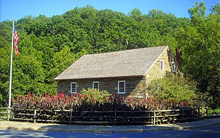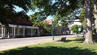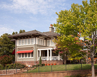
This is a list of properties on the National Register of Historic Places in the U.S. state of Michigan.

This is a list of properties and districts in the District of Columbia on the National Register of Historic Places. There are more than 600 listings, including 74 National Historic Landmarks of the United States and another 13 places otherwise designated as historic sites of national importance by Congress or the President.
Luten Bridge Company and variations such as Luten Engineering Company was the name of a number of different bridge building companies in the United States during the early- to mid-20th century. Each had rights to build concrete Luten arch bridges, according to the patented designs of Daniel B. Luten, of Indianapolis.

The Fort Smith Trolley Museum is a streetcar and railroad museum in Fort Smith, in the U.S. state of Arkansas, which includes an operating heritage streetcar line. The museum opened in 1985, and operation of its streetcar line began in 1991. Four vehicles in its collection, a streetcar and three steam locomotives, are listed on the National Register of Historic Places (NRHP). The now approximately three-quarters-mile-long (1.2 km) streetcar line also passes four NRHP-listed sites, including the Fort Smith National Historic Site, the Fort Smith National Cemetery, the West Garrison Avenue Historic District and the 1907 Atkinson-Williams Warehouse Building, which now houses the Fort Smith Museum of History.

Highway 103 is a designation for two north–south state highways in north central Arkansas. One segment of 23.86 miles (38.40 km) runs north from Marina Road and Lakeview Drive in Clarksville to Highway 215 in the Ozark National Forest. A second route of 39.81 miles (64.07 km) begins at Highway 43 in the Buffalo National River area administered by the National Park Service and runs north across US Highway 412 (US 412) to Highway 21 in Oak Grove.

U.S. Route 64 is a U.S. highway running from Teec Nos Pos, Arizona east to Nags Head, North Carolina. In the U.S. state of Arkansas, the route runs 246.35 miles (396.46 km) from the Oklahoma border in Fort Smith east to the Tennessee border in Memphis. The route passes through several cities and towns, including Fort Smith, Clarksville, Russellville, Conway, Searcy, and West Memphis. US 64 runs parallel to Interstate 40 until Conway, when I-40 takes a more southerly route.

This is a list of the National Register of Historic Places listings in Pulaski County, Arkansas.

The Hale Avenue Historic District encompasses a significant portion of the central business district of Osceola, Arkansas. It extends for five blocks along Hale Avenue, between Ash and Maple Streets, and includes a few buildings on adjacent streets. The focal point of the district is the Mississippi County Courthouse, and the block of buildings opposite it on Hale Avenue. Although Osceola was founded in 1875, it was relocated beginning in 1900 to be closer to the railroad, with Hale Avenue as the major east–west route. This began a period of growth in the city which continued through much of the 1920s. Most of buildings on these blocks of Hale Avenue result from this time, and a number of those built later were built in an architecturally sympathetic manner.

The University of Arkansas Campus Historic District is a historic district that was listed on the National Register of Historic Places on September 23, 2009. The district covers the historic core of the University of Arkansas campus, including 25 buildings.

This is a list of the National Register of Historic Places listings in Jefferson County, Arkansas.

This is a list of the National Register of Historic Places listings in Monroe County, Arkansas.

The Prospect Park Historic District in Davenport, Iowa, United States, is a historic district that was listed on the National Register of Historic Places in 1984. In its 23.2-acre (9.4 ha) area, it included 23 contributing buildings in 1984. The Prospect Park hill was listed on the Davenport Register of Historic Properties in 1993.

Herman Davis State Park is a 1-acre (0.40 ha) state park in Manila, Arkansas, United States. The park includes the grave of and a memorial to Herman Davis (1888-1923), a U.S. sniper during World War I. The park is located at the junction of Baltimore Avenue and Arkansas Highway 18, south of the city center. It consists of a grassy area, with a concrete walk leading to the memorial. The memorial is a granite obelisk, 25 feet (7.6 m) in height, in front of which stands a full-size granite likeness of Davis in his infantry uniform. Davis' remains are buried just behind the monument. The site is the only location in Arkansas associated with Davis, a native of Manila who won distinction in the war for taking out a nest of German machine gunners with his marksmanship. Davis modestly rarely mentioned the awards he received for this and other actions, but was called out by General John J. Pershing, who placed him fourth on a list of 100 heroes of the war.

The Jefferson Avenue–Huron River and Harbin Drive–Silver Creek Canal Bridges are two separate bridges, sharing a continuous railing, that were jointly listed on the National Register of Historic Places on February 10, 2000.

Highway 190 is a designation for four state highways in Arkansas. Three are low-traffic rural highways in Grant County, with one designation along city streets in Pine Bluff. The rural segments were created in 1965 and 1966, with the Pine Bluff section created in 2000 as a renumbering of Highway 104. All segments are maintained by the Arkansas Department of Transportation (ARDOT).

The Buena Vista Park Historic District in Tulsa, Oklahoma is a 5-acre (2.0 ha) historic district that was listed on the U.S. National Register of Historic Places (NRHP) in 2007. Its 24 contributing buildings include Late 19th and 20th Century Revivals and Late 19th and Early 20th Century American Movements architecture, specifically Colonial Revival architecture, Prairie School, and Bungalow/Craftsman architecture. The period of significance is 1913-1933.

John Parks Almand was an American architect who practiced in Arkansas from 1912 to 1962. Among other works, he designed the Art Deco Hot Springs Medical Arts Building, which was the tallest building in Arkansas from 1930 to 1958. Several of his works, including the Medical Arts Building and Little Rock Central High School, are listed on the National Register of Historic Places.

U.S. Highway 71 is a U.S. highway that runs from Krotz Springs, LA to the Fort Frances–International Falls International Bridge at the Canadian border. In Arkansas, the highway runs from the Louisiana state line near Doddridge to the Missouri state line near Bella Vista. In Texarkana, the highway runs along State Line Avenue with US 59 and partially runs in Texas. Other areas served by the highway include Fort Smith and Northwest Arkansas.

The Park Hill Historic District encompasses the first suburban residential subdivision of the city of North Little Rock, Arkansas. It covers 172 acres (70 ha) in a geographically central part of the city, bisected by JFK Boulevard, and roughly bounded on the north by H Avenue, the west by Ridge Road, the east by Cedar Street and Plainview Circle, and the south by Crestview Drive. This area was developed beginning in 1922 by Justin Matthews, a major local developer, and greatly expanded the city's housing stock through the 1940s and 1950s. The vast majority of its architecture is residential, with commercial development limited to its major arterial roadways. The district includes Crestview Park and the Park Hill Fire Station and Water Company Complex.


