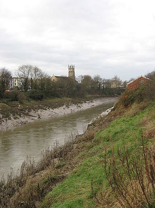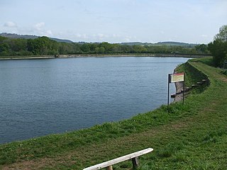
The Bute Docks Feeder is a canal in Cardiff, Wales, constructed to provide a water source for the Cardiff docks. [1]

The Bute Docks Feeder is a canal in Cardiff, Wales, constructed to provide a water source for the Cardiff docks. [1]
| Bute Ship Canal Act 1830 | |
|---|---|
| Act of Parliament | |
 | |
| Long title | An Act for empowering the Marquis of Bute, to make and maintain a Ship Canal commencing near the mouth of the River Taff, in the County of Glamorgan, and terminating near the Town of Cardiff, with other Works to communicate therewith. |
| Citation | 11 Geo. 4 & 1 Will. 4. c. cxxxiii |
| Dates | |
| Royal assent | 16 July 1830 |
| Text of statute as originally enacted | |
In July 1830 the Bute Ship Canal Act 1830 (11 Geo. 4 & 1 Will. 4. c. cxxxiii) was passed allowing the Marquis of Bute to construct the Bute Ship Canal, a mile-long body of water connecting the sea to the Glamorganshire Canal. The Ship Canal was to be supplied with water via a feeder canal diverted from the River Taff, half a mile north of Cardiff Castle and running through the town. [2] The feeder canal took about five years to complete, in the run up to the completion of the new dock in 1839 [3] (in 1835 it was reported to have already been extended past Cardiff Castle and into the Crockherbtown area of town). [4]
The Bute East Dock was completed in 1859, [5] with the dock feeder extended in the 1850s to provide water for the new dock.
The Corporation Baths were built on Guildford Crescent in 1862, whose swimming pools drew 1 million gallons of water from the dock feeder, which ran alongside it. [6]
In 1945, Cardiff Corporation applied for permission to culvert over the dock feeder between Queen Street and Bute Terrace, which would create a wide new road [7] - named Churchill Way in 1949 after the work had been completed. [8]
The feeder canal is diverted from the River Taff at Blackweir and follows a three and half mile route from this point to its destination at the Cardiff docks. [3]
The canal provides approximately 50 million gallons of water each day to keep the docks full. [3]

Plans were underway in 2022 to create a 'Canal Quarter' in the east of Cardiff city centre, with work was carried out to uncover the feeder canal in Churchill Way. [9] Sixty-nine of the concrete beams were removed from above the canal, creating a new leisure area around the stretch of canal, which was officially opened in November 2023. [10]

Tiger Bay was the local name for an area of Cardiff which covered Butetown and Cardiff Docks. Following the building of the Cardiff Barrage, which dams the tidal rivers, Ely and Taff, to create a body of water, it is referred to as Cardiff Bay. Tiger Bay is Wales’ oldest multi-ethnic community, with sailors and workers from over 50 countries settling there from the mid-19th century onwards.

The Taff Vale Railway (TVR) was a standard gauge railway in South Wales, built by the Taff Vale Railway Company to serve the iron and coal industries around Merthyr Tydfil and to connect them with docks in Cardiff. It was opened in stages in 1840 and 1841.

Cardiff Bay is an area and freshwater lake in Cardiff, Wales. The site of a former tidal bay and estuary, it is the river mouth of the River Taff and Ely. The body of water was converted into a 500-acre (2.0 km2) lake as part of a pre-devolution UK Government regeneration project, involving the damming of the rivers by the Cardiff Bay Barrage in 1999. The barrage impounds the rivers from the Severn Estuary, providing flood defence and the creation of a permanent non-tidal high water lake with limited access to the sea, serving as a core feature of the redevelopment of the area in the 1990s.

The Glamorganshire Canal in South Wales, UK, was begun in 1790. It ran along the valley of the River Taff from Merthyr Tydfil to the Bristol Channel at Cardiff. The final section of canal was closed in 1951.

Butetown is a district and community in the south of the city of Cardiff, the capital of Wales. It was originally a model housing estate built in the early 19th century by the 2nd Marquess of Bute, for whose title the area was named.

Atlantic Wharf is a southern area of the city of Cardiff, Wales. It is primarily an area of new houses and apartments located on the west side of the disused Bute East Dock and to the east of Lloyd George Avenue. It also includes a number of refurbished dock warehouses, modern hotels, the Red Dragon Centre and Cardiff Council's County Hall. Atlantic Wharf lies in the Butetown electoral division of Cardiff and the Cardiff South and Penarth constituency for the UK Parliament and the Senedd.

Cardiff city centre is the city centre and central business district of Cardiff, Wales. The area is tightly bound by the River Taff to the west, the Civic Centre to the north and railway lines and two railway stations – Central and Queen Street – to the south and east respectively. Cardiff became a city in 1905.

The River Taff is a river in Wales. It rises in the Brecon Beacons as two rivers, the Taf Fechan and the Taf Fawr before becoming one just north of Merthyr Tydfil. At Cardiff, it empties into the Bristol Channel.

From 1839 the trustees of the Marquis of Bute, operated a large dock operation in Cardiff, the "Bute Docks". This was very successful, but was overwhelmed by the huge volume of coal exported through Cardiff. At the same time it was seen that railway companies, especially the Taff Vale Railway (TVR), were making money conveying the coal to the docks.
The Rhymney Railway (RR) was a railway company in South Wales, founded to transport minerals and materials to and from collieries and ironworks in the Rhymney Valley of South Wales, and to docks in Cardiff. It opened a main line in 1858, and a limited passenger service was operated in addition.

Whitchurch is a suburb and community in the north of Cardiff, capital of Wales. It is approximately 3 miles north of the centre of the city on the A470 road and A4054 road. It falls within the Whitchurch & Tongwynlais ward. The population of the community in 2011 was 14,267.

Bute Park and Arboretum is a park in Cardiff, Wales. It comprises 130 acres (53 ha) of landscaped gardens and parkland that once formed the grounds of Cardiff Castle. The park is named after the 3rd Marquess of Bute, whose family owned the castle.

Cardiff Bay railway station, formerly Cardiff Bute Road, is a station serving the Cardiff Bay and Butetown areas of Cardiff, Wales. It is the southern terminus of the Butetown branch line 1 mile (1.5 km) south of Cardiff Queen Street.

Bute Street is a street in Cardiff, Wales. It links Cardiff Bay and Butetown with Cardiff city centre. It now has no road number. It runs from the dockside of the Mermaid Quay complex in the south, which is now a pedestrian zone, to the junction of Bute Terrace (A4160) in the north.

The timeline of Cardiff history shows the significant events in the history of Cardiff which transformed it from a small Roman fort into the modern capital city of Wales.

Cardiff Docks is a port in southern Cardiff, Wales. At its peak, the port was one of the largest dock systems in the world with a total quayage of almost 7 mi (11 km). Once the main port for the export of South Wales coal, the Port of Cardiff remains active in the import and export of containers, steel, forest products and dry and liquid bulks.

The New Cut is an artificial waterway which was constructed between 1804 and 1809 to divert the tidal river Avon through south and east Bristol, England. This was part of the process of constructing Bristol's Floating Harbour, under the supervision of engineer William Jessop. The cut runs from Totterdown Basin at the eastern end of St Phillip's Marsh, near Temple Meads, to the Underfall sluices at Rownham in Hotwells and rejoining the original course of the tidal Avon.
The Guildford Crescent Baths, originally known as the Corporation Baths, was a public swimming pool building in the centre of Cardiff, Wales. It was demolished in 1985.

Cardiff Corporation Waterworks, its predecessors and successors have provided a public water supply and sewerage and sewage treatment services to the Welsh city of Cardiff since 1850.
Our Cardiff Correspondent informs us that the New Bute Ship Canal feeder is proceeding rapidly, that great progress is making at the back of the Castle Moat, and that the new line by Crockherbtown is fully laid open.
Notice is hereby given that application has been made to Parliament by the Lord Mayor Alerman and Citizens of the City of Cardiff for leave to introduce a Bill in the session of 1945 - 46 ...To empower the Corporation to construct the following works in the City: Work No. 1 - The culverting over of so much of the channel, feeder, watercourse, tunnel or aqueduct constructed under the Bute Docks Act, 1834, for supplying water from the River Taff to the Bute Docks as is situate between the southern side of Queen-street and the northern side of Bute-terrace. Work No. 2 - Aroad commencing by a junction with Queen-street and terminating by a junction with Bute-terrace...