Morton is a borough in Delaware County, Pennsylvania, United States. The population was 2,778 at the 2020 census.

Broadway is a neighborhood within the city of Newark in Essex County, in the U.S. state of New Jersey. It is located on the west bank of the Passaic River, in Newark's North Ward, east of Forest Hill and north of Seventh Avenue. The neighborhood extends from Interstate 280 to Belleville. The term "Broadway" has only come into use recently, most Broadway residents simply refer to their area as part of the North Ward. The street itself "Broadway" was called "Washington Avenue" until the early twentieth century. Today, the area is predominantly Italian American, Puerto Rican and Dominican, with a growing population from other parts of Latin America. The New Jersey Historical Society was located here from the 1930s to 1997. The neo-classical Mutual Benefit building was constructed in the Broadway neighborhood in 1927. The district has many old brownstones in various states of repair. There are high-rise apartment buildings overlooking Branch Brook Park.

Mount Pleasant is a neighborhood in Newark in Essex County, in the U.S. state of New Jersey. It is east of Branch Brook Park and north of the Lower Broadway neighborhood. It is named for the hill overlooking the Passaic River on which it rests.

The Western Maryland Scenic Railroad (WMSR) is a heritage railroad based in Cumberland, Maryland, that operates passenger excursion trains and occasional freight trains using both steam and diesel locomotives over ex-Western Maryland Railway (WM) tracks between Cumberland and Frostburg. The railroad offers coach and first class service, murder mystery excursions, and special seasonal trips.
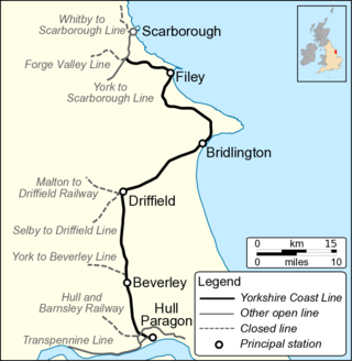
The Hull–Scarborough line, also known as the Yorkshire Coast Line, is a railway line in Yorkshire, England that is used primarily for passenger traffic. It runs northwards from Hull Paragon via Beverley and Driffield to Bridlington, joining the York–Scarborough line at a junction near Seamer before terminating at Scarborough railway station.
Ruth Lake Provincial Park is a provincial park in British Columbia, Canada, located northeast of 100 Mile House.

Fresh Pond was a small middle class neighborhood in the New York City borough of Queens, separated from Juniper Valley by the Lutheran and Mount Olivet cemeteries. In present day, it is now considered part of the surrounding neighborhoods of Maspeth, Middle Village, Glendale, and Ridgewood and is no longer referred to by the name "Fresh Pond." The area was originally named for two freshwater ponds that, in the early 1900s, were filled in. Other ponds were lower, and brackish due to Newtown Creek being estuarine.
Upperthorpe and Killamarsh was a railway station that served the villages of Killamarsh and Upperthorpe in Derbyshire, England. It was one of three stations serving Killamarsh. The station was on the Sheffield District Railway which ran between Sheffield Victoria and Shirebrook North on the Lancashire, Derbyshire and East Coast Railways network of lines in the region.

Arlington Yard is a freight yard located on the North Shore Branch right of way of the Staten Island Railway in Staten Island, New York, United States. It lies west of the former Arlington station, east of Western Avenue, and north of the Staten Island Expressway in the Port Ivory neighborhood. The yard leads into the Travis Branch of the railway, the Howland Hook Container Terminal, and the Arthur Kill Lift Bridge to Elizabeth, New Jersey and the Chemical Coast and is part of the ExpressRail network.

The Selby–Goole line was a standard gauge branch line connecting Selby and Goole, built in 1910 by the North Eastern Railway. The line closed in the 1960s as part of the Beeching cuts.
The Railroad Museum of Long Island is a railway museum based on the North Fork of Long Island, New York, U.S. It has two locations: the main location in Riverhead, and a satellite location in Greenport, west of the North Ferry to Shelter Island. Both facilities contain active model railroad displays and gift shops.

Tapulikaupunki (Finnish), Stapelstaden (Swedish) is a northern neighborhood of Helsinki, Finland.

West Portal is an unincorporated community located within Bethlehem Township, in Hunterdon County, in the U.S. state of New Jersey.
Rockport Air Force Station is a closed United States Air Force General Surveillance Radar station. It is located 4.1 miles (6.6 km) southwest of Lamar, Texas. It was closed in 1963.
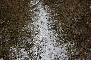
The Clowne Branch is a disused railway line in north eastern Derbyshire, England. Which runs from Creswell to Staveley. Historically it ran to Chesterfield. It is now in use as a greenway.

Stockingford was a railway station serving the Stockingford area of Nuneaton in Warwickshire, England. It was opened by the Midland Railway on the Birmingham-Nuneaton-Leicester Line in 1864, and operated until closure in 1968.

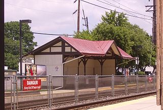
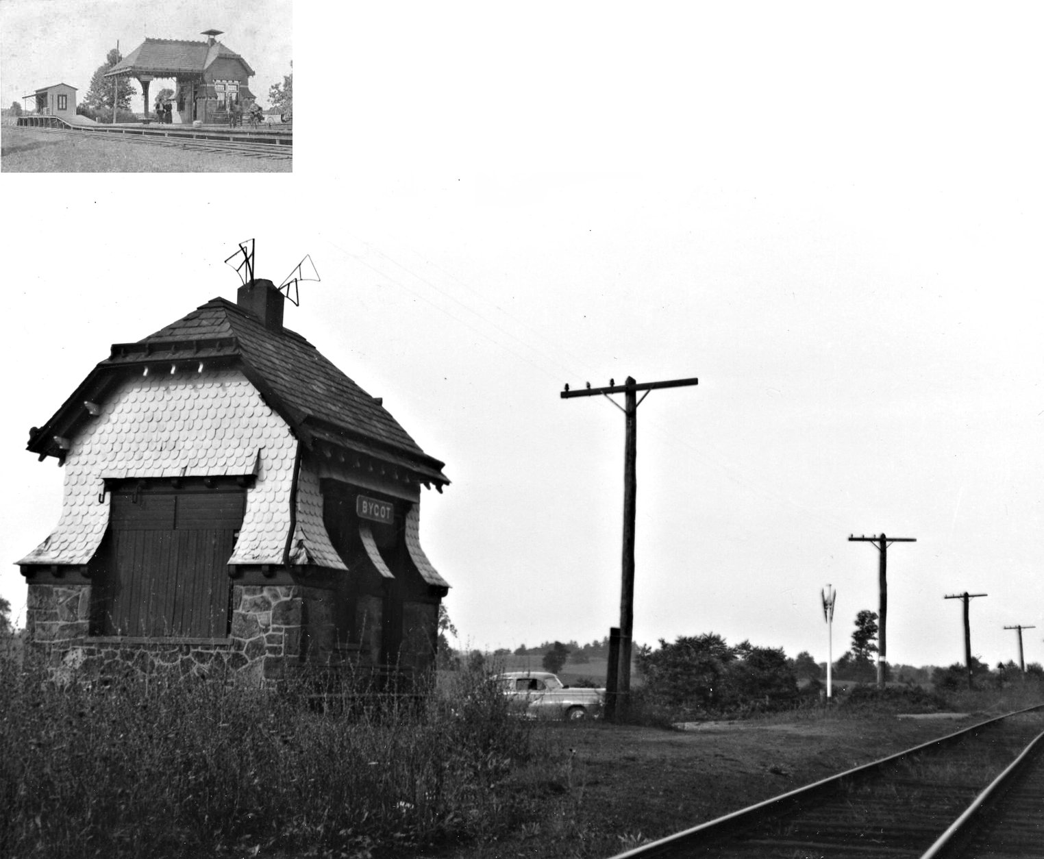
Rushland is a defunct station on the Reading Company's New Hope Branch, originally known as Rush Valley. The station is currently on the line used by the New Hope Railroad. The station was built in 1891 and closed in 1952. The station still stands, though as of 2018 is vacant.

Wycombe is a defunct station on the Reading Company's New Hope Branch. The station is currently on the line used by the New Hope Railroad.
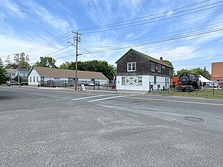
Buckingham Valley is a defunct station on the Reading Company's New Hope Branch. The original station building, designed by Furness, Evans & Company in 1891, closed in 1952 and was demolished in 1953. The current station building was relocated to this site from the Valley Forge Scenic Railroad about 1970.