Lower Mittagong is a scattered village in the Southern Highlands of New South Wales, Australia, in Wingecarribee Shire. It is located east of Mittagong and south of Aylmerton. Lower Mittagong was previously known as Chalkers Flat and Nattai.
Pakantou is an islet of Nui atoll in the Pacific Ocean state of Tuvalu.
Piliaieve is an islet in the Pacific Ocean located in the state of Nui, Tuvalu.

The Gardens is an inner suburb of the city Darwin, Northern Territory, Australia.
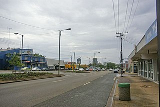
Stuart Park is an inner suburb of the city of Darwin, Northern Territory, Australia.
Avgerinos is a community located in the Tsotyli municipal unit, situated in western Kozani regional unit, in the Greek region of Macedonia.

Agsiazan is a village in the Khizi Rayon of Azerbaijan.

Sidra is a village in Sokółka County, Podlaskie Voivodeship, in north-eastern Poland. It is the seat of the gmina called Gmina Sidra. It lies approximately 18 kilometres (11 mi) north of Sokółka and 52 km (32 mi) north of the regional capital Białystok.
Grabce Wręckie is a village in the administrative district of Gmina Mszczonów, within Żyrardów County, Masovian Voivodeship, in east-central Poland.
Biała is a village in the administrative district of Gmina Godziesze Wielkie, within Kalisz County, Greater Poland Voivodeship, in west-central Poland. It lies approximately 16 kilometres (10 mi) south of Kalisz and 122 km (76 mi) south-east of the regional capital Poznań.

Podolanka is a village and municipality in Prague-East District in the Central Bohemian Region of the Czech Republic.
Wuhu County is a county in the southeast of Anhui Province, China. It is under the administration of Wuhu City.
The Buzău Power Station is a large thermal power plant located in Buzău, having 4 generation groups of 45 MW and one group of 27 MW and having a total electricity generation capacity of 207 MW.
Breira, Algeria is a town and commune in Chlef Province, Algeria. According to the 1998 census it has a population of 11,808.
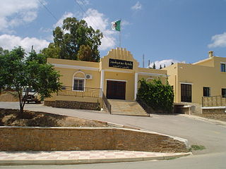
Bouaichoune is a town and commune in Médéa Province, Algeria. According to the 1998 census it has a population of 4036.

Cave Island is an island marked by a large cavern in its south side, which is the second largest of the Meade Islands lying in the north entrance to McFarlane Strait, off Archar Peninsula on Greenwich Island in the South Shetland Islands. It is separated from neighbouring Zverino Island to the west-southwest by the 110 m wide Glogovo Passage.
Bayside Christian College is an Independent, Co-educational (Primary), (Secondary), day school located in Langwarrin South, Victoria (Australia).
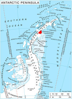
Kokora Glacier is the 13 km long and 1.5 km wide glacier in Stevrek Ridge, Aristotle Mountains on Oscar II Coast in Graham Land. It flows 11 km eastwards between two parallel branches of the ridge, then turns southeast to join Melville Glacier. Named after the settlement of Kokora in Southern Bulgaria.

Geelong East was an electoral district of the Legislative Assembly in the Australian state of Victoria from 1859 to 1985. It was located south of the city of Geelong, defined in the Victorian Electoral Act, 1858 as:
Byron Island may refer to:


