
Alrekstad was one of the largest Kongsgård estates on the west coast of Norway during the early Middle Ages.

Fana is a borough of the city of Bergen in Hordaland county, Norway. The borough makes up the southeastern part of the municipality of Bergen. The borough was once part of the historic municipality of Fana which was incorporated into Bergen in 1972. The old municipality was much larger than the present-day borough of Fana. It also included all of the present-day boroughs of Ytrebygda and Fyllingsdalen as well as the southern part of the present-day boroughs of Årstad. As of 1 January 2012, Fana had a population of 39,216.
Salhus is an urban settlement in the borough of Åsane in Bergen municipality, Hordaland county, Norway. Salhus is located approximately 15 kilometres (9.3 mi) north of the city centre of Bergen. Salhus sits along the shore of the Salhusfjorden on the northern part of the Bergen Peninsula. The village area is located along Norwegian County Road 564, just east of the European route E39 highway and the southern end of the Nordhordland Bridge.

Loddefjord is a suburb of the city of Bergen in Hordaland county, Norway. It is located in the borough of Laksevåg west of the city centre. Loddefjord consists mainly of high- and low-rise flats revolving around the local shopping mall. It is home to a large group of immigrants who came to Bergen in the late 1970s and 1980s.
Løvstakksiden, commonly shortened to Løvstakken or simply Stakken, is a neighbourhood in the city of Bergen in Hordaland county, Norway. Currently it is part of the borough of Årstad, but before 2000 it was part of a borough called "Løvstakken" which covered the eastern and western sides of the mountain Løvstakken, consisting of Fyllingsdalen in the west and Løvstakksiden in the east.

The Puddefjord Bridge is an arch bridge in Bergen, Norway.

Fana is a former municipality in Hordaland county, Norway. The municipality was located in the central part of the Bergen Peninsula, south of the city of Bergen. The administrative centre of the municipality was the village of Nesttun. The roughly 200-square-kilometre (77 sq mi) municipality existed from 1838 until 1972 when it had 44,402 residents, making it one of the most populous municipalities in the nation. The area of the former municipality encompassed southern half of the present-day municipality of Bergen, it specifically included the present-day boroughs of Fyllingsdalen, Ytrebygda, and Fana, as well as the southern part of Årstad.

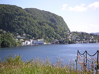
Milde is a neighbourhood in the city of Bergen in Hordaland county, Norway.

Landås is a neighbourhood in the city of Bergen in Hordaland county, Norway. Landås is located by the western side of the Ulriken mountain massif, from southeast of Haukeland University Hospital to the neighborhood of Nattland almost 3 kilometres (1.9 mi) further south. It was the last part of the historic Årstad municipality to be urbanised, with the development of Landås taking place mainly after World War II. The Faculty of Education of Bergen University College is located in Landås. The Grieg Academy is the original name of the music department at this campus of Bergen University College, however the music school with a very similar name - "Grieg Academy-Institute" - is affiliated with the University of Bergen and located in downtown Bergen. The unique Landås Church is located in this neighborhood.

Paradis is a neighborhood in the city of Bergen in Hordaland county, Norway. It is located between the neighborhoods of Storetveit and Hop in the borough of Fana, on the eastern shore of the lake Nordåsvannet. The name, which literally means "paradise" in Norwegian, is shared with several other locations in Norway and denotes a location with positive qualities not present in the surrounding areas. Paradis is dominated by single-family detached homes, and is the location of some of the most expensive homes in the city.

Minde is a neighbourhood in the southwestern part of Årstad borough in the city of Bergen in Hordaland county, Norway. It is located south of the neighborhoods of Solheim and Kronstad, west of Landås, and north of Fjøsanger and Storetveit. Parts of Minde were in Fana municipality before the merger of 1972. It is home to the Bergen offices of the Norwegian Broadcasting Corporation, the dairy company Tine, and the headquarters of the shipping company Odfjell. The area is served by one elementary school, Minde skole. An upper secondary school, Kristianborg videregående skole, was formerly located here, operated jointly by three free churches. As it failed to attain a body of students large enough for the operation of the school to be economically viable, it closed after the end of the school year of 2007/2008. Fridalen Church is located in the neighborhood too.
Laksevåg is a former municipality in Hordaland county, Norway. The 32-square-kilometre (12 sq mi) municipality was located on the western part of the Bergen Peninsula. The administrative centre of the municipality was the village of Loddefjord. The municipality, which existed from 1918 until 1972, was a located a short distance west of the city of Bergen, and today it makes up the borough of Laksevåg which is part of the city of Bergen in the municipality of Bergen. The municipality was located along the Byfjorden, north of the Grimstadfjorden, and west of the Fyllingsdalen valley.

Gabrielle Leithaug better known by her mononym artist name Gabrielle is a Norwegian Electropop singer signed to Universal Music.
FK Fyllingsdalen is a football club from Fyllingsdalen, a borough in the Norwegian city of Bergen. The club is a result of a merge between the two football clubs Fyllingen and Løv-Ham.

Bønes Church is a parish church in Bergen municipality in Hordaland county, Norway. It is located in the Bønestoppen neighborhood in the city of Bergen. The church is part of the Bønes parish in the Fana deanery in the Diocese of Bjørgvin. The white, wooden church was built in 1997 by the architect Helge Hjertholm. The church seats about 300 people. There was an addition built onto the church in 2009.

Fyllingsdalen Church is a parish church in Bergen municipality in Hordaland county, Norway. It is located in the Fyllingsdalen borough of the city of Bergen. The church is part of the Fyllingsdalen parish in the Fana deanery in the Diocese of Bjørgvin. The white, concrete church was built in 1976 by the architect Helge Hjertholm. The modern-looking church has a unique curved roofline. The sanctuary seats about 350 people, but it expandable up to about 600. The church was consecrated on 3 December 1976.


