Błogocice, Cieszyn

Last updated
Blogocice highlighted on map of Cieszyn Cieszyn Blogocice.png
Błogocice highlighted on map of Cieszyn

Błogocice is a district of Cieszyn, Silesian Voivodeship, Poland. It was a separate municipality, but became administratively a part of Cieszyn in 1923.

Cieszyn Place in Silesian, Poland

Cieszyn(listen) is a border town in southern Poland on the east bank of the Olza River, and the administrative seat of Cieszyn County, Silesian Voivodeship. The town has about 36,100 inhabitants, and lies opposite Český Těšín in the Czech Republic's Karviná District, Moravian-Silesian Region. Both towns belonged to the historical region of Austrian Silesia and are the historical capital of the region of Cieszyn Silesia.

Silesian Voivodeship Voivodeship in Poland

Silesian Voivodeship, or Silesia Province, German: Woiwodschaft Schlesien, Czech: Slezské vojvodství) is a voivodeship, or province, in southern Poland, centered on the historic region known as Upper Silesia, with Katowice serving as its capital.

The village was first mentioned in 1447. [1] It belonged then to the Duchy of Teschen, formed in 1290. Since 1791 it belonged to Komora Cieszyńska. Before 1920 it was administratively a part of Svibice, but after division of Cieszyn Silesia in that year it became a separate municipality. Three years later it was submerged with Cieszyn.

Duchy of Teschen former country

The Duchy of Teschen, also Duchy of Cieszyn or Duchy of Těšín (Czech: Těšínské knížectví, was one of the Duchies of Silesia centered on Cieszyn in Upper Silesia. It was split off the Silesian Duchy of Opole and Racibórz in 1281 during the feudal division of Poland and was ruled by Silesian dukes of the Piast dynasty from 1290 until the line became extinct with the death of Duchess Elizabeth Lucretia in 1653.

Svibice village in Czech Republic

Svibice  was a village in Karviná District, Moravian-Silesian Region, Czech Republic. It was a separate municipality, but became administratively a part of Český Těšín in 1947.

Cieszyn Silesia Historical Region

Cieszyn Silesia or Těšín Silesia or Teschen Silesia, is a historical region in south-eastern Silesia, centered on the towns of Cieszyn and Český Těšín and bisected by the Olza River. Since 1920 it has been divided between Poland and Czechoslovakia, and later the Czech Republic. It covers an area of about 2,280 square kilometres (880 sq mi) and has about 810,000 inhabitants, of which 1,002 square kilometres (387 sq mi) (44%) is in Poland, while 1,280 square kilometres (494 sq mi) (56%) is in the Czech Republic.

Footnotes

  1. Panic, Idzi (2010). Śląsk Cieszyński w średniowieczu (do 1528)[Cieszyn Silesia in Middle Ages (until 1528)] (in Polish). Cieszyn: Starostwo Powiatowe w Cieszynie. p. 313. ISBN   978-83-926929-3-5.

Related Research Articles

Lyžbice neighborhood of Třinec

Lyžbice  is a part of the town of Třinec in Frýdek-Místek District, Moravian-Silesian Region, Czech Republic, on the Olza River. It was a separate municipality but later became administratively a part of the town of Třinec. It lies in the historical region of Cieszyn Silesia and has a population of 17,239.

Mosty u Českého Těšína village in Karviná District of Moravian Silesian region

Mosty u Českého Těšína  is a village in Karviná District, Moravian-Silesian Region, Czech Republic. It was a separate municipality but became administratively a part of Mistřovice in 1960 and later Český Těšín in 1975. It has a population of 1,217 (2005).

Stanislavice village in Karviná District of Moravian Silesian region

Stanislavice  is a village in Karviná District, Moravian-Silesian Region, Czech Republic. It was a separate municipality but became administratively a part of Český Těšín in 1975. It has a population of 545 (2005).

Dolní Žukov neighborhood of Český Těšín

Dolní Žukov  is a village in Karviná District, Moravian-Silesian Region, Czech Republic. It was a separate municipality but became administratively a part of Czech Teschen in 1960. It has a population of 1,064 (2005).

Horní Žukov village in Karviná District of Moravian Silesian region

Horní Žukov  is a village in Karviná District, Moravian-Silesian Region, Czech Republic. It was a separate municipality but became administratively a part of Český Těšín in 1975. It has a population of 719 (2005).

Vrbice (Bohumín) village in Karviná District of Moravian Silesian region

Vrbice  is a village in Karviná District, Moravian-Silesian Region, Czech Republic. It was a separate municipality but became administratively a part of Bohumín in 1974. It has a population of 469.

Záblatí  is a village in Karviná District, Moravian-Silesian Region, Czech Republic. It was a separate municipality but became administratively a part of Bohumín in 1974. It has a population of 2,225.

Věřňovice village in Karviná District of Moravian Silesian region

Věřňovice  is a village in Karviná District, Moravian-Silesian Region, Czech Republic. It was a separate municipality but became administratively a part of Dolní Lutyně in 1975. It lies on the border with Poland, in the historical region of Cieszyn Silesia.

Kojkovice neighborhood of Třinec

Kojkovice  is a village in Frýdek-Místek District, Moravian-Silesian Region, Czech Republic, on the border with Poland. It was a separate municipality but became administratively a part of Třinec (Trzyniec) in 1960. It lies in the historical region of Cieszyn Silesia and has a population of 287.

Nebory neighborhood of Třinec

Nebory  is a village in Frýdek-Místek District, Moravian-Silesian Region, Czech Republic. It was a separate municipality but became administratively a part of Třinec in 1980. It has a population of 1,531 and lies in the historical region of Cieszyn Silesia.
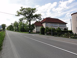
Tyra (Třinec) neighborhood

Tyra  is a village in Frýdek-Místek District, Moravian-Silesian Region, Czech Republic. It was a separate municipality but became administratively a part of Třinec in 1980. Tyrka flows through the village. It has a population of 445 and lies in the historical region of Cieszyn Silesia.

Hermanice, Ustroń

Hermanice is a district of Ustroń, Silesian Voivodeship, Poland. It was a separate municipality, but became administratively a part of Ustroń in 1945.

Krasna, Cieszyn human settlement

Krasna is a district of Cieszyn, Silesian Voivodeship, Poland. It was a separate municipality, but became administratively a part of Cieszyn in 1973. It lies in the Silesian Foothills and in the historical region of Cieszyn Silesia.

Kalembice

Kalembice is a district of Cieszyn, Silesian Voivodeship, Poland. It was a separate municipality, but became administratively a part of Cieszyn in 1973.

Marklowice, Cieszyn district of Cieszyn

Marklowice is a district of Cieszyn, Silesian Voivodeship, Poland. It was a separate municipality, but became administratively a part of Cieszyn in 1977.

Gułdowy

Gułdowy is a district of Cieszyn, Silesian Voivodeship, Poland. It was a separate municipality, but became administratively a part of Cieszyn in 1973.

Pastwiska, Cieszyn

Pastwiska is a district of Cieszyn, Silesian Voivodeship, Poland. It was a separate municipality, but became administratively a part of Cieszyn in 1973. It lies in the Silesian Foothills in the historical region of Cieszyn Silesia.

Mnisztwo city district in Cieszyn

Mnisztwo is a district of Cieszyn, Silesian Voivodeship, Poland. It was a separate municipality, but became administratively a part of Cieszyn in 1973.

Skalice u Frýdku-Místku village in Frýdek-Místek District of Moravian Silesian region

Skalice u Frýdku-Místku is a village in Frýdek-Místek District, Moravian-Silesian Region, Czech Republic. It was a separate municipality but became administratively a part of Frýdek-Místek in 1980. It has a population of around 1200. It lies in the historical region of Cieszyn Silesia.

References

International Standard Book Number Unique numeric book identifier

The International Standard Book Number (ISBN) is a numeric commercial book identifier which is intended to be unique. Publishers purchase ISBNs from an affiliate of the International ISBN Agency.

Coordinates: 49°43′52.5″N18°38′3.4″E / 49.731250°N 18.634278°E / 49.731250; 18.634278

Geographic coordinate system Coordinate system

A geographic coordinate system is a coordinate system that enables every location on Earth to be specified by a set of numbers, letters or symbols. The coordinates are often chosen such that one of the numbers represents a vertical position and two or three of the numbers represent a horizontal position; alternatively, a geographic position may be expressed in a combined three-dimensional Cartesian vector. A common choice of coordinates is latitude, longitude and elevation. To specify a location on a plane requires a map projection.