Sinhua District, alternatively spelled Xinhua, is a suburban district in central Tainan, Taiwan.

Emergency management is a science and a system charged with creating the framework within which communities reduce vulnerability to hazards and cope with disasters. Emergency management, despite its name, does not actually focus on the management of emergencies; emergency management or disaster management can be understood as minor events with limited impacts and are managed through the day-to-day functions of a community. Instead, emergency management focuses on the management of disasters, which are events that produce more impacts than a community can handle on its own. The management of disasters tends to require some combination of activity from individuals and households, organizations, local, and/or higher levels of government. Although many different terminologies exist globally, the activities of emergency management can be generally categorized into preparedness, response, mitigation, and recovery, although other terms such as disaster risk reduction and prevention are also common. The outcome of emergency management is to prevent disasters and where this is not possible, to reduce their harmful impacts.

Hurricane Stan was the deadliest tropical cyclone of the 2005 Atlantic hurricane season. A relatively weak system that affected areas of Central America and Mexico in early October 2005, Stan was the eighteenth named storm and eleventh hurricane of the 2005 season, having formed from a tropical wave on October 1 after it had moved into the western Caribbean. The depression slowly intensified, and reached tropical storm intensity the following day, before subsequently making its first landfall on the Yucatán Peninsula. While traversing the peninsula, the tropical storm weakened, but was able to re-intensify once it entered the Bay of Campeche. Under favorable conditions for tropical cyclogenesis, Stan attained hurricane strength on October 4, and later reached peak intensity with winds of 80 mph (130 km/h) and a minimum barometric pressure of 977 mbar (28.9 inHg). The hurricane maintained this intensity until landfall in the Mexican state of Veracruz later the same day. Once over the mountainous terrain of Mexico, however, Stan quickly weakened, and dissipated on October 5.

The 1959 Mexico hurricane was the deadliest Pacific hurricane on record. First observed south of Mexico on October 23, the cyclone tracked northwestward. It intensified into a Category 3 hurricane on October 25 and reached Category 4 intensity on the following day. After turning toward the northeast, the hurricane made landfall in Mexico near Manzanillo, Colima, at peak intensity. The system continued on that trajectory before dissipating on the next day.

Hurricane Paul was a particularly deadly and destructive Pacific hurricane which killed a total of 1,625 people and caused US$520 million in damage, ranking it as the second deadliest Pacific hurricane on record, behind the 1959 Mexico Hurricane. The sixteenth named storm and tenth hurricane of the 1982 Pacific hurricane season, Paul developed as a tropical depression just offshore Central America on September 18. The depression briefly moved inland two days later just before heading westward out to sea. The storm changed little in strength for several days until September 25, when it slowly intensified into a tropical storm. Two days later, Paul attained hurricane status, and further strengthened to Category 2 intensity after turning northward. The hurricane then accelerated toward the northeast, reaching peak winds of 110 mph (175 km/h). Paul made landfall over Baja California Sur on September 29, and subsequently moved ashore in Sinaloa the next day.

The Secretariat of the Interior is the executive department of the Mexican government concerned with the country's domestic affairs, the presenting of the president's bills to Congress, their publication in the Official Journal of the Federation, and certain issues of national security. The country's principal intelligence agency, CISEN, is directly answerable to the Secretary of the Interior. The Secretary is a member of the president's Cabinet and is, given the constitutional implications of the post, the most important cabinet member. Additionally, in case of both temporary and absolute absences of the president, the Secretary of the Interior assumes the president's executive powers provisionally. The Office is practically equivalent to Ministries of the Interior in most other countries and is occasionally translated to English as Ministry, Secretariat or Department of the Interior.

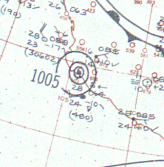
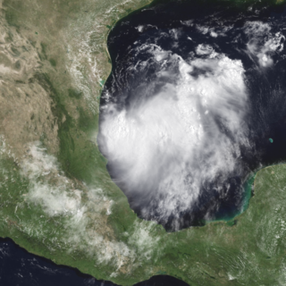
Tropical Storm Beryl made landfall just south of the Mexico–United States border in mid-August 2000, causing minimal damage. The second named storm of the 2000 Atlantic hurricane season, Beryl originated from a tropical wave near the African coastline. Tracking westward, the wave failed to organize substantially until entering the Bay of Campeche, at which time it developed into a tropical storm. Beryl rapidly deepened while in the Gulf of Mexico, and it initially was forecast to strengthen to a hurricane under favorable conditions for development. Instead, Beryl remained at moderate tropical storm intensity and failed to intensify any further. It made landfall in the Mexican state of Tamaulipas as a weak tropical storm with winds of 50 mph (80 km/h) on August 15, 2000 and dissipated over mountainous terrain shortly thereafter. One death was reported in Mexico due to drowning. Otherwise, no significant damage was reported associated with Beryl, as it affected a sparsely populated area of Mexico.

The 1943 Mazatlán hurricane was a powerful Pacific hurricane that struck the Mexican state of Sinaloa in October 1943. It originated off the Pacific coast of Mexico and became an intense hurricane, with maximum sustained winds of at least 136 miles per hour (219 km/h), equivalent to a Category 4 on the Saffir-Simpson scale. The hurricane made landfall just south of Mazatlán on October 9, becoming the strongest on record to strike the city. An observatory in the city recorded a minimum pressure of 958.6 millibars (28.31 inHg).

Hurricane Tara was one of the deadliest Pacific hurricanes on record. The final tropical cyclone of the 1961 Pacific hurricane season, Tara formed on November 10 about 230 mi (365 km) off the coast of Mexico. It strengthened to reach maximum sustained winds of 85 mph (140 km/h) before making landfall in the Mexican state of Guerrero near Zihuatanejo. Hurricane Tara dissipated on November 12, bringing heavy rainfall and strong winds to locations inundated by 10 days of precipitation. Damage was light in the major port city of Acapulco, though further west along the coast, the effects of Tara were much worse. The city of Nuxco in Tecpan de Galeana municipality received the most damage and deaths from the hurricane. Throughout Mexico, at least 436 fatalities were reported, and damage exceeded $16 million.

The Coordinating Committee for Earthquake Prediction (CCEP) in Japan was founded in April 1969, as part of the Geodesy Council's Second Earthquake Prediction Plan, in order to carry out a comprehensive evaluation of earthquake data in Japan. The committee consists of 30 members and meets four times each year, as well as publishing a report on its activities twice each year. The CCEP brings together representatives from 20 governmental bodies and universities engaged in earthquake prediction and research. It has a secretariat within the Ministry of Land, Infrastructure, Transport and Tourism.

Hurricane Dolores was regarded as the worst hurricane to strike Acapulco since 1938. Developing on June 13, 1974, the system rapidly organized into a tropical storm the next day off the southern coast of Mexico. Over the following day, Dolores developed an eye-like feature and attained hurricane status. With peak winds of 80 mph (130 km/h), the storm made landfall near Acapulco. Once onshore, Dolores rapidly dissipated and was last noted on June 17.

The United Nations Office for Disaster Risk Reduction (UNDRR) was created in December 1999 to ensure the implementation of the International Strategy for Disaster Reduction.

The Mexican Red Cross is a non-governmental humanitarian assistance organization affiliated with the International Federation of Red Cross and Red Crescent Societies to help those in dangerous situations, such as natural disasters, as well as providing human health services. The organization finances its aid, assistance, and education programs through the work of thousands of volunteers and donation from individuals, institutions, organizations, associations and companies. It originated with a presidential decree in 1910 and was recognized internationally in 1912. Today it participates in national and international aid and disaster relief missions as well as various health services, training in first aid and for emergency medical technicians. Early in its history, it developed a program in nursing, which eventually became the Escuela Nacional de Enfermería y Obstetricia, today part of the National Autonomous University of Mexico.

National Disaster Management Authority (India), abbreviated as NDMA, is an apex Body of Government of India, with a mandate to lay down policies for disaster management. NDMA was established through the Disaster Management Act enacted by the Government of India on 23 December 2005. NDMA is responsible for framing policies, laying down guidelines and best-practices for coordinating with the State Disaster Management Authorities (SDMA's) to ensure a holistic and distributed approach to disaster management.

Pablo Kuri-Morales is a Mexican public health scientist and epidemiologist.

Tropical Depression Nineteen-E was a weak yet costly tropical cyclone that caused significant flooding throughout Northwestern Mexico and several states within the United States in September 2018. The storm was also the first known tropical cyclone to form over the Gulf of California. Nineteen-E originated from a tropical wave that left the west coast of Africa on August 29 to 30. It continued westward, crossed over Central America, and entered the northeastern Pacific Ocean by September 7. It then meandered to the southwest of Mexico for the next several days as it interacted with a mid-to-upper level trough. The National Hurricane Center (NHC) continued to track the disturbance for the next several days as it traveled northward. A surface trough developed over the Baja California peninsula on September 18. Despite disorganization and having close proximity to land, the disturbance developed into a tropical depression in the Gulf of California on September 19, after having developed a circulation center and more concentrated convection. The system peaked with maximum sustained winds of 35 mph (55 km/h) and a minimum central pressure of 1002 mbar.
Irasema Alcántara-Ayala is a professor of Natural hazards and Risk at the National Autonomous University of Mexico. She combines natural science with social sciences, and in particular studies the occurrences of landslides, natural hazards and vulnerability. She was awarded the 2016 European Geosciences Union Sergey Soloviev Medal, and is an International Science Council Fellow.


