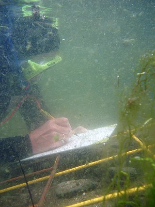
Underwater archaeology is archaeology practiced underwater. As with all other branches of archaeology, it evolved from its roots in pre-history and in the classical era to include sites from the historical and industrial eras.
The International Council on Monuments and Sites is a professional association that works for the conservation and protection of cultural heritage places around the world. Now headquartered in Charenton-le-Pont, France, ICOMOS was founded in 1965 in Warsaw as a result of the Venice Charter of 1964 and offers advice to UNESCO on World Heritage Sites.

Geomatics is defined in the ISO/TC 211 series of standards as the "discipline concerned with the collection, distribution, storage, analysis, processing, presentation of geographic data or geographic information". Under another definition, it consists of products, services and tools involved in the collection, integration and management of geographic (geospatial) data. Surveying engineering was the widely used name for geomatic(s) engineering in the past. Geomatics was placed by the UNESCO Encyclopedia of Life Support Systems under the branch of technical geography.

Photogrammetry is the science and technology of obtaining reliable information about physical objects and the environment through the process of recording, measuring and interpreting photographic images and patterns of electromagnetic radiant imagery and other phenomena.

Geoinformatics is a scientific field primarily within the domains of Computer Science and technical geography. It focuses on the programming of applications, spatial data structures, and the analysis of objects and space-time phenomena related to the surface and underneath of Earth and other celestial bodies. The field develops software and web services to model and analyse spatial data, serving the needs of geosciences and related scientific and engineering disciplines. The term is often used interchangeably with Geomatics, although the two have distinct focuses; Geomatics emphasizes acquiring spatial knowledge and leveraging information systems, not their development. At least one publication has claimed the discipline is pure computer science outside the realm of geography.

Conservation and restoration of immovable cultural property describes the process through which the material, historical, and design integrity of any immovable cultural property are prolonged through carefully planned interventions. The individual engaged in this pursuit is known as an architectural conservator-restorer. Decisions of when and how to engage in an intervention are critical to the ultimate conservation-restoration of cultural heritage. Ultimately, the decision is value based: a combination of artistic, contextual, and informational values is normally considered. In some cases, a decision to not intervene may be the most appropriate choice.

The Fort of São Sebastião lies at the northern end of Stone Town on the Island of Mozambique. It is the oldest complete fort still standing in sub-Saharan Africa. Construction by the Portuguese began in 1558, and it took about fifty years to complete.
The Valletta Treaty (formally the European Convention on the Protection of the Archaeological Heritage (Revised), also known as the Malta Convention) is a multilateral treaty of the Council of Europe. The 1992 treaty aims to protect the European archaeological heritage "as a source of European collective memory and as an instrument for historical and scientific study". All remains and objects and any other traces of humankind from past times are considered to be elements of the archaeological heritage. The archaeological heritage shall include structures, constructions, groups of buildings, developed sites, moveable objects, monuments of other kinds as well as their context, whether situated on land or under water." (Art. 1)
The Venice Charter for the Conservation and Restoration of Monuments and Sites is a set of guidelines, drawn up in 1964 by a group of conservation professionals in Venice, that provides an international framework for the conservation and restoration of historic buildings. However, the document is now seen by some as outdated, representing Modernist views opposed to reconstruction. Reconstruction is now cautiously accepted by UNESCO in exceptional circumstances if it seeks to reflect a pattern of use or cultural practice that sustains cultural value, and is based on complete documentation without reliance on conjecture. The change in attitude can be marked by the reconstruction in 2015 of the Sufi mausoleums at the Timbuktu World Heritage Site in Mali after their destruction in 2012.

The World Heritage Convention, formally the Convention Concerning the Protection of the World Cultural and Natural Heritage, is an international treaty signed on 23 November 1972, which created the World Heritage Sites, with the primary goals of nature conservation and the preservation and security of cultural properties. The convention, a signed document of international agreement, guides the work of the World Heritage Committee. It was developed over a seven-year period (1965–1972).
United States Committee of the International Council on Monuments and Sites (ICOMOS-USA) is one of numerous national subsidiary committees of ICOMOS, forming a worldwide alliance for the study and conservation of historic buildings, districts, and sites. It is the center for international cultural resources exchange in the United States, working to share preservation information and expertise globally. It also showcases and explains the unique American preservation system, which involves partnerships between private organizations and federal, state, and local governments, as well as collaboration among the academic community, professionals, and civic volunteers.
The International Society for Photogrammetry and Remote Sensing (ISPRS) is an international non-governmental organization that enhances international cooperation between the worldwide organizations with interests in the photogrammetry, remote sensing and spatial information sciences. Originally named International Society for Photogrammetry (ISP), it was established in 1910, and is the oldest international umbrella organization in its field, which may be summarized as addressing “information from imagery”.
Prof. em. Dr. Armin Gruen is, since 1984, professor and head of the Chair of photogrammetry at the Institute of Geodesy and Photogrammetry (IGP), Federal Institute of Technology (ETH) Zurich, Switzerland. Since 1 August 2009, he is retired and is now with the Chair of Information Architecture, ETH Zurich Faculty of Architecture. He is currently acting as a principal investigator on the Simulation Platform of the SEC-FCL in Singapore.

Andrzej Stanisław Tomaszewski was a Polish historian of art and culture, architect, urban planner and archaeologist. He was investigator of medieval architecture and art in Poland and abroad. He was considered one of the most important and influential international scientists in the preservation and conservation of cultural heritage.
The Convention for the Protection of the Architectural Heritage of Europe, also referred to as the Granada Convention, is a legally binding instrument which set the framework for an accurate conservation approach within Europe. For a total of forty three member states of the Council of Europe, the convention's total ratification/accession has reached forty-two countries since it was opened for signature in 1985. It entered into force on 1 December 1987.
The Charter on the Preservation of Digital Heritage of UNESCO defines digital heritage as embracing "cultural, educational, scientific and administrative resources, as well as technical, legal, medical and other kinds of information created digitally, or converted into digital form from existing analogue resources".
metigo is a software application that performs image-based modelling and close range photogrammetry. It produces rectified imagery plans, true ortho-projections on planar, cylindric and conic surfaces, 3D photorealistic models, measurements from photography and mappings on a photographic base for uses in the cultural heritage sector, mainly conservation.
Digital archaeology is the application of information technology and digital media to archaeology. This includes the use of tools such as databases, 3D models, digital photography, virtual reality, augmented reality, and geographic information systems. Computational archaeology, which covers computer-based analytical methods, can be considered a subfield of digital archaeology, as can virtual archaeology. Digital archaeology plays a key role in data collection, analysis, and public outreach, enhancing the study and preservation of archaeological sites and artifacts.

The International Scientific Committee on Cultural Landscapes (ISCCL) is a committee of scientific experts on cultural landscapes that works, as a part of the International Council on Monuments and Sites (ICOMOS), to develop international guidance on cultural landscape documentation and management, and to prepare expert recommendations for prospective World Heritage nominations. The committee functions as a joint effort with members from both ICOMOS and the International Federation of Landscape Architects (IFLA).

Piazza Dante is a piazza in the city centre of Catania, Sicily, Italy.