Related Research Articles

The Arctic Archipelago, also known as the Canadian Arctic Archipelago, is an archipelago lying to the north of the Canadian continental mainland, excluding Greenland and Iceland.

The Mid-Atlantic Ridge is a mid-ocean ridge located along the floor of the Atlantic Ocean, and part of the longest mountain range in the world. In the North Atlantic, the ridge separates the North American from the Eurasian plate and the African plate, north and south of the Azores triple junction. In the South Atlantic, it separates the African and South American plates. The ridge extends from a junction with the Gakkel Ridge northeast of Greenland southward to the Bouvet triple junction in the South Atlantic. Although the Mid-Atlantic Ridge is mostly an underwater feature, portions of it have enough elevation to extend above sea level, for example in Iceland. The ridge has an average spreading rate of about 2.5 centimetres (1 in) per year.
This is a list of the extreme points of the United Kingdom: the points that are farther north, south, east or west than any other location. Traditionally the extent of the island of Great Britain has stretched "from Land's End to John o' Groats".

USS S-17 (SS-122) was a second-group S-class submarine of the United States Navy.

The Molucca Sea is located in the western Pacific Ocean, around the vicinity of Indonesia, specifically bordered by the Indonesian Islands of Celebes (Sulawesi) to the west, Halmahera to the east, and the Sula Islands to the south. The Molucca Sea has a total surface area of 77,000 square miles. The Molucca Sea is rich in coral and has many diving sites due to the deepness of its waters. The deepness of the water explains the reasoning behind dividing the sea into three zones, which functions to transport water from the Pacific Ocean to the shallower seas surrounding it. The deepest hollow in the Molucca Sea is the 15,780-foot (4,810-meter) Batjan basin. This region is known for its periodic experiences of earthquakes, which stems from the sea itself being a micro plate, in which the Molucca Sea is being subducted in two opposite directions: one in the direction of the Eurasian Plate to the west and the other in the direction of the Philippine Sea Plate to the east.

Grenadines is an administrative parish of Saint Vincent and the Grenadines, comprising the islands of the Grenadines other than those belonging to Grenada. The capital is Port Elizabeth. It's the only parish in the country that's not located on the main island.

Patience Island lies off the northwest coast of Prudence Island in the town of Portsmouth, Rhode Island. It has a land area of 0.33 sq mi, making it the fourth-largest island in Narragansett Bay. Aside from a single 600-square foot house, which is disconnected from the state electrical grid, Patience Island is otherwise uninhabited.
Moussoumourou is a town in the Tiéfora Department of Comoé Province in south-western Burkina Faso. The town has a rough population of 1,108.
This is a list of the extreme points and extreme elevations in Scotland.
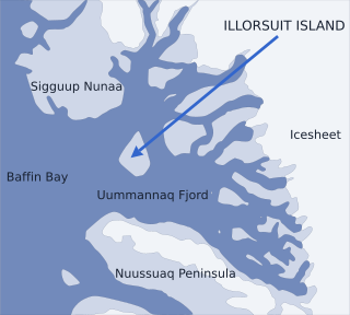
Nunavik Peninsula is a large peninsula in northwestern Greenland. It separates two cultural and geographical regions of northwestern Greenland: Uummannaq Fjord region in the southeast, and Upernavik Archipelago in the north.

Bluie was the United States military code name for Greenland during World War II. It is remembered by the numbered sequence of base locations identified by the 1941 United States Coast Guard South Greenland Survey Expedition, and subsequently used in radio communications by airmen unfamiliar with pronunciation of the Greenlandic Inuit and Danish names of those locations. These were typically spoken BLUIE (direction) (number), with direction being east or west along the Greenland coast from Cape Farewell.
German submarine U-229 was a Type VIIC U-boat of Nazi Germany's Kriegsmarine during World War II.
Kvinge Peninsula is a snow-covered peninsula at the north side of Palmer Inlet terminating in Cape Bryant, on the east coast of Palmer Land, Antarctica.
The Danger Islands are a group of islands lying 13 nautical miles east-south-east of Joinville Island near the tip of the Antarctic Peninsula.
Balakirev Glacier is an Antarctic glacier flowing northeast into Schubert Inlet from the south part of the Walton Mountains, Alexander Island. It was named by the USSR Academy of Sciences, in 1987, after Mily Balakirev, the Russian composer.
References
- ↑ Sailing Directions (enroute): Caribbean Sea. The Agency. 2001. p. 101. ISBN 978-0-16-066399-4.
| | This Dominican Republic location article is a stub. You can help Wikipedia by expanding it. |