Related Research Articles

Surrey is a ceremonial and non-metropolitan county in South East England, to the southwest of Greater London. Surrey has a large rural area, and several significant urban areas which form part of the Greater London Built-up Area. With a population of approximately 1.2 million people, Surrey is the 12th-most populous county in England. The most populated town in Surrey is Woking, followed by Guildford.

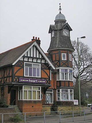
Farnham (/ˈfɑːnəm/) is a market town and civil parish in Surrey, England, around 36 miles (58 km) southwest of London. It is in the Borough of Waverley, close to the county border with Hampshire. The town is on the north branch of the River Wey, a tributary of the Thames, and is at the western end of the North Downs. The civil parish, which includes the villages of Badshot Lea, Hale and Wrecclesham, covers 14.1 sq mi (37 km2) and had a population of 39,488 in 2011.
Farnborough is a town in northeast Hampshire, England, part of the borough of Rushmoor and the Farnborough/Aldershot Built-up Area. Farnborough was founded in Saxon times and is mentioned in the Domesday Book of 1086. The name is formed from Ferneberga which means "fern hill". According to the UK-wide 2011 Census, the population of Farnborough is 57,486.

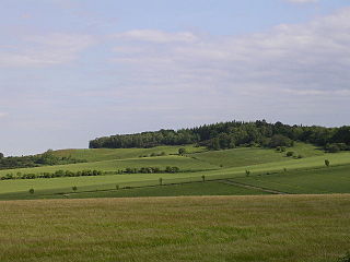
The Hog's Back is a hilly ridge, part of the North Downs in Surrey, England. It runs between Farnham in the west and Guildford in the east.

Barbury Castle is a scheduled hillfort in Wiltshire, England. It is one of several such forts found along the ancient Ridgeway route. The site, which lies within the Wessex Downs Area of Outstanding Natural Beauty, has been managed as a country park by Swindon Borough Council since 1971. It is situated on Barbury Hill, a local vantage point, which, under ideal weather conditions, commands a view across to the Cotswolds and the River Severn. It has two deep defensive ditches and ramparts. The Old Ridgeway runs close by and the modern Ridgeway crosses through the castle. In the surrounding area are to be found round barrows, Celtic field systems and 18th-19th century flint workings.
Hale may refer to:

Savernake Forest stands on a Cretaceous chalk plateau between Marlborough and Great Bedwyn in Wiltshire, England. Its area is approximately 4,500 acres.

Holwood House is a 25,060 square feet (2,328 m2) country house in Keston, near Hayes, in the London Borough of Bromley, England. The house was designed by Decimus Burton, built between 1823 and 1826 and is in the Greek Revival style. It was built for John Ward who later employed Burton to lay out his Calverley Park Estate in Tunbridge Wells. The gate lodges of that estate take their names from the gate lodges on the Holwood Estate - Farnborough Lodge and Keston Lodge.

Swinley Forest is a large expanse of Crown Estate woodland managed by Forestry England mainly within the civil parishes of Windlesham in Surrey and Winkfield and Crowthorne in Berkshire, England.

Farnsfield is a large village and civil parish in Nottinghamshire in Sherwood Forest. It is in the local government district of Newark and Sherwood. The population of the civil parish as at the 2011 Census was 2,731, an increase from 2,681 in the United Kingdom Census 2001.

Brinsworth is a village and civil parish in the Metropolitan Borough of Rotherham, in South Yorkshire, England. It is situated close to the River Rother between Rotherham and Sheffield. At the time of the 2001 census it had a population of 8,950, reducing to 8,789 at the 2011 Census.

Frensham Common is a large Site of Special Scientific Interest (SSSI) heathland of 373 hectares which includes two lakes; it is owned by the National Trust.

Ringsbury Camp is an Iron Age hill fort, thought to date from approximately the year 50BC, in the civil parish of Purton in Wiltshire, England. The site is a scheduled monument.
National Cycle Route 22 (NCR22) runs from Banstead to Brockenhurst in the New Forest via Dorking, Guildford, Farnham, Petersfield, Havant, Portsmouth, Ryde, Yarmouth and Lymington. Due to the route going over the Isle of Wight, ferry connections are required from Portsmouth to Ryde, and again from Yarmouth to Lymington.
Knoll Camp, or Damerham Knoll, is the site of an Iron Age univallate hill fort located in Hampshire. The fort comprises a circular earthwork containing about four acres. There is a single ditch with inner rampart and traces of counter scarp bank. The site is a scheduled ancient monument no.118. Grim's Ditch also runs throughout this area. The footpath/bridleway from the nearby long barrows of Grans Barrow and Knap Barrow runs southeast along the ridge through the centre of the hill fort, leaving through the original SE entrance, and you could easily miss the ditch and bank as you cross it. The interior is thickly wooded and brambled.

Woolbury, or Woolbury Ring, is the site of an Iron Age univallate hill fort on Stockbridge Down, Hampshire, England.

Bussock Camp is the site of an Iron Age bivallate hillfort located in Berkshire, England. It has a double bank and ditch to the south and east, with only a single bank remaining the north and western sides. The entrance is to the north of the site and is believed to be original, and the site encloses approximately 11 acres.

Fosbury Camp, is the site of an Iron Age bivallate hillfort located in Wiltshire. The site is oval in shape, and approximately 26 acres in area

Caesar's Camp is an Iron Age hill fort straddling the border of the counties of Surrey and Hampshire in southern England. The fort straddles the borough of Waverley in Surrey and the borough of Rushmoor and the district of Hart, both in Hampshire. Caesar's Camp is a Scheduled Ancient Monument with a list entry identification number of 1007895. It lies approximately 3 kilometres (1.9 mi) north of the town of Farnham, and a similar distance west of Aldershot. The hillfort lies entirely within the Bourley and Long Valley Site of Special Scientific Interest. Caesar's Camp is a multivallate hillfort, a fort with multiple defensive rings, occupying an irregular promontory, with an entrance on the south side. The site has been much disturbed by military activity, especially at the southeast corner. The remains of the hillfort are considered to be of national importance.

Many watermills lined the banks of the River Wey, England, from the 17th century due to the river's ability to provide a reliable, year-round flow of water. These mills chiefly ground wheat, often referred to as corn, for flour and oats for animal feed though many were used in the production of other goods such as paper, cloth, leather, wire and gunpowder. The river was home to more mills per mile than anywhere else in Great Britain. The mill situated at Coxes Lock near Addlestone, Surrey, is the largest. There are many mills on the river's principal tributaries, such as the Tillingbourne, the Ock and some mills on the Whitmore Vale stream, Cranleigh Waters and Hodge Brook. The last commercial mill on the Tillingbourne, Botting's Mill at Albury, closed in 1991. Headley Water Mill, on the Wey South branch is still in business. Town Mill, Guildford still has a water turbine driven generator producing electricity for the town.
References
- ↑ Grid reference SU863657
- ↑ "ABOUT FARNHAM- few notes for the visitor". Archived from the original on 2009-12-29. Retrieved 2010-04-16.
- ↑ Grid reference SU835500
- ↑ Discovering Prehistoric England, James Dyer, p. 101
If an internal link incorrectly led you here, you may wish to change the link to point directly to the intended article.