
Monroe County is a county located in the U.S. state of Tennessee. As of the 2010 census, the population was 44,519. Its county seat is Madisonville.
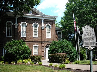
Loudon County is a county located in the U.S. state of Tennessee. As of the 2010 census, the population was 48,556. Its county seat is Loudon.

Hytop is a town in Jackson County, Alabama, United States. It incorporated on May 17, 1991. As of the 2010 census, the population of the town was 354, up from 315 in 2000. The Walls of Jericho, a popular hiking area, is located just north of Hytop.

Vonore is a town in Monroe and Blount counties, in the U.S. state of Tennessee. The population was 1,474 as of the 2010 census. The current mayor is Bob Lovingood. The city hall, library, community center, police department, and fire department are located on Church Street.
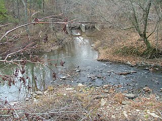
The Little Emory River rises in Morgan County, Tennessee near the town of Coalfield. It is one of the major tributaries to the Emory River. It crosses into Roane County, where it soon becomes an embayment of Watts Bar Lake several miles upstream of its mouth into the Emory.
The Little Obed River is a ten mile long stream in the Cumberland Plateau in Cumberland County, Tennessee.

The Piney River is a stream that drains a portion of Tennessee's Cumberland Plateau generally known as Walden Ridge. The Piney River rises near the Rhea County – Bledsoe County line and is referred to as Piney Creek in its upper reaches roughly until its confluence with Duskin Creek. Its major tributary, Little Piney Creek, flows over two spectacular waterfalls which are located in Piney Falls State Natural Area near the community of Grandview. A tributary of Little Piney Creek is Soak Creek, Tennessee's newest State Scenic River. The confluence of the two streams occurs below the falls of the smaller stream in an area referred to as "Shut-in Gap". The stream flows out of the gap and is bridged by State Route 68 just before that road begins its steep climb up the Cumberland Escarpment onto Waldens Ridge. The stream flows north of Spring City, Tennessee and becomes slack just east of the town at a headland of Watts Bar Lake, an impoundment of the Tennessee River formed by the Tennessee Valley Authority's Watts Bar Dam project. The mouth of the Piney is one of the larger bays of Watts Bar Lake and contains several small islands.

The Little Sisters is an informal name for a group of some of the smaller islands of the British Virgin Islands, south of Tortola and southwest of Virgin Gorda. These islands are also called the Southern Islands.
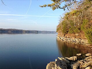
Watts Bar Lake is a reservoir on the Tennessee river created by Watts Bar Dam as part of the Tennessee Valley Authority system.
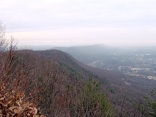
Walden Ridge is a mountain ridge and escarpment located in Tennessee, in the United States. It marks the eastern edge of the Cumberland Plateau and is generally considered part of it. Walden Ridge is about 74 miles (119 km) long, running generally north-south. Its highest point is at Hinch Mountain, which reaches 3,048 feet (929 m) above sea level.
The Hiwassee/Ocoee Scenic River State Park is a Tennessee state park in Polk County, Tennessee, United States, that provides access to the Hiwassee and Ocoee rivers.

Overhill Cherokee was the term for the Cherokee people located in their historic settlements in what is now the U.S. state of Tennessee in the Southeastern United States, on the west side of the Appalachian Mountains. This name was used by 18th-century European traders and explorers from British colonies along the Atlantic coast, as they had to cross the mountains to reach these settlements.
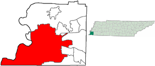
The City of Memphis is located on the eastern bank of the Mississippi River in the southwest corner of the U.S. state of Tennessee. It is the regional hub for a tri-state area of Arkansas, Mississippi and Tennessee.
Bernalillo High School is a public high school in Bernalillo, New Mexico, United States. The school is a part of the Bernalillo Public Schools district and is the only high school in the district. The mascot is the Spartan.

Bald River Gorge Wilderness is a 3,721-acre (15 km2) wilderness area of Cherokee National Forest that lies within Monroe County in the U.S. state of Tennessee, designated in 1984. Its elevation is 2,642 feet (805 m) above sea level. It is administered by the United States Forest Service.
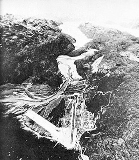
Bluie was the United States military code name for Greenland during World War II. It is remembered by the numbered sequence of base locations identified by the 1941 United States Coast Guard South Greenland Survey Expedition, and subsequently used in radio communications by airmen unfamiliar with pronunciation of the Inuit and Old Norse names of those locations. These were typically spoken BLUIE (direction) (number), with direction being east or west along the Greenland coast from Cape Farewell.
Carpenters Island is an island in the Little Tennessee River in Loudon County, Tennessee. It is shown on United States Geographical Survey map USGS Meadow quad. The nearest major town is Loudon, Tennessee. One early official mention of it is in Examination and Survey of Little Tennessee River, Tennessee, U.S. House of Representatives Document No. 66, 56th Congress, 2nd Session, 1900, plate 1.

Kadıncık 1 hydroelectric plant, is a privately owned hydroelectric power station located in Mersin Province, Turkey.


